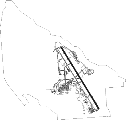
Ogden - Hill Afb
Airport details
| Country | United States of America |
| State | Utah |
| Region | K2 |
| Airspace | Salt Lake City Ctr |
| Municipality | Davis County |
| Elevation | 4789ft (1460m) |
| Timezone | GMT -7 |
| Coordinates | 41.12394, -111.97306 |
| Magnetic var | |
| Type | land |
| Available since | X-Plane v10.40 |
| ICAO code | KHIF |
| IATA code | HIF |
| FAA code | HIF |
Communication
| Hill AFB ATIS | 134.925 |
| Hill AFB Clearance DEL | 124.100 |
| Hill AFB Ground Control | 121.600 |
| Hill AFB Tower | 127.150 |
| Hill AFB SALT LAKE CITY Approach | 126.800 |
| Hill AFB SALT LAKE CITY Approach | 121.100 |
| Hill AFB SALT LAKE CITY Approach | 124.900 |
| Hill AFB SALT LAKE CITY Approach | 126.000 |
| Hill AFB SALT LAKE CITY Departure | 121.100 |
| Hill AFB SALT LAKE CITY Departure | 124.900 |
| Hill AFB SALT LAKE CITY Departure | 126.800 |
Approach frequencies
| ILS-cat-I | RW14 | 109.9 | 18.00mi |
| 2.8° GS | RW14 | 109.9 | 18.00mi |
Nearby Points of Interest:
Joseph Adams House (Layton, Utah)
-John Henry Layton House
-Congregation Montefiore Synagogue
-Layton Depot
-Devil's Gate-Weber Hydroelectric Power Plant
-George W. Layton House
-Browning Apartments
-Fairview Apartments
-La Frantz Apartments
-Avelan Apartments
-John Moses Browning House
-John George Moroni Barnes House
-Kaysville City Hall
-John R. Barnes House
-Geffas Apartments
-Barnhart Apartments
-Henry Blood House
-Flowers Apartments
-Jefferson Avenue Historic District
-Historic 25th Street
-Fern-Marylyn Apartments
-Ladywood Apartments
-Ogden/Weber Municipal Building
-Farnsworth Apartments
-United States Forest Service Building
Nearby beacons
| code | identifier | dist | bearing | frequency |
|---|---|---|---|---|
| HIF | HILL (OGDEN) TACAN | 0.4 | 110° | 111.20 |
| OGD | OGDEN VORTAC | 8.2 | 309° | 115.70 |
| TCH | WASATCH VORTAC | 16.4 | 182° | 116.80 |
| LHO | BRIGHAM CITY (LOGAN) VOR/DME | 40.2 | 357° | 112.90 |
| EVW | EVANSTON VOR/DME | 42.7 | 81° | 109.60 |
| FFU | FAIRFIELD (PROVO) VORTAC | 51 | 178° | 116.60 |
| PVU | PROVO VOR/DME | 55.7 | 165° | 108.40 |
| MIJ | MICHAEL (DUGWAY) TACAN | 70.7 | 226° | 113.20 |
Departure and arrival routes
| Transition altitude | 18000ft |
| Transition level | 18000ft |
| SID end points | distance | outbound heading | |
|---|---|---|---|
| RW14 | |||
| DEVLN1 | 20mi | 265° | |
| ILONN1, LGTNG1 | 15mi | 265° | |
| RW32 | |||
| DEVLN1 | 20mi | 265° | |
| ILONN1, LGTNG1 | 15mi | 265° | |
Disclaimer
The information on this website is not for real aviation. Use this data with the X-Plane flight simulator only! Data taken with kind consent from X-Plane 12 source code and data files. Content is subject to change without notice.