Jackson - Hawkins Fld
Airport details
| Country | United States of America |
| State | Mississippi |
| Region | K7 |
| Airspace | Memphis Ctr |
| Municipality | Jackson |
| Elevation | 340ft (104m) |
| Timezone | GMT -6 |
| Coordinates | 32.33478, -90.22253 |
| Magnetic var | |
| Type | land |
| Available since | X-Plane v10.40 |
| ICAO code | KHKS |
| IATA code | HKS |
| FAA code | HKS |
Communication
| HAWKINS FLD ASOS | 120.625 |
| HAWKINS FLD CTAF | 119.650 |
| HAWKINS FLD UNICOM | 122.950 |
| HAWKINS FLD Ground Control | 121.900 |
| HAWKINS FLD Tower | 119.650 |
| HAWKINS FLD JACKSON Approach/Departure | 123.900 |
| HAWKINS FLD JACKSON Approach/Departure | 125.250 |
Approach frequencies
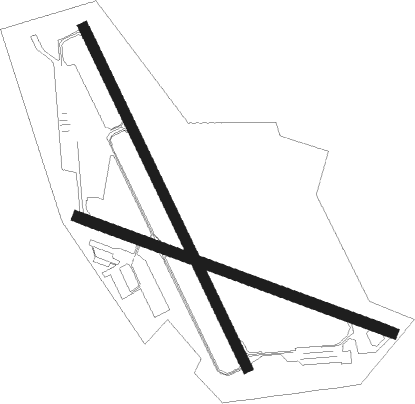
| ILS-cat-I | RW16 | 111.7 | 18.00mi |
| 3° GS | RW16 | 111.7 | 18.00mi |
Nearby Points of Interest:
Manship House
-Warren-Guild-Simmons House
-Farish Street Neighborhood Historic District
-Castle Crest
-Fountainhead
-Mississippi State Capitol
-Garner Wynn Green House
-Millsaps-Buie House
-Sims House
-Joseph Henry Morris House
-Mississippi Governor's Mansion
-Smith Park Architectural District
-Virden-Patton House
-Spengler–Thomas Building
-Central Fire Station
-Jackson City Hall
-Old Mississippi State Capitol
-Woodrow Wilson Bridge
-The Cedars
-Sub Rosa
-Ervin Lewis House
-Holly Grove Plantation House
-Peyton House
-Porter House
-Hinds County Courthouse

Nearby beacons
| code | identifier | dist | bearing | frequency |
|---|---|---|---|---|
| JH | BRENZ (JACKSON) NDB | 5 | 334° | 260 |
| JA | ALLEN (JACKSON) NDB | 7 | 53° | 365 |
| MHZ | MAGNOLIA (MADISON) VORTAC | 8.6 | 51° | 113.20 |
| TKH | TALLULAH (VICKSBURG/TALLULAH) NDB | 41.1 | 264° | 344 |
| LBY | EATON (HATTIESBURG) VORTAC | 71.1 | 136° | 110.60 |
Instrument approach procedures
| runway | airway (heading) | route (dist, bearing) |
|---|---|---|
| RW16 | OCARO (155°) | OCARO 2000ft |
| RNAV | OCARO 2000ft GUGWA (7mi, 155°) 1900ft UTUWI (3mi, 155°) 860ft KHKS (2mi, 155°) 397ft (5416mi, 110°) 542ft JILHO (5412mi, 290°) 2000ft JILHO (turn) | |
| RW34 | JILHO (336°) | JILHO 2000ft |
| RNAV | JILHO 2000ft IBRAQ (7mi, 335°) 1900ft WUWRE (3mi, 335°) 1000ft KHKS (2mi, 336°) 346ft (5416mi, 110°) 572ft OCARO (5421mi, 290°) 2000ft OCARO (turn) |
Disclaimer
The information on this website is not for real aviation. Use this data with the X-Plane flight simulator only! Data taken with kind consent from X-Plane 12 source code and data files. Content is subject to change without notice.