Hill City - Hill City Muni
Airport details
| Country | United States of America |
| State | Kansas |
| Region | K3 |
| Airspace | Denver Ctr |
| Municipality | Graham County |
| Elevation | 2229ft (679m) |
| Timezone | GMT -6 |
| Coordinates | 39.38020, -99.83147 |
| Magnetic var | |
| Type | land |
| Available since | X-Plane v10.40 |
| ICAO code | KHLC |
| IATA code | HLC |
| FAA code | HLC |
Communication
| Hill City Muni ASOS | 118.425 |
| Hill City Muni CTAF | 122.800 |
Nearby Points of Interest:
Nicodemus National Historic Site
-St. Joseph Catholic Church
-Barbeau House
-Cottonwood Ranch
-Shafer Barn
-Lipp Barn
-Rooks County Courthouse
-Ellis Congregational Church
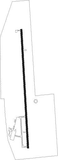
Runway info
| Runway 18 / 36 | ||
| length | 1527m (5010ft) | |
| bearing | 182° / 2° | |
| width | 23m (75ft) | |
| surface | concrete | |
Nearby beacons
| code | identifier | dist | bearing | frequency |
|---|---|---|---|---|
| HLC | HILL CITY VORTAC | 19.7 | 253° | 113.70 |
| NRN | NORTON NDB | 28.6 | 353° | 230 |
| HYS | HAYS VORTAC | 41.1 | 134° | 110.40 |
| OIN | OBERLIN NDB | 42.3 | 302° | 341 |
| HY | NETTE (HAYS) NDB | 45.5 | 136° | 374 |
| OEL | OAKLEY NDB | 48.4 | 255° | 380 |
| MCK | MC COOK VOR/DME | 60.7 | 317° | 115.30 |
Instrument approach procedures
| runway | airway (heading) | route (dist, bearing) |
|---|---|---|
| RW18 | GECEV (182°) | GECEV 4200ft |
| RNAV | GECEV 4200ft HAKIP (6mi, 182°) 3900ft WITUB (3mi, 182°) 3000ft KHLC (3mi, 182°) 2278ft (5861mi, 112°) 2488ft FIMEV (5862mi, 291°) 4200ft FIMEV (turn) | |
| RW36 | FIMEV (2°) | FIMEV 4200ft |
| RNAV | FIMEV 4200ft HAVRI (6mi, 2°) 3900ft IGEFO (2mi, 2°) 3140ft KHLC (3mi, 2°) 2228ft (5861mi, 112°) 2600ft GECEV (5859mi, 292°) 4200ft GECEV (turn) |
Disclaimer
The information on this website is not for real aviation. Use this data with the X-Plane flight simulator only! Data taken with kind consent from X-Plane 12 source code and data files. Content is subject to change without notice.