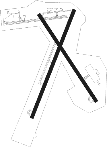
Wheeling - Wheeling Ohio Co
Airport details
| Country | United States of America |
| State | West Virginia |
| Region | K6 |
| Airspace | Cleveland Ctr |
| Municipality | Ohio County |
| Elevation | 1191ft (363m) |
| Timezone | GMT -5 |
| Coordinates | 40.17308, -80.64082 |
| Magnetic var | |
| Type | land |
| Available since | X-Plane v10.40 |
| ICAO code | KHLG |
| IATA code | HLG |
| FAA code | HLG |
Communication
| Wheeling Ohio Co ASOS | 127.375 |
| Wheeling Ohio Co CTAF | 118.100 |
| Wheeling Ohio Co UNICOM | 122.950 |
| Wheeling Ohio Co Ground Control | 121.750 |
| Wheeling Ohio Co Tower | 118.100 |
| Wheeling Ohio Co PITTSBURG Approach/Departure | 118.650 |
Approach frequencies
| ILS-cat-I | RW03 | 109.7 | 18.00mi |
| 3° GS | RW03 | 109.7 | 18.00mi |
Nearby Points of Interest:
Shaw Hall
-Shotwell Hall, West Liberty State College
-Stringer Stone House
-Old Main
-Pendleton Heights
-Delta Tau Delta Founders House
-Alexander Campbell Mansion
-Elm Hill
-Stratford Springs
-Carter Farm
-Nicholls House and Woolen Mill Site
-Fischer-Lasch Farmhouse
-Johnson Camden McKinley House
-H. C. Ogden House
-Wellsburg Wharf
-William Miles Tiernan House
-Woodsdale-Edgewood Neighborhood Historic District
-Danforth Brown House
-Gen. I.H. Duval Mansion
-Wellsburg Historic District
-Vancroft
-Lucy Tarr Mansion
-Edemar
-Beallmore
-Kirker House
Nearby beacons
| code | identifier | dist | bearing | frequency |
|---|---|---|---|---|
| HLG | WHEELING VOR/DME | 6.1 | 40° | 112.20 |
| AIR | BELLAIRE VOR/DME | 12.3 | 229° | 117.10 |
| CFX | CADIZ NDB | 17.5 | 280° | 239 |
| MMJ | (PITTSBURGH) DME | 27.8 | 55° | 112 |
| AGC | ALLEGHENY (PITTSBURGH) VOR/DME | 28.2 | 80° | 110 |
| CTW | DME | 38.4 | 274° | 111.80 |
| EWC | ELLWOOD CITY VOR/DME | 43.7 | 33° | 115.80 |
| VV | CAMOR (CONNELLSVILLE) NDB | 44.7 | 108° | 299 |
| BSV | BRIGGS VOR/DME | 49.6 | 306° | 112.40 |
| MGW | MORGANTOWN VOR/DME | 51.6 | 128° | 111.60 |
| UCP | CASTLE (NEW CASTLE) NDB | 52 | 15° | 272 |
| JPU | PARKERSBURG VOR/DME | 55.4 | 225° | 108.60 |
| CKB | CLARKSBURG VOR/DME | 57.8 | 158° | 112.60 |
| ACO | AKRON VOR/DME | 61.6 | 329° | 114.40 |
| AK | AKRON NDB | 63.7 | 320° | 362 |
| PK | VERSI (PARKERSBURG) NDB | 67.5 | 223° | 388 |
Instrument approach procedures
| runway | airway (heading) | route (dist, bearing) |
|---|---|---|
| RW03 | AHTIY (315°) | AHTIY AMNOV (14mi, 277°) 3200ft BOGGS (5mi, 314°) 3100ft |
| RW03 | CTW (94°) | CTW BOGGS (36mi, 106°) 3100ft |
| RW03 | HLG (220°) | HLG BOGGS (17mi, 216°) 3100ft BOGGS (turn) 3100ft |
| RNAV | BOGGS 3100ft CESKA (6mi, 32°) 2600ft YIZQI (3mi, 32°) 1800ft KHLG (2mi, 41°) 1230ft (4976mi, 116°) 1600ft HLG (4974mi, 297°) 3100ft HLG (turn) 3100ft | |
| RW16 | AIR (49°) | AIR FAPNU (19mi, 11°) 3100ft FAPNU (turn) 2900ft |
| RW16 | CTW (94°) | CTW FAPNU (34mi, 82°) 2900ft |
| RW16 | HEFJA (247°) | HEFJA FAPNU (16mi, 280°) 3100ft FAPNU (turn) 2900ft |
| RNAV | FAPNU 2900ft BOVPY (5mi, 144°) 2800ft KHLG (6mi, 143°) 1211ft (4976mi, 116°) 1700ft AIR (4984mi, 296°) 3100ft AIR (turn) | |
| RW21 | WISKE (39°) | WISKE BEKSE (14mi, 32°) 3100ft BEKSE (turn) 3100ft |
| RNAV | BEKSE 3100ft ACETE (5mi, 213°) 3000ft KHLG (6mi, 209°) 1236ft (4976mi, 116°) 1700ft AIR (4984mi, 296°) 3100ft AIR (turn) | |
| RW34 | AHTIY (315°) | AHTIY CEPGI (8mi, 303°) 3100ft |
| RW34 | AIR (49°) | AIR GELIF (12mi, 114°) 3100ft CEPGI (6mi, 45°) 3100ft |
| RW34 | PIDYY (143°) | PIDYY CEPGI (18mi, 144°) 3100ft CEPGI (turn) 3100ft |
| RNAV | CEPGI 3100ft ECAYO (6mi, 324°) 3000ft XACJE (3mi, 324°) 1920ft KHLG (2mi, 327°) 1233ft (4976mi, 116°) 1594ft PIDYY (4980mi, 297°) 3300ft PIDYY (turn) 3300ft |
Disclaimer
The information on this website is not for real aviation. Use this data with the X-Plane flight simulator only! Data taken with kind consent from X-Plane 12 source code and data files. Content is subject to change without notice.

