Holland - Park Township
Airport details
| Country | United States of America |
| State | Michigan |
| Region | K5 |
| Airspace | Chicago Ctr |
| Municipality | Park Township |
| Elevation | 603ft (184m) |
| Timezone | GMT -5 |
| Coordinates | 42.79591, -86.16199 |
| Magnetic var | |
| Type | land |
| Available since | X-Plane v10.40 |
| ICAO code | KHLM |
| IATA code | HLM |
| FAA code | HLM |
Communication
| PARK TOWNSHIP CTAF/UNICOM | 122.800 |
| PARK TOWNSHIP MUSKEGON Approach/Departure | 119.800 |
Nearby Points of Interest:
Egbert H. Gold Estate
-Isaac Cappon House
-Holland Downtown Historic District
-Holland Old City Hall and Fire Station
-Old Wing Mission
-Dorr E. Felt Mansion
-All Saints Episcopal Church
-Warner P. Sutton House
-Lake Shore Chapel
-Olive Township District No. 1 School
-Hacklander Site
-Hudsonville Christian School Building
-Battle Point Site
-Spoonville site
-Nathaniel and Esther (Savidge) Robbins House
-Grand Trunk Western Railroad Grand Haven Coal Tipple
-Grand Rapids, Grand Haven and Muskegon Railway Depot
-Edward D. Born House
-Henry Franks House
-Griswold Civic Center Historic District
-William H. Brown House
-Norton Mound Group
-Sarah Lowe Stedman House
-Marshall Street Historic District
-Division Avenue–Plaster Creek Bridge
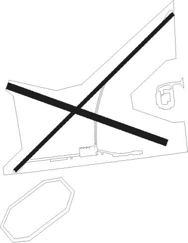
Runway info
Runway 5 / 23  | ||
| length | 913m (2995ft) | |
| bearing | 58° / 238° | |
| width | 15m (50ft) | |
| surface | asphalt | |
| displ threshold | 221m (725ft) / 348m (1142ft) | |
| Runway 12 / 30 | ||
| length | 680m (2231ft) | |
| bearing | 108° / 288° | |
| width | 27m (90ft) | |
| surface | grass | |
| displ threshold | 311m (1020ft) / 250m (820ft) | |
Nearby beacons
| code | identifier | dist | bearing | frequency |
|---|---|---|---|---|
| PMM | PULLMAN VOR/DME | 19.9 | 170° | 112.10 |
| MKG | MUSKEGON TACAN | 23 | 18° | 115.20 |
| VIO | VICTORY VOR/DME | 29.3 | 91° | 115.95 |
| GR | KNOBS (GRAND RAPIDS) NDB | 35 | 83° | 263 |
| ELX | KEELER VOR/DME | 39.1 | 177° | 116.60 |
| AZO | KALAMAZOO VOR/DME | 43 | 133° | 109 |
| AZ | AUSTN (KALAMAZOO) NDB | 48.7 | 136° | 371 |
| BT | BATOL (BATTLE CREEK) NDB | 50.4 | 114° | 272 |
| HIC | WHITE CLOUD VOR/DME | 50.6 | 30° | 117.60 |
| IRS | STURGIS NDB | 67.3 | 143° | 382 |
Disclaimer
The information on this website is not for real aviation. Use this data with the X-Plane flight simulator only! Data taken with kind consent from X-Plane 12 source code and data files. Content is subject to change without notice.