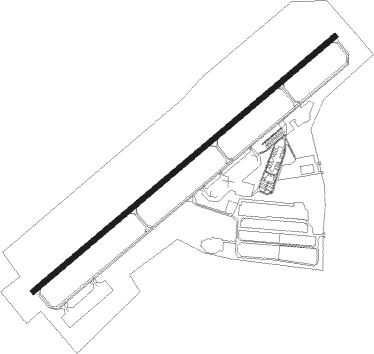
Hampton - Henry Co
Airport details
| Country | United States of America |
| State | Georgia |
| Region | K7 |
| Airspace | Atlanta Ctr |
| Municipality | Henry County |
| Elevation | 880ft (268m) |
| Timezone | GMT -5 |
| Coordinates | 33.38990, -84.33103 |
| Magnetic var | |
| Type | land |
| Available since | X-Plane v10.40 |
| ICAO code | KHMP |
| IATA code | n/a |
| FAA code | HMP |
Communication
| Henry Co AWOS 3 | 124.825 |
| Henry Co CTAF/UNICOM | 122.725 |
| Henry Co ATLANTA Approach | 128.575 |
| Henry Co ATLANTA Departure | 128.575 |
Nearby Points of Interest:
Crawford-Dorsey House and Cemetery
-Stately Oaks
-Holliday-Dorsey-Fife House
-Mills House
-Double Cabins
-Old Spalding County Courthouse
-Bailey-Tebault House
-Sam Bailey Building
-McDonough Historic District
-Brown House
-Hill-Kurtz House
-Henry County Courthouse
-Old Gaissert Homeplace
-Locust Grove Institute
-Locust Grove Historic District
-Rex Mill
-Campbell County Courthouse
-Aaron and Margaret Parker Jr. House
-Pike County Courthouse
-White Oak Creek Covered Bridge
-Thomas P. Arnold House
-Jeremiah S. Gilbert House
-McFarland-Render House
-J. R. Carmichael House
-Butts County Courthouse
Nearby beacons
| code | identifier | dist | bearing | frequency |
|---|---|---|---|---|
| FFC | PECAT (ATLANTA) NDB | 9.4 | 240° | 316 |
| ATL | ATLANTA VORTAC | 15.2 | 336° | 116.90 |
| AT | CATTA (ATLANTA) NDB | 18.7 | 321° | 375 |
| EQQ | COWETA COUNTY (NEWNAN) NDB | 20.7 | 251° | 234 |
| OP | YATES (THOMASTON) NDB | 29.1 | 163° | 339 |
| PDK | PEACHTREE (ATLANTA) VOR/DME | 29.2 | 4° | 116.60 |
| VOF | ALCOVY (COVINGTON) NDB | 31 | 66° | 370 |
| DOB | DOBBINS (MARIETTA) TACAN | 32.7 | 341° | 113 |
| GPQ | CARROLLTON NDB | 41.4 | 282° | 278 |
| TX | GWNET (LAWRENCEVILLE) NDB | 44.4 | 37° | 419 |
| LGC | LA GRANGE VORTAC | 48.5 | 249° | 115.60 |
| BMW | BARROW COUNTY (WINDER) NDB | 49.4 | 54° | 404 |
| DJD | CHERO NDB | 52.3 | 350° | 415 |
| FKV | FLOWERY BRANCH (GAINESVILLE) NDB | 53.2 | 28° | 365 |
| MCN | MACON VORTAC | 54.2 | 136° | 114.20 |
| CSG | COLUMBUS VORTAC | 57.9 | 222° | 117.10 |
| WRB | ROBINS (WARNER ROBINS) TACAN | 58.4 | 135° | 135.30 |
| RMG | ROME VORTAC | 60.8 | 314° | 115.40 |
| CS | FENIX (COLUMBUS) NDB | 66.7 | 217° | 355 |
Departure and arrival routes
| Transition altitude | 18000ft |
| Transition level | 18000ft |
| STAR starting points | distance | inbound heading | |
|---|---|---|---|
| ALL | |||
| BUKHD3 | 76.8 | 145° | |
| DEHAN3 | 67.7 | 198° | |
Instrument approach procedures
| runway | airway (heading) | route (dist, bearing) |
|---|---|---|
| RW06 | JUPEP (59°) | JUPEP 2500ft |
| RNAV | JUPEP 2500ft BGGOH (6mi, 59°) 2500ft ZUXUD (3mi, 59°) 1400ft KHMP (2mi, 59°) 896ft (5121mi, 112°) 1061ft YEBUT (5111mi, 292°) 2600ft YEBUT (turn) | |
| RW24 | YEBUT (239°) | YEBUT 2600ft |
| RNAV | YEBUT 2600ft HAMPP (7mi, 239°) 2600ft CUVLI (3mi, 239°) 1700ft KHMP (3mi, 239°) 922ft (5121mi, 112°) 1132ft JUPEP (5130mi, 291°) 2500ft JUPEP (turn) |
Holding patterns
| STAR name | hold at | type | turn | heading* | altitude | leg | speed limit |
|---|---|---|---|---|---|---|---|
| BUKHD3 | HLNDS | VHF | right | 327 (147)° | DME 10.0mi | ICAO rules | |
| DEHAN3 | AWSON | VHF | left | 29 (209)° | DME 10.0mi | ICAO rules | |
| DEHAN3 | TRALZ | VHF | right | 32 (212)° | DME 10.0mi | ICAO rules | |
| *) magnetic outbound (inbound) holding course | |||||||
Disclaimer
The information on this website is not for real aviation. Use this data with the X-Plane flight simulator only! Data taken with kind consent from X-Plane 12 source code and data files. Content is subject to change without notice.