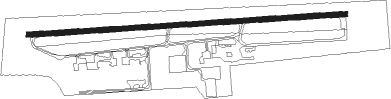
Huntingburg
Airport details
| Country | United States of America |
| State | Indiana |
| Region | K5 |
| Airspace | Indianapolis Ctr |
| Municipality | Dubois County |
| Elevation | 526ft (160m) |
| Timezone | GMT -5 |
| Coordinates | 38.24903, -86.95370 |
| Magnetic var | |
| Type | land |
| Available since | X-Plane v10.40 |
| ICAO code | KHNB |
| IATA code | HNB |
| FAA code | HNB |
Communication
| Huntingburg AWOS 3 | 118.250 |
| Huntingburg CTAF/UNICOM | 122.800 |
| Huntingburg EVANSVILLE Approach/Departure | 126.400 |
Nearby Points of Interest:
Huntingburg Town Hall and Fire Engine House
-Huntingburg Commercial Historic District
-Dr. Alois Wollenmann House
-John Opel House
-Deutsch Evangelische St. Paul's Kirche
-Louis H. Sturm Hardware Store
-Dubois County Courthouse
-Gramelspacher–Gutzweiler House
-Col. William Jones House
-St. Boniface Catholic Church
-Evangelische Lutherische Emanuels Kirche
-Palace Lodge
-Jacob Rickenbaugh House
-Nester House
-Potts Creek Rockshelter
-Old Warrick County Jail
-Boonville Public Square Historic District
-William M. Cockrum House
-Patoka Bridges Historic District
-Tell City Oddfellows' Hall
-Robert C. Beauchamp House
-Rockhouse Cliffs Rockshelters
-Pike County Courthouse
-Spencer County Courthouse
-Cannelton Cotton Mill
Nearby beacons
| code | identifier | dist | bearing | frequency |
|---|---|---|---|---|
| EVV | VICCI (EVANSVILLE) NDB | 24.1 | 256° | 219 |
| OWB | OWENSBORO VOR/DME | 31.9 | 203° | 108.60 |
| MYS | MYSTIC VOR | 39.7 | 117° | 108.20 |
| PXV | POCKET CITY (EVANSVILLE) VORTAC | 42.8 | 248° | 113.30 |
| LWV | DME | 43.7 | 309° | 108.80 |
| FTK | FORT KNOX VOR/DME | 50.7 | 109° | 109.60 |
| CCT | CITY DME | 54 | 200° | 109.80 |
| OOM | HOOSIER (BLOOMINGTON) VORTAC | 56 | 21° | 110.20 |
| PLX | PALESTINE (ROBINSON) NDB | 56.1 | 318° | 391 |
Instrument approach procedures
| runway | airway (heading) | route (dist, bearing) |
|---|---|---|
| RW09 | AGKIP (65°) | AGKIP APKEW (7mi, 1°) 2500ft |
| RW09 | APKEW (90°) | APKEW 2500ft |
| RW09 | EFWAV (116°) | EFWAV APKEW (7mi, 181°) 2500ft |
| RNAV | APKEW 2500ft OGEDY (6mi, 90°) 2200ft KHNB (6mi, 90°) 557ft (5262mi, 114°) 774ft IDGOW (5250mi, 294°) 2500ft IDGOW (turn) | |
| RW27 | ANDUQ (245°) | ANDUQ IDGOW (7mi, 181°) 2500ft |
| RW27 | EGWAB (296°) | EGWAB IDGOW (7mi, 1°) 2500ft |
| RW27 | IDGOW (271°) | IDGOW 2500ft |
| RNAV | IDGOW 2500ft NECWI (6mi, 271°) 2200ft CILMA (3mi, 271°) 1340ft KHNB (3mi, 271°) 569ft (5262mi, 114°) 729ft APKEW (5273mi, 294°) 2500ft APKEW (turn) |
Disclaimer
The information on this website is not for real aviation. Use this data with the X-Plane flight simulator only! Data taken with kind consent from X-Plane 12 source code and data files. Content is subject to change without notice.