Hobbs - Lea Co Rgl
Airport details
| Country | United States of America |
| State | New Mexico |
| Region | K2 |
| Airspace | Ft Worth Ctr |
| Municipality | Lea County |
| Elevation | 3661ft (1116m) |
| Timezone | GMT -7 |
| Coordinates | 32.68750, -103.21733 |
| Magnetic var | |
| Type | land |
| Available since | X-Plane v10.40 |
| ICAO code | KHOB |
| IATA code | HOB |
| FAA code | HOB |
Communication
| Lea Co Rgl ATIS | 119.750 |
| Lea Co Rgl CTAF | 120.650 |
| Lea Co Rgl UNICOM | 122.950 |
| Lea Co Rgl Ground Control | 121.900 |
| Lea Co Rgl HOBBS Tower | 120.650 |
Approach frequencies
| ILS-cat-I | RW03 | 108.5 | 18.00mi |
| 3° GS | RW03 | 108.5 | 18.00mi |
Nearby Points of Interest:
Lea County Courthouse
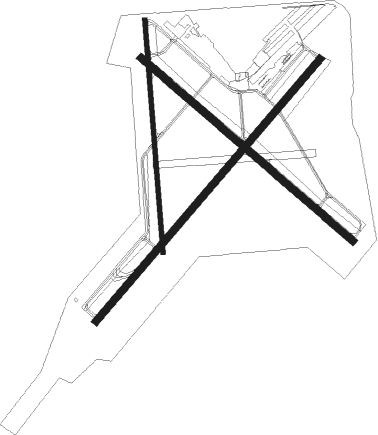
Runway info
Runway 12 / 30  | ||
| length | 1831m (6007ft) | |
| bearing | 130° / 310° | |
| width | 46m (150ft) | |
| surface | asphalt | |
| Runway 17 / 35 | ||
| length | 1525m (5003ft) | |
| bearing | 180° / 0° | |
| width | 30m (100ft) | |
| surface | asphalt | |
| displ threshold | 150m (492ft) / 0m (0ft) | |
| Runway 3 / 21 | ||
| length | 2257m (7405ft) | |
| bearing | 50° / 230° | |
| width | 46m (150ft) | |
| surface | asphalt | |
Nearby beacons
| code | identifier | dist | bearing | frequency |
|---|---|---|---|---|
| HOB | HOBBS VORTAC | 3.9 | 227° | 111 |
| INK | WINK VORTAC | 48.8 | 182° | 112.10 |
| MA | FARLY (MIDLAND) NDB | 61.7 | 128° | 326 |
Instrument approach procedures
| runway | airway (heading) | route (dist, bearing) |
|---|---|---|
| RW03 | ANEEL (308°) | ANEEL CIMID (24mi, 278°) 5600ft FIBGA (7mi, 331°) 5600ft |
| RW03 | DEKEC (233°) | DEKEC FIBGA (25mi, 231°) 5600ft FIBGA (turn) 5600ft |
| RW03 | KUCEY (107°) | KUCEY BUMIW (11mi, 160°) 5600ft FIBGA (7mi, 112°) 5600ft |
| RW03 | WUDRU (66°) | WUDRU FIBGA (19mi, 74°) 5600ft |
| RNAV | FIBGA 5600ft JISKY (7mi, 50°) 4800ft KHOB (4mi, 49°) 3700ft (6071mi, 108°) 3902ft DEKEC (6060mi, 288°) 6000ft DEKEC (turn) | |
| RW21 | ANEEL (308°) | ANEEL ZEGBO (23mi, 352°) 6000ft DEKEC (7mi, 301°) 6000ft |
| RW21 | HOB (47°) | HOB DEKEC (18mi, 51°) 6000ft DEKEC (turn) 6000ft |
| RNAV | DEKEC 6000ft ROBRY (8mi, 234°) 5500ft KOYES (3mi, 230°) 4420ft KHOB (3mi, 231°) 3690ft (6071mi, 108°) 3896ft FIBGA (6080mi, 287°) 5600ft FIBGA (turn) | |
| RW30 | ANEEL (308°) | ANEEL LISNY (14mi, 307°) 6000ft |
| RW30 | HOB (47°) | HOB LISNY (13mi, 113°) 6000ft LISNY (turn) 6000ft |
| RW30 | INK (2°) | INK IFNOF (35mi, 20°) 6000ft LISNY (7mi, 0°) 6000ft |
| RW30 | TASNE (232°) | TASNE CUKED (24mi, 190°) 6000ft LISNY (7mi, 253°) 6000ft |
| RW30 | WUDRU (66°) | WUDRU LISNY (34mi, 83°) 6000ft LISNY (turn) 6000ft |
| RNAV | LISNY 6000ft OJIRO (6mi, 310°) 5500ft WAMGI (4mi, 310°) 4340ft KHOB (3mi, 308°) 3682ft (6071mi, 108°) 4700ft LISNY (6064mi, 288°) 6000ft LISNY (turn) |
Disclaimer
The information on this website is not for real aviation. Use this data with the X-Plane flight simulator only! Data taken with kind consent from X-Plane 12 source code and data files. Content is subject to change without notice.