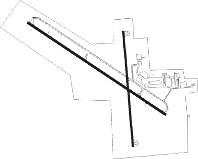
Huron - Huron Regl
Airport details
| Country | United States of America |
| State | South Dakota |
| Region | K3 |
| Airspace | Minneapolis Ctr |
| Municipality | Huron |
| Elevation | 1289ft (393m) |
| Timezone | GMT -6 |
| Coordinates | 44.38519, -98.22855 |
| Magnetic var | |
| Type | land |
| Available since | X-Plane v10.40 |
| ICAO code | KHON |
| IATA code | HON |
| FAA code | HON |
Communication
| Huron Regl ASOS | 118.125 |
| Huron Regl CTAF | 123.600 |
| Huron Regl UNICOM | 123.000 |
Approach frequencies
| ILS-cat-I | RW12 | 110.3 | 18.00mi |
| 3° GS | RW12 | 110.3 | 18.00mi |
Nearby Points of Interest:
Hattie O. and Henry Drake Octagon House
-Chicago and North Western Roundhouse
-Grace Episcopal Church
-Pyle House
-Methodist Episcopal Church of Wessington Springs
-Jerauld County Courthouse
-Robert S. Vessey House

Nearby beacons
| code | identifier | dist | bearing | frequency |
|---|---|---|---|---|
| HON | DME | 4.8 | 304° | 117.60 |
| HO | BEADY (HURON) NDB | 5.8 | 298° | 302 |
| MHE | MITCHELL VOR/DME | 37.4 | 163° | 109.20 |
Instrument approach procedures
| runway | airway (heading) | route (dist, bearing) |
|---|---|---|
| RW12 | CAGUX (230°) | CAGUX TESHE (17mi, 267°) 3000ft MIMFA (5mi, 227°) 3000ft |
| RW12 | DAKPE (96°) | DAKPE HEMES (8mi, 87°) 3000ft MIMFA (5mi, 47°) 3000ft |
| RW12 | MIMFA (119°) | MIMFA 3000ft |
| RW12 | TULLA (166°) | TULLA TESHE (13mi, 191°) 3000ft MIMFA (5mi, 227°) 3000ft |
| RNAV | MIMFA 3000ft PUMMI (6mi, 119°) 3000ft KHON (6mi, 119°) 1339ft (5758mi, 114°) 1489ft CAVOR (5754mi, 294°) FARVA (7mi, 119°) 3000ft FARVA (turn) | |
| RW30 | HON (124°) | HON FARVA (17mi, 121°) 3000ft FARVA (turn) 3000ft |
| RW30 | KAATS (40°) | KAATS HUBOB (26mi, 65°) 3900ft FARVA (6mi, 48°) 3000ft |
| RW30 | ZOTBY (265°) | ZOTBY HUDIS (20mi, 255°) 4000ft FARVA (6mi, 228°) 3000ft |
| RNAV | FARVA 3000ft CAVOR (7mi, 299°) 3000ft KHON (6mi, 299°) 1333ft (5758mi, 114°) 1559ft COGAC (5759mi, 294°) HON (3mi, 307°) 3000ft HON (turn) |
Disclaimer
The information on this website is not for real aviation. Use this data with the X-Plane flight simulator only! Data taken with kind consent from X-Plane 12 source code and data files. Content is subject to change without notice.