Erwin - Harnett Regl
Airport details
| Country | United States of America |
| State | North Carolina |
| Region | K7 |
| Airspace | Washington Ctr |
| Municipality | Harnett County |
| Elevation | 202ft (62m) |
| Timezone | GMT -5 |
| Coordinates | 35.38015, -78.73224 |
| Magnetic var | |
| Type | land |
| Available since | X-Plane v10.40 |
| ICAO code | KHRJ |
| IATA code | n/a |
| FAA code | HRJ |
Communication
| Harnett Regl AWOS 3 | 119.025 |
| Harnett Regl CTAF/UNICOM | 122.700 |
| Harnett Regl FAYETTEVILLE Approach/Departure | 125.175 |
Approach frequencies
| LOC | RW05 | 108.35 | 18.00mi |
Nearby Points of Interest:
Dunn Commercial Historic District
-Williams Grove School
-Ellerslie
-Fuquay Springs Historic District
-Fuquay Mineral Spring
-Fuquay Springs Teacherage
-Fuquay-Varina Woman's Club Clubhouse
-Kemp B. Johnson House
-J. Beale Johnson House
-Four Oaks Commercial Historic District
-Samuel Bartley Holleman House
-Leslie-Alford-Mims House
-Holly Springs Masonic Lodge
-North Durham County Prison Camp
-Confederate Breastworks
-Fayetteville Veterans Administration Hospital Historic District
-Beaver Dam
-Jesse Penny House and Outbuildings
-Harper House
-Orange Street School
-Hood-Strickland House
-Johnston County Courthouse
-Barge's Tavern
-Belden-Horne House
-Hood Brothers Building
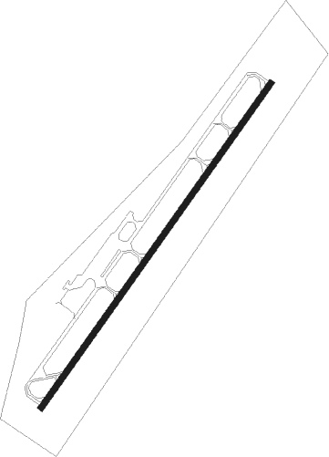
Runway info
| Runway 5 / 23 | ||
| length | 1527m (5010ft) | |
| bearing | 46° / 226° | |
| width | 23m (75ft) | |
| surface | asphalt | |
Nearby beacons
| code | identifier | dist | bearing | frequency |
|---|---|---|---|---|
| HQT | HARNETT (ERWIN) NDB | 4.2 | 47° | 417 |
| POB | POPE (FAYETTEVILLE) NDB | 14.2 | 235° | 338 |
| FGP | FORT BRAGG NDB | 15 | 198° | 393 |
| JN | JURLY (SMITHFIELD) NDB | 16 | 73° | 263 |
| POB | POPE (FAYETTEVILLE) TACAN | 18.9 | 234° | 113.80 |
| FAY | FAYETTEVILLE VOR/DME | 24.7 | 200° | 108.80 |
| RDU | RALEIGH-DURHAM VORTAC | 29.6 | 354° | 117.20 |
| CTZ | CLINTON NDB | 30.3 | 138° | 412 |
| LE | LEEVY (RALEIGH/DURHAM) NDB | 32.8 | 1° | 350 |
| GSB | SEYMOUR JOHNSON TACAN | 37.3 | 93° | 116.50 |
| SDZ | SANDHILLS (SOUTHERN PINES VORTAC | 43 | 259° | 111.80 |
| LIB | LIBERTY VORTAC | 50.1 | 296° | 113 |
| ME | MAXTN (MAXTON) NDB | 52.2 | 228° | 257 |
| HUR | PERSON (ROXBORO) NDB | 53.7 | 339° | 220 |
| JB | JIGEL (LUMBERTON) NDB | 53.9 | 206° | 384 |
| HB | ALAMM NDB | 54.9 | 305° | 361 |
| HXO | HUNTSBORO (OXFORD) NDB | 55.5 | 7° | 271 |
| DLC | DILLON NDB | 64 | 214° | 274 |
Instrument approach procedures
| runway | airway (heading) | route (dist, bearing) |
|---|---|---|
| RW05 | ECLEJ (20°) | ECLEJ 3400ft IRWOX (5mi, 304°) 2500ft |
| RW05 | IRWOX (46°) | IRWOX 2500ft |
| RW05 | OMFOH (67°) | OMFOH 3400ft IRWOX (5mi, 124°) 2500ft |
| RNAV | IRWOX 2500ft IJADE (6mi, 46°) 1900ft KHRJ (6mi, 46°) 223ft (4855mi, 114°) 474ft WUKGY (4848mi, 294°) 3400ft WUKGY (turn) | |
| RW23 | EZUWI (248°) | EZUWI 3400ft WUKGY (5mi, 304°) 3400ft |
| RW23 | UWOGI (200°) | UWOGI 3400ft WUKGY (5mi, 124°) 3400ft |
| RW23 | WUKGY (226°) | WUKGY 3400ft |
| RNAV | WUKGY 3400ft IBUWE (6mi, 226°) 1900ft CIRKO (3mi, 226°) 860ft KHRJ (2mi, 226°) 242ft IRWOX (12mi, 226°) 2500ft IRWOX (turn) |
Disclaimer
The information on this website is not for real aviation. Use this data with the X-Plane flight simulator only! Data taken with kind consent from X-Plane 12 source code and data files. Content is subject to change without notice.