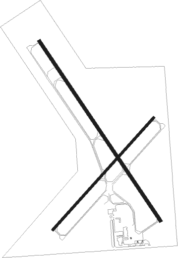
Hastings - Hastings Muni
Airport details
| Country | United States of America |
| State | Nebraska |
| Region | K3 |
| Airspace | Minneapolis Ctr |
| Municipality | Hastings |
| Elevation | 1959ft (597m) |
| Timezone | GMT -6 |
| Coordinates | 40.60525, -98.42789 |
| Magnetic var | |
| Type | land |
| Available since | X-Plane v10.40 |
| ICAO code | KHSI |
| IATA code | HSI |
| FAA code | HSI |
Communication
| Hastings Muni ASOS | 120.525 |
| Hastings Muni CTAF/UNICOM | 122.800 |
Nearby Points of Interest:
William Brach House
-St. Mark's Pro-Cathedral
-Nowlan-Dietrich House
-Foote Clinic
-Nebraska Loan and Trust Company Building
-Stein Brothers Building
-Farrell Block
-McCormick Hall
-Glenville School
-Nine Bridges Bridge
-Gloe Brothers Service Station
-Meisner Bank Building
-Clay County Courthouse
-Heinrich Giese House
-Fairfield Carnegie Library
-George Meisner House
-IOOF Hall and Opera House
-Oscar Roeser House
-H. J. Bartenbach House
-Hamilton-Donald House
-Cathedral of the Nativity of the Blessed Virgin Mary (Grand Island, Nebraska)
-Liederkranz
-Grand Island Carnegie Library
-Hall County Courthouse
-Grand Island United States Post Office and Courthouse
Nearby beacons
| code | identifier | dist | bearing | frequency |
|---|---|---|---|---|
| HSI | HASTINGS VOR/DME | 0 | 248° | 108.80 |
| GR | SANCY NDB | 16.8 | 23° | 380 |
| GRI | GRAND ISLAND VOR/DME | 23.3 | 17° | 112 |
| EAR | KEARNEY VOR | 27.2 | 282° | 111.20 |
| FMZ | BEKLOF (FAIRMONT) NDB | 39.2 | 91° | 392 |
| JYR | YORK NDB | 40.8 | 70° | 257 |
| OBH | WOLBACH VORTAC | 46.3 | 6° | 114.80 |
| TKO | MANKATO VORTAC | 48.5 | 168° | 109.80 |
Instrument approach procedures
| runway | airway (heading) | route (dist, bearing) |
|---|---|---|
| RW04 | HSI (68°) | HSI HEDNU (12mi, 234°) 4000ft HEDNU (turn) 4000ft |
| RW04 | IKUME (348°) | IKUME WARTA (10mi, 297°) 4000ft HEDNU (6mi, 323°) 4000ft |
| RW04 | LENIY (102°) | LENIY EYAGE (10mi, 157°) 4000ft HEDNU (6mi, 114°) 4000ft |
| RNAV | HEDNU 4000ft GICLE (6mi, 54°) 3600ft EPAJO (3mi, 54°) 2680ft KHSI (3mi, 52°) 1979ft (5789mi, 112°) 2189ft DECNE (5786mi, 292°) ROMAD (7mi, 90°) 4000ft ROMAD (turn) | |
| RW14 | EAR (102°) | EAR CIRLU (16mi, 89°) 4000ft IDROC (5mi, 66°) 4000ft |
| RW14 | GRI (197°) | GRI EBIKE (9mi, 207°) 4000ft IDROC (9mi, 247°) 4000ft |
| RW14 | IDROC (143°) | IDROC 4000ft |
| RNAV | IDROC 4000ft OWNEW (6mi, 143°) 3600ft CISOT (4mi, 143°) 2440ft KHSI (2mi, 145°) 2006ft (5789mi, 112°) 2220ft FEPOB (5784mi, 292°) 4000ft FEPOB (turn) | |
| RW32 | FEPOB (323°) | FEPOB 4000ft |
| RW32 | IKUME (348°) | IKUME FEPOB (10mi, 21°) 4000ft |
| RW32 | KECER (280°) | KECER ZELUN (11mi, 237°) 4000ft FEPOB (6mi, 281°) 4000ft |
| RNAV | FEPOB 4000ft JEKRU (7mi, 323°) 3400ft KHSI (5mi, 323°) 1982ft (5789mi, 112°) 2194ft IDROC (5794mi, 292°) 4000ft IDROC (turn) |
Disclaimer
The information on this website is not for real aviation. Use this data with the X-Plane flight simulator only! Data taken with kind consent from X-Plane 12 source code and data files. Content is subject to change without notice.

