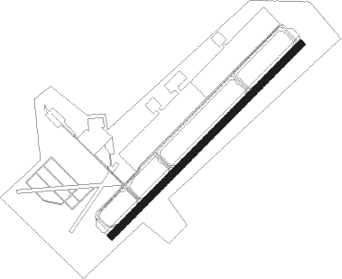
Homestead - Homestead Arb
Airport details
| Country | United States of America |
| State | Florida |
| Region | K7 |
| Airspace | Miami Oceanic Ctr |
| Municipality | Miami-Dade County |
| Elevation | 4ft (1m) |
| Timezone | GMT -5 |
| Coordinates | 25.48855, -80.38357 |
| Magnetic var | |
| Type | land |
| Available since | X-Plane v10.40 |
| ICAO code | KHST |
| IATA code | HST |
| FAA code | HST |
Communication
| Homestead ARB ATIS | 132.275 |
| Homestead ARB Ground Control | 121.750 |
| Homestead ARB Tower | 133.450 |
| Homestead ARB GCA | 123.800 |
| Homestead ARB Approach/Departure | 123.800 |
Approach frequencies
| ILS-cat-I | RW06 | 109.9 | 18.00mi |
| 2.5° GS | RW06 | 109.9 | 18.00mi |
Nearby Points of Interest:
Coral Castle
-William Anderson General Merchandise Store
-Silver Palm Schoolhouse
-McMinn-Horne House
-Lindeman–Johnson House
-Homestead Multiple Property Submission
-Seminole Cafe and Hotel
-Lily Lawrence Bow Library
-Homestead Historic Downtown District
-Florida East Coast Railway 153
-Ferdinand Magellan
-Charles Deering Estate
-Jones Family Historic District
-Boca Chita Key Historic District
-Hervey Allen Study
-Anhinga Trail
-Arden Doc Thomas House
-Marjory Stoneman Douglas House
-The Kampong
-El Jardin
-Lincoln Memorial Park
-MacFarlane Homestead Historic District
-First Coconut Grove School
-Ace Theatre
-Coast Guard Air Station Dinner Key
Nearby beacons
| code | identifier | dist | bearing | frequency |
|---|---|---|---|---|
| HST | HOMESTEAD TACAN | 0.2 | 71° | 108.20 |
| DHP | DOLPHIN (MIAMI) VORTAC | 18.7 | 6° | 113.90 |
| VKZ | VIRGINIA KEY VOR/DME | 20.1 | 41° | 117.10 |
| FLL | FORT LAUDERDALE VOR/DME | 37 | 20° | 114.40 |
| FX | PRAIZ (FT LAUDERDALE) NDB | 42.1 | 7° | 221 |
| MTH | MARATHON NDB | 60.6 | 223° | 260 |
Departure and arrival routes
| Transition altitude | 18000ft |
| Transition level | 18000ft |
| SID end points | distance | outbound heading | |
|---|---|---|---|
| RW06 | |||
| FOLZZ1 | 264mi | 27° | |
| MELLZ1 | 115mi | 139° | |
| MHITO1 | 147mi | 235° | |
| BNGOS1 | 76mi | 320° | |
| HURCN1 | 181mi | 326° | |
| VACAY1 | 113mi | 346° | |
| AARPS1 | 176mi | 347° | |
| RW24 | |||
| FOLZZ1 | 264mi | 27° | |
| MELLZ1 | 115mi | 139° | |
| MHITO1 | 147mi | 235° | |
| BNGOS1 | 76mi | 320° | |
| HURCN1 | 181mi | 326° | |
| VACAY1 | 113mi | 346° | |
| AARPS1 | 176mi | 347° | |
| STAR starting points | distance | inbound heading | |
|---|---|---|---|
| ALL | |||
| SNDBR1 | 26.5 | 78° | |
| DVALL3 | 33.3 | 92° | |
| PALMZ2 | 66.2 | 111° | |
| FROGZ1 | 43.5 | 123° | |
| CSTAL1 | 60.7 | 198° | |
| ANNEY4 | 61.3 | 199° | |
| BLUFI4 | 89.4 | 201° | |
| TARPN1 | 65.5 | 201° | |
| VIICE1 | 36.2 | 279° | |
| FOWEE2 | 72.7 | 295° | |
Instrument approach procedures
| runway | airway (heading) | route (dist, bearing) |
|---|---|---|
| RW06 | GULPE (52°) | GULPE 7000ft GULPE (turn) 3000ft |
| RNAV | GULPE 3000ft FLATE (9mi, 52°) 1500ft KHST (6mi, 52°) 59ft (4884mi, 108°) 800ft JOMIN (4881mi, 287°) 3000ft JOMIN (turn) 7000ft | |
| RW24 | WERGO (232°) | WERGO 3000ft |
| RNAV | WERGO 3000ft CAHOO (8mi, 232°) 1200ft KHST (5mi, 232°) 49ft (4884mi, 108°) 800ft JOMIN (4881mi, 287°) 3000ft JOMIN (turn) 7000ft |
Holding patterns
| STAR name | hold at | type | turn | heading* | altitude | leg | speed limit |
|---|---|---|---|---|---|---|---|
| ANNEY4 | PBI | NDB | right | 90 (270)° | 1.0min timed | ICAO rules | |
| ANNEY4 | PCMAN | VHF | left | 341 (161)° | 1.5min timed | ICAO rules | |
| ANNEY4 | TRV | NDB | left | 347 (167)° | < 17999ft | 1.0min timed | ICAO rules |
| BLUFI4 | LEBUR | VHF | left | 10 (190)° | < 17999ft | DME 8.0mi | ICAO rules |
| CSTAL1 | BEEIN | VHF | right | 347 (167)° | DME 10.0mi | ICAO rules | |
| CSTAL1 | CSTAL | VHF | left | 352 (172)° | DME 10.0mi | ICAO rules | |
| CSTAL1 | XPRSO | VHF | left | 346 (166)° | DME 10.0mi | ICAO rules | |
| CSTAL1 | YEPPA | VHF | left | 346 (166)° | DME 10.0mi | ICAO rules | |
| DVALL3 | CARNU | VHF | left | 217 (37)° | < 17999ft | 1.0min timed | ICAO rules |
| DVALL3 | WEVER | VHF | right | 248 (68)° | 1.0min timed | ICAO rules | |
| FOWEE2 | FOWEE | VHF | left | 137 (317)° | DME 7.0mi | ICAO rules | |
| FOWEE2 | JUNUR | VHF | left | 137 (317)° | DME 10.0mi | ICAO rules | |
| FROGZ1 | BETTL | VHF | right | 325 (145)° | DME 10.0mi | ICAO rules | |
| FROGZ1 | DANSE | VHF | right | 344 (164)° | DME 10.0mi | ICAO rules | |
| FROGZ1 | FROGZ | VHF | right | 319 (139)° | DME 10.0mi | ICAO rules | |
| FROGZ1 | GAWKS | VHF | left | 287 (107)° | DME 15.0mi | ICAO rules | |
| FROGZ1 | HARAP | VHF | right | 317 (137)° | DME 10.0mi | ICAO rules | |
| FROGZ1 | MATCY | VHF | right | 317 (137)° | DME 10.0mi | ICAO rules | |
| PALMZ2 | DUMDY | VHF | right | 340 (160)° | DME 4.0mi | ICAO rules | |
| PALMZ2 | PRIVY | VHF | right | 281 (101)° | DME 10.0mi | ICAO rules | |
| SNDBR1 | PAMPR | VHF | left | 240 (60)° | DME 10.0mi | ICAO rules | |
| SNDBR1 | PEAKY | VHF | left | 191 (11)° | DME 10.0mi | ICAO rules | |
| SNDBR1 | SNDBR | VHF | right | 209 (29)° | DME 10.0mi | ICAO rules | |
| VIICE1 | CLYER | VHF | left | 129 (309)° | DME 10.0mi | ICAO rules | |
| VIICE1 | MADIZ | VHF | right | 129 (309)° | DME 10.0mi | ICAO rules | |
| VIICE1 | MULYN | VHF | right | 154 (334)° | DME 10.0mi | ICAO rules | |
| VIICE1 | SUTON | VHF | right | 93 (273)° | DME 10.0mi | ICAO rules | |
| VIICE1 | VIICE | VHF | left | 128 (308)° | DME 10.0mi | ICAO rules | |
| *) magnetic outbound (inbound) holding course | |||||||
Disclaimer
The information on this website is not for real aviation. Use this data with the X-Plane flight simulator only! Data taken with kind consent from X-Plane 12 source code and data files. Content is subject to change without notice.