East Hampton
Airport details
| Country | United States of America |
| State | New York |
| Region | K6 |
| Airspace | Boston Ctr |
| Municipality | Town of East Hampton |
| Elevation | 56ft (17m) |
| Timezone | GMT -5 |
| Coordinates | 40.95942, -72.25166 |
| Magnetic var | |
| Type | land |
| Available since | X-Plane v10.40 |
| ICAO code | KHTO |
| IATA code | HTO |
| FAA code | HTO |
Communication
| East Hampton AWOS-3PT | 118.075 |
| East Hampton UNICOM | 122.700 |
| East Hampton NEW YORK Clearance DEL | 118.950 |
| East Hampton Ground | 121.900 |
| East Hampton Tower | 125.225 |
| East Hampton NEW YORK Approach/Departure | 132.250 |
Nearby Points of Interest:
Thomas Strong House
-Briar Patch Road Historic District
-Jericho Historic District
-Jones Road Historic District
-Buell's Lane Historic District
-Nathaniel Rogers House
-Thomas Moran House
-Beebe Windmill
-East Hampton Village District
-Sag Harbor Village District
-North Main Street Historic District
-Hook Windmill
-Stephen Sherrill House
-Egypt Lane Historic District
-Pantigo Road Historic District
-Hayground Windmill
-Saint Thomas' Chapel
-Amelia Cottage Museum
-Pleasants House
-Ambrose Parsons House
-Pollock-Krasner House and Studio
-Wickapogue Road Historic District
-Rosemary Lodge
-Smith-Taylor Cabin
-Capt. C. Goodale House
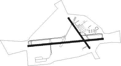
Runway info
Runway 10 / 28  | ||
| length | 1294m (4245ft) | |
| bearing | 89° / 269° | |
| width | 30m (100ft) | |
| surface | asphalt | |
| Runway 16 / 34 | ||
| length | 629m (2064ft) | |
| bearing | 142° / 322° | |
| width | 23m (75ft) | |
| surface | asphalt | |
| blast zone | 20m (66ft) / 30m (98ft) | |
Nearby beacons
| code | identifier | dist | bearing | frequency |
|---|---|---|---|---|
| HTO | HAMPTON (EAST HAMPTON) VORTAC | 3.8 | 238° | 113.60 |
| FOK | SUFFOLK CO (WESTHAMPTON B TACAN | 18.7 | 252° | 111 |
| GON | GROTON VOR/DME | 24 | 28° | 110.85 |
| CCC | CALVERTON VOR/DME | 24.8 | 267° | 117.20 |
| MAD | MADISON VOR/DME | 29.1 | 309° | 110.40 |
| SEY | SANDY POINT (BLOCK ISLAND VOR/DME | 33 | 73° | 117.80 |
| HVN | HAVEN DME | 33.9 | 296° | 109.80 |
| ORW | NORWICH VOR/DME | 37.6 | 23° | 110 |
| BDR | BRIDGEPORT VOR/DME | 41.3 | 283° | 108.80 |
| HFD | HARTFORD VOR/DME | 43 | 337° | 114.90 |
| PVD | PROVIDENCE VOR/DME | 59 | 47° | 115.60 |
| PUT | PUTNAM VOR/DME | 62.5 | 22° | 117.40 |
Instrument approach procedures
| runway | airway (heading) | route (dist, bearing) |
|---|---|---|
| RW10-X | CCC (87°) | CCC JORNU (18mi, 86°) 1800ft |
| RW10-X | HTO (58°) | HTO JORNU (4mi, 295°) 1800ft JORNU (turn) 1800ft |
| RNAV | JORNU 1800ft HURUN (3mi, 89°) 1500ft KHTO (3mi, 89°) 115ft (4606mi, 120°) 394ft BIGGA (4595mi, 300°) 2000ft BIGGA (turn) | |
| RW10-Y | HTO (58°) | HTO MATHW (8mi, 282°) 1800ft MATHW (turn) 1800ft |
| RW10-Y | JORDN (254°) | JORDN MATHW (27mi, 260°) 1800ft MATHW (turn) 1800ft |
| RNAV | MATHW 1800ft GOODI (6mi, 89°) 1600ft LAZYE (2mi, 89°) 860ft KHTO (3mi, 89°) 115ft (4606mi, 120°) 455ft BIGGA (4595mi, 300°) 2000ft BIGGA (turn) | |
| RW10-Z | HTO (58°) | HTO MATHW (8mi, 282°) 1800ft MATHW (turn) 1800ft |
| RW10-Z | JORDN (254°) | JORDN MATHW (27mi, 260°) 1800ft MATHW (turn) 1800ft |
| RNAV | MATHW 1800ft GOODI (6mi, 89°) 1800ft KHTO (5mi, 89°) 115ft (4606mi, 120°) 361ft BIGGA (4595mi, 300°) 2000ft BIGGA (turn) | |
| RW28-Y | JORDN (254°) | JORDN BIGGA (7mi, 225°) 2000ft |
| RW28-Y | SEFRD (295°) | SEFRD BIGGA (7mi, 357°) 2000ft |
| RNAV | BIGGA 2000ft FEAST (6mi, 269°) 1600ft HTOAD (3mi, 269°) 580ft KHTO (2mi, 270°) 90ft (4606mi, 120°) 400ft MATHW (4617mi, 299°) 2000ft MATHW (turn) | |
| RW28-Z | JORDN (254°) | JORDN BIGGA (7mi, 225°) 2000ft |
| RW28-Z | SEFRD (295°) | SEFRD BIGGA (7mi, 357°) 2000ft |
| RNAV | BIGGA 2000ft FEAST (6mi, 269°) 1900ft HTOAD (3mi, 269°) 680ft KHTO (2mi, 270°) 90ft (4606mi, 120°) 346ft MATHW (4617mi, 299°) 2000ft MATHW (turn) |
Disclaimer
The information on this website is not for real aviation. Use this data with the X-Plane flight simulator only! Data taken with kind consent from X-Plane 12 source code and data files. Content is subject to change without notice.