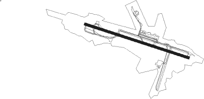
Huntington - Tri State
Airport details
| Country | United States of America |
| State | West Virginia |
| Region | K6 |
| Airspace | Indianapolis Ctr |
| Municipality | Wayne County |
| Elevation | 828ft (252m) |
| Timezone | GMT -5 |
| Coordinates | 38.36851, -82.56036 |
| Magnetic var | |
| Type | land |
| Available since | X-Plane v10.40 |
| ICAO code | KHTS |
| IATA code | HTS |
| FAA code | HTS |
Communication
| Tri State ATIS | 125.200 |
| Tri State UNICOM | 122.950 |
| Tri State Clearance DEL | 118.050 |
| Tri State Ground Control | 121.900 |
| Tri State HUNTINGTON Tower | 118.500 |
| Tri State HUNTINGTON Approach/Departure | 119.750 |
Approach frequencies
| ILS-cat-I | RW12 | 109.9 | 18.00mi |
| ILS-cat-I | RW30 | 108.7 | 18.00mi |
| 3° GS | RW12 | 109.9 | 18.00mi |
| 3° GS | RW30 | 108.7 | 18.00mi |
Nearby Points of Interest:
Z. D. Ramsdell House
-Joseph S. Miller House
-First United Methodist Church
-Catlettsburg station
-Ninth Street West Historic District
-Foster Memorial Home
-Johnston-Meek House
-Prichard House
-Ritter Park Historic District
-Old Huntington High School
-Cabell County Courthouse
-United States Post Office and Court House
-Mortimer Place Historic District
-Carnegie Public Library
-Campbell-Hicks House
-Barnett Hospital and Nursing School
-Masonic Temple
-Elk River Coal and Lumber Company No. 10
-Harvey House
-Douglass Junior and Senior High School
-Simms School Building
-Old Main
-Ricketts House
-First Christian Church
-Bath Avenue Historic District
Nearby beacons
| code | identifier | dist | bearing | frequency |
|---|---|---|---|---|
| ECB | DME | 20.7 | 239° | 110.40 |
| YRK | YORK VORTAC | 25.6 | 303° | 112.80 |
| HNN | DME | 34.1 | 54° | 115.90 |
| HVQ | CHARLESTON VOR/DME | 37.2 | 91° | 117.40 |
| EOP | WAVERLY NDB | 51 | 335° | 385 |
| UGS | UNIVERSITY (ATHENS) NDB | 57.1 | 26° | 250 |
| AZQ | DME | 67.4 | 216° | 111.20 |
Instrument approach procedures
| runway | airway (heading) | route (dist, bearing) |
|---|---|---|
| RW12 | YRK (123°) | YRK MYKEE (16mi, 135°) 2600ft |
| RNAV | MYKEE 2600ft JAVUP (6mi, 108°) 2300ft KEVGE (2mi, 108°) 1760ft KHTS (3mi, 108°) 884ft (5055mi, 115°) 1700ft CROUP (5048mi, 295°) 3000ft CROUP (turn) | |
| RW30 | CELLI (320°) | CELLI KOSME (10mi, 318°) 3200ft KIRRK (9mi, 28°) 3200ft |
| RW30 | GREGZ (261°) | GREGZ KIRRK (8mi, 208°) 3200ft |
| RW30 | HAITI (288°) | HAITI KIRRK (4mi, 288°) 3200ft |
| RNAV | KIRRK 3200ft HIBTI (7mi, 288°) 2100ft KHTS (4mi, 288°) 878ft (5055mi, 115°) 1700ft CROUP (5048mi, 295°) 3000ft CROUP (turn) |
Disclaimer
The information on this website is not for real aviation. Use this data with the X-Plane flight simulator only! Data taken with kind consent from X-Plane 12 source code and data files. Content is subject to change without notice.