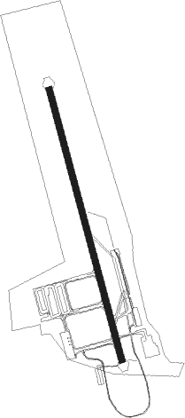
Redstone Arsnl Huntsville - Redstone Aaf
Airport details
| Country | United States of America |
| State | Alabama |
| Region | K7 |
| Airspace | Memphis Ctr |
| Municipality | Madison County |
| Elevation | 685ft (209m) |
| Timezone | GMT -6 |
| Coordinates | 34.67865, -86.68478 |
| Magnetic var | |
| Type | land |
| Available since | X-Plane v10.40 |
| ICAO code | KHUA |
| IATA code | HUA |
| FAA code | HUA |
Communication
| REDSTONE AAF Weather | 120.650 |
| REDSTONE AAF CTAF | 126.950 |
| REDSTONE AAF Clearance Delivery | 126.200 |
| REDSTONE AAF Ground Control | 126.200 |
| REDSTONE AAF Tower | 126.950 |
| REDSTONE AAF Huntsville App/Departure | 118.050 |
| REDSTONE AAF Huntsville Approach/Departure | 125.600 |
| REDSTONE AAF GCA | 124.800 |
Nearby Points of Interest:
Neutral Buoyancy Simulator
-William Lanford House
-Saturn V Dynamic Test Vehicle
-Saturn V Dynamic Test Stand
-Madison Station Historic District
-Propulsion and Structural Test Facility
-James H. Bibb House
-Merrimack Mill Village Historic District
-Lowe Mill
-Humphreys-Rodgers House
-W. T. Hutchens Building
-Terry Hutchens Building
-Kelly Brothers and Rowe Building
-First National Bank
-Beckers Block
-Lombardo Building
-Struve-Hay Building
-305 Jefferson Street
-Halsey Grocery Warehouse
-Henderson National Bank
-Hundley House
-W. L. Halsey Warehouse
-Shelta Cave
-White-Turner-Sanford House
-Donegan Block
Nearby beacons
| code | identifier | dist | bearing | frequency |
|---|---|---|---|---|
| RQZ | ROCKET (HUNTSVILLE) VORTAC | 7.5 | 23° | 112.20 |
| DCU | DME | 12.7 | 263° | 112.80 |
| MSL | MUSCLE SHOALS VORTAC | 39.8 | 272° | 116.50 |
| GAD | GADSDEN VOR/DME | 51.6 | 139° | 112.30 |
| SYI | SHELBYVILLE VOR/DME | 54.4 | 16° | 113.55 |
Instrument approach procedures
| runway | airway (heading) | route (dist, bearing) |
|---|---|---|
| RW17 | RQZ (203°) | RQZ IPUDE (7mi, 312°) 3000ft IPUDE (turn) 3000ft |
| RW17 | TANNE (105°) | TANNE IPUDE (15mi, 64°) 3000ft IPUDE (turn) 3000ft |
| RNAV | IPUDE 3000ft OYOVA (6mi, 167°) 2600ft NICGI (3mi, 167°) 1520ft KHUA (3mi, 167°) 731ft FASOV (13mi, 167°) 3000ft FASOV (turn) 6000ft | |
| RW35 | FEWER (6°) | FEWER FASOV (11mi, 27°) 3000ft |
| RW35 | RQZ (203°) | RQZ FASOV (20mi, 181°) 3000ft FASOV (turn) 3000ft |
| RNAV | FASOV 3000ft CAVPU (6mi, 347°) 2500ft ITIYU (3mi, 347°) 1400ft KHUA (3mi, 347°) 704ft IPUDE (13mi, 347°) 3000ft IPUDE (turn) 6000ft |
Disclaimer
The information on this website is not for real aviation. Use this data with the X-Plane flight simulator only! Data taken with kind consent from X-Plane 12 source code and data files. Content is subject to change without notice.
