Harlowton - Wheatland Co At Harlowton
Airport details
| Country | United States of America |
| State | Montana |
| Region | K1 |
| Airspace | Salt Lake City Ctr |
| Municipality | Wheatland County |
| Elevation | 4311ft (1314m) |
| Timezone | GMT -7 |
| Coordinates | 46.44861, -109.85277 |
| Magnetic var | |
| Type | land |
| Available since | X-Plane v10.40 |
| ICAO code | KHWQ |
| IATA code | n/a |
| FAA code | HWQ |
Communication
| Wheatland Co At Harlowton CTAF | 122.900 |
Nearby Points of Interest:
Milwaukee Road Historic District
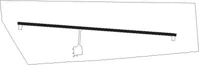
Runway info
| Runway 9 / 27 | ||
| length | 1278m (4193ft) | |
| bearing | 96° / 276° | |
| width | 18m (60ft) | |
| surface | asphalt | |
Nearby beacons
| code | identifier | dist | bearing | frequency |
|---|---|---|---|---|
| LWT | LEWISTOWN VOR/DME | 37.6 | 22° | 115.45 |
| LVM | LIVINGSTON VOR/DME | 51.1 | 218° | 116.10 |
Instrument approach procedures
| runway | airway (heading) | route (dist, bearing) |
|---|---|---|
| RW09 | BAXTA (16°) | BAXTA FAMGI (14mi, 300°) 8300ft FAMGI (turn) 8300ft |
| RW09 | TEKOE (142°) | TEKOE RIELS (20mi, 171°) 9700ft FAMGI (8mi, 171°) 8300ft |
| RNAV | FAMGI 8300ft AZAPU (5mi, 96°) 6500ft HALKO (2mi, 96°) 5900ft RECTA (2mi, 96°) 5160ft KHWQ (3mi, 96°) 4367ft (6218mi, 113°) 4673ft FALKI (6213mi, 293°) TASSE (38mi, 116°) 8000ft TASSE (turn) | |
| RW27 | BAXTA (16°) | BAXTA PEGME (14mi, 73°) 6900ft PEGME (turn) 6900ft |
| RW27 | PELJE (301°) | PELJE PEGME (30mi, 312°) 6900ft |
| RNAV | PEGME 6900ft MACSY (6mi, 276°) 5900ft CEBLO (2mi, 276°) 5200ft KHWQ (3mi, 276°) 4313ft (6218mi, 113°) 4606ft QOVCA (6228mi, 293°) ZERZO (24mi, 5°) 9600ft ZERZO (turn) |
Disclaimer
The information on this website is not for real aviation. Use this data with the X-Plane flight simulator only! Data taken with kind consent from X-Plane 12 source code and data files. Content is subject to change without notice.