Warrenton - Warrenton-fauquier
Airport details
| Country | United States of America |
| State | Virginia |
| Region | K6 |
| Airspace | Washington Ctr |
| Municipality | Fauquier County |
| Elevation | 333ft (101m) |
| Timezone | GMT -5 |
| Coordinates | 38.58628, -77.71064 |
| Magnetic var | |
| Type | land |
| Available since | X-Plane v10.40 |
| ICAO code | KHWY |
| IATA code | n/a |
| FAA code | HWY |
Communication
| Warrenton-Fauquier AWOS-3 | 120.350 |
| Warrenton-Fauquier CTAF/UNICOM | 122.700 |
| Warrenton-Fauquier Potomoc Approach | 128.525 |
| Warrenton-Fauquier Potomoc Departure | 128.525 |
Approach frequencies
| LOC | RW15 | 109.75 | 18.00mi |
Nearby Points of Interest:
Calverton Historic District
-Auburn Battlefield
-Weston
-Melrose (Casanova, Virginia)
-Remington Historic District
-Catlett Historic District
-Casanova Historic District
-Pilgrim's Rest
-North Wales (Warrenton, Virginia)
-Brentmoor
-Monterosa (Warrenton, Virginia)
-Dakota (Warrenton, Virginia)
-The Oaks (Warrenton, Virginia)
-Paradise (Warrenton, Virginia)
-Yorkshire House
-Effingham (Aden, Virginia)
-Park Gate
-Nokesville Truss Bridge
-The Lawn (Nokesville, Virginia)
-Hopefield (Warrenton, Virginia)
-Oakwood
-Loretta (Warrenton, Virginia)
-Orlean Historic District
-Sumerduck Historic District
-New Baltimore Historic District
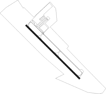
Runway info
| Runway 15 / 33 | ||
| length | 1525m (5003ft) | |
| bearing | 132° / 312° | |
| width | 31m (103ft) | |
| surface | asphalt | |
Nearby beacons
| code | identifier | dist | bearing | frequency |
|---|---|---|---|---|
| CSN | CASANOVA VORTAC | 7.9 | 290° | 116.30 |
| MSQ | NAILR (CULPEPER) NDB | 12.1 | 236° | 351 |
| BRV | BROOKE VORTAC | 22.5 | 125° | 114.50 |
| EZF | SHANNON (FREDERICKSBURG) NDB | 22.7 | 141° | 237 |
| AML | ARMEL (WASH.,D.C.) VOR/DME | 23.8 | 35° | 113.50 |
| LDN | LINDEN VORTAC | 28.2 | 298° | 114.30 |
| DAA | DAVEE (FT BELVOIR) NDB | 28.5 | 83° | 223 |
| DCA | OXONN (WASHINGTON) NDB | 33.8 | 75° | 332 |
| GTN | GEORGETOWN (WASH., D.C.) NDB | 34.3 | 60° | 323 |
| DCA | WASHINGTON, D.C. VOR/DME | 35.5 | 68° | 111 |
| LUA | CAVERNS (LURAY) NDB | 36.3 | 278° | 245 |
| GVE | GORDONSVILLE VORTAC | 40.2 | 218° | 115.60 |
| ADW | ANDREWS (CAMP SPRINGS) VORTAC | 41.7 | 75° | 113.10 |
| OTT | NOTTINGHAM VORTAC | 45.8 | 83° | 113.70 |
| MRB | MARTINSBURG VORTAC | 48.4 | 350° | 112.10 |
| FDK | FREDERICK VOR | 52 | 22° | 109 |
| BUH | ANNE ARUNDEL (FT MEADE) NDB | 53.5 | 62° | 260 |
| FND | ELLICOTT (BALTIMORE) NDB | 60.6 | 53° | 371 |
| EMI | WESTMINSTER VORTAC | 64.3 | 39° | 117.90 |
Departure and arrival routes
| Transition altitude | 18000ft |
| Transition level | 18000ft |
| STAR starting points | distance | inbound heading | |
|---|---|---|---|
| ALL | |||
| TRSTN3 | 30.1 | 7° | |
| TIKEE3 | 25.3 | 93° | |
| HYPER8 | 96.9 | 218° | |
Instrument approach procedures
| runway | airway (heading) | route (dist, bearing) |
|---|---|---|
| RW15 | CSN (110°) | CSN EYAGI (7mi, 346°) 3600ft EYAGI (turn) 3600ft |
| RNAV | EYAGI 3600ft LIPIY (7mi, 132°) 2200ft OPAAL (3mi, 132°) 1160ft KHWY (3mi, 132°) 366ft (4830mi, 116°) 1800ft CSN (4838mi, 296°) 3000ft CSN (turn) | |
| RW33 | ANTNY (315°) | ANTNY 2000ft |
| RNAV | ANTNY 2000ft CRLYN (7mi, 319°) 2000ft LRGNT (3mi, 312°) 1160ft KHWY (3mi, 312°) 381ft (4830mi, 116°) 800ft CSN (4838mi, 296°) 3000ft CSN (turn) |
Holding patterns
| STAR name | hold at | type | turn | heading* | altitude | leg | speed limit |
|---|---|---|---|---|---|---|---|
| HYPER8 | BINNS | VHF | right | 68 (248)° | 1.0min timed | 265 | |
| HYPER8 | HYPER | VHF | left | 65 (245)° | 6001ft - 14000ft | 1.0min timed | 210 |
| TRSTN3 | JOHOF | VHF | right | 214 (34)° | DME 10.0mi | ICAO rules | |
| *) magnetic outbound (inbound) holding course | |||||||
Disclaimer
The information on this website is not for real aviation. Use this data with the X-Plane flight simulator only! Data taken with kind consent from X-Plane 12 source code and data files. Content is subject to change without notice.