Hilton Head Island
Airport details
| Country | United States of America |
| State | South Carolina |
| Region | K7 |
| Airspace | Jacksonville Ctr |
| Municipality | Hilton Head Island |
| Elevation | 19ft (6m) |
| Timezone | GMT -5 |
| Coordinates | 32.22436, -80.69747 |
| Magnetic var | |
| Type | land |
| Available since | X-Plane v10.40 |
| ICAO code | KHXD |
| IATA code | HHH |
| FAA code | HXD |
Communication
| Hilton Head Island ATIS | 121.400 |
| Hilton Head Island Ground | 121.100 |
| Hilton Head Island Tower | 118.975 |
| Hilton Head Island Savannah Approach/Departure | 125.300 |
Approach frequencies
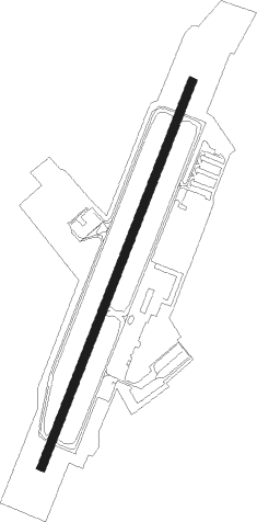
| LOC | RW21 | 111.3 | 18.00mi |
Nearby Points of Interest:
Charlesfort-Santa Elena Site
-Fort Fremont Battery
-Fort Fremont Hospital
-Tombee Plantation
-Bluffton Historic District
-F.W. Scheper Store
-Union Church of Port Royal
-Rose Hill Plantation House
-Frogmore Plantation Complex (St. Helena Island, South Carolina)
-The Corner Store and Office
-The Green
-The Corner Packing Shed
-Dr. York Bailey House
-Knights of Wise Men Lodge
-Beaufort National Cemetery
-The Anchorage
-John A. Cuthbert House
-Tabby Manse
-Marshlands
-William Barnwell House
-Robert Smalls House
-Beaufort Historic District
-Barnwell-Gough House
-Emanuel Alston House
-Sams Plantation Complex Tabby Ruins
Nearby beacons
| code | identifier | dist | bearing | frequency |
|---|---|---|---|---|
| NBC | BEAUFORT TACAN | 15.3 | 356° | 110.50 |
| SV | WASSA (SAVANNAH) NDB | 19.7 | 233° | 335 |
| SAV | SAVANNAH VORTAC | 25.9 | 261° | 115.95 |
| SVN | HUNTER (SAVANNAH) VOR/DME | 25.9 | 244° | 111.60 |
| MOQ | MC INTOSH (HINESVILLE) NDB | 47.6 | 244° | 263 |
| BZ | BULLO (STATESBORO) NDB | 50.3 | 281° | 407 |
| JYL | SYLVANIA NDB | 52.1 | 295° | 245 |
| CHS | CHARLESTON VORTAC | 52.2 | 45° | 113.50 |
| CH | ASHLY (CHARLESTON) NDB | 54.4 | 39° | 329 |
| DYB | DORCHESTER COUNTY(SUMMERVILLE) NDB | 54.5 | 27° | 365 |
| ALD | ALLENDALE VOR | 56 | 323° | 116.70 |
Instrument approach procedures
| runway | airway (heading) | route (dist, bearing) |
|---|---|---|
| RW03 | GORGE (30°) | GORGE 1900ft |
| RNAV | GORGE 1900ft HUNDO (8mi, 30°) 1800ft KHXD (6mi, 30°) 59ft (4933mi, 112°) 321ft FUMMA (4928mi, 292°) 1900ft FUMMA (turn) | |
| RW21 | FUMMA (210°) | FUMMA 1900ft |
| RNAV | FUMMA 1900ft JAAMM (8mi, 210°) 1800ft KHXD (6mi, 210°) 70ft (4933mi, 112°) 293ft GORGE (4938mi, 292°) 1900ft GORGE (turn) |
Disclaimer
The information on this website is not for real aviation. Use this data with the X-Plane flight simulator only! Data taken with kind consent from X-Plane 12 source code and data files. Content is subject to change without notice.