Hartford - Hartford Municipal Airport
Airport details
| Country | United States of America |
| State | Wisconsin |
| Region | K5 |
| Airspace | Chicago Ctr |
| Municipality | Hartford |
| Elevation | 1067ft (325m) |
| Timezone | GMT -6 |
| Coordinates | 43.34879, -88.39403 |
| Magnetic var | |
| Type | land |
| Available since | X-Plane v10.40 |
| ICAO code | KHXF |
| IATA code | n/a |
| FAA code | HXF |
Communication
| Hartford Municipal Airport CTAF/UNICOM | 123.000 |
| Hartford Municipal Airport MILWAUKEE Approach/Departure | 125.350 |
Nearby Points of Interest:
John Hustis House
-Washington County Courthouse and Jail
-Hollenstein Wagon and Carriage Factory
-Main Street Historic District
-White Limestone School
-Christ Evangelical Church
-Horicon State Bank
-Daniel C. Van Brunt House
-Lizard Mound County Park
-Christian Turck House
-W. H. Boller Meat Market and Residence
-Clarence Peck Residence
-Bank of Hartland
-First Congregational Church
-Stephen Warren House
-Trapp Filling Station
-St. Peter's Church
-Dansk Evangelical Lutheran Kirke
-Harold Hornburg House
-Zion Evangelical Lutheran Church
-St. Andrew's Church
-St. Augustine Catholic Church and Cemetery
-St. John of God Roman Catholic Church, Convent, and School
-Saint John Evangelical Lutheran Church
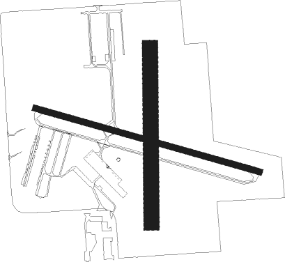
Runway info
Runway 11 / 29  | ||
| length | 915m (3002ft) | |
| bearing | 105° / 285° | |
| width | 23m (75ft) | |
| surface | asphalt | |
| Runway 18 / 36 | ||
| length | 687m (2254ft) | |
| bearing | 186° / 6° | |
| width | 60m (196ft) | |
| surface | grass | |
Nearby beacons
| code | identifier | dist | bearing | frequency |
|---|---|---|---|---|
| BJB | WEST BEND VOR | 12.5 | 75° | 109.80 |
| UNU | JUNEAU NDB | 14.2 | 285° | 344 |
| BAE | BADGER (MILWAUKEE) VOR/DME | 14.7 | 155° | 116.40 |
| RYV | ROCK RIVER (WATERTOWN) NDB | 17.9 | 242° | 371 |
| LJT | (MILWAUKEE) DME | 21.2 | 124° | 115.65 |
| OS | POBER (OSHKOSH) NDB | 32.3 | 343° | 395 |
| FAH | (SHEBOYGAN) DME | 34.6 | 52° | 110 |
| OSH | OSHKOSH VORTAC | 39.1 | 346° | 116.75 |
| BUU | (BURLINGTON) DME | 39.8 | 172° | 114.50 |
| MSN | MADISON VORTAC | 43.1 | 258° | 108.60 |
| HRK | (RACINE) DME | 43.4 | 135° | 117.70 |
| RA | PASER (RACINE) NDB | 45.5 | 143° | 206 |
| ENW | DME | 49.3 | 148° | 109.20 |
| AQ | KOOKY (APPLETON) NDB | 52 | 360° | 407 |
| MTW | DME | 56.1 | 42° | 111 |
| JVL | JANESVILLE VOR/DME | 56.8 | 222° | 114.30 |
| UG | WAUKE (CHICAGO/WAUKEGAN) NDB | 59.1 | 146° | 379 |
| MT | MAWOC (MANITOWOC) NDB | 59.2 | 39° | 362 |
Departure and arrival routes
| Transition altitude | 18000ft |
| Transition level | 18000ft |
| SID end points | distance | outbound heading | |
|---|---|---|---|
| ALL | |||
| UECKR6 | 92mi | 146° | |
| ACCRA5 | 87mi | 165° | |
| STAR starting points | distance | inbound heading | |
|---|---|---|---|
| ALL | |||
| GOPAC2 | 31.9 | 2° | |
Instrument approach procedures
| runway | airway (heading) | route (dist, bearing) |
|---|---|---|
| RW09 | DOYAG (120°) | DOYAG MAKPC (19mi, 140°) 3000ft |
| RW09 | DREAR (72°) | DREAR MAKPC (21mi, 61°) 3000ft |
| RNAV | MAKPC 3000ft TAWIE (6mi, 91°) 2700ft IDUTE (3mi, 91°) 1900ft KHXF (3mi, 93°) 1091ft (5335mi, 116°) 1700ft HAWKN (5330mi, 296°) 3000ft HAWKN (turn) 3000ft | |
| RW27 | PROOT (287°) | PROOT ZANUV (22mi, 297°) 3000ft |
| RW27 | WOKNO (258°) | WOKNO ZANUV (17mi, 248°) 3000ft |
| RNAV | ZANUV 3000ft TAVME (6mi, 271°) 2800ft REJPA (3mi, 271°) 1900ft KHXF (3mi, 269°) 1110ft (5335mi, 116°) 1700ft CORIR (5335mi, 296°) 3000ft CORIR (turn) 3000ft |
Holding patterns
| STAR name | hold at | type | turn | heading* | altitude | leg | speed limit |
|---|---|---|---|---|---|---|---|
| GOPAC2 | LEEDN | VHF | right | 181 (1)° | DME 10.0mi | ICAO rules | |
| GOPAC2 | ZOWRO | VHF | right | 273 (93)° | DME 10.0mi | ICAO rules | |
| *) magnetic outbound (inbound) holding course | |||||||
Disclaimer
The information on this website is not for real aviation. Use this data with the X-Plane flight simulator only! Data taken with kind consent from X-Plane 12 source code and data files. Content is subject to change without notice.