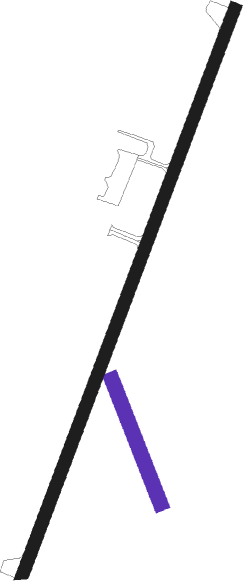
Hayward - Sawyer Co
Airport details
| Country | United States of America |
| State | Wisconsin |
| Region | K5 |
| Airspace | Minneapolis Ctr |
| Municipality | Town of Hayward |
| Elevation | 1214ft (370m) |
| Timezone | GMT -6 |
| Coordinates | 46.02527, -91.44427 |
| Magnetic var | |
| Type | land |
| Available since | X-Plane v10.40 |
| ICAO code | KHYR |
| IATA code | HYR |
| FAA code | HYR |
Communication
| SAWYER CO CTAF/UNICOM | 122.800 |
| SAWYER CO MINNEAPOLIS CNTR | 126.450 |
Approach frequencies
| ILS-cat-I | RW21 | 108.5 | 18.00mi |
| 3° GS | RW21 | 108.5 | 18.00mi |
Nearby Points of Interest:
North Wisconsin Lumber Company Office
-Forest Lodge Library
-Mrs. Richard Polson House
-George V. Siegner House
Nearby beacons
| code | identifier | dist | bearing | frequency |
|---|---|---|---|---|
| HYR | DME | 0.3 | 199° | 113.40 |
| RCX | RUSK COUNTY (LADYSMITH) NDB | 36.5 | 140° | 356 |
| BXR | BIG DOCTOR (SIREN) NDB | 40.4 | 258° | 203 |
| RZN | DME | 40.7 | 258° | 109.40 |
| RP | WICKR (RICE LAKE) NDB | 45 | 207° | 221 |
| DLH | DULUTH VORTAC | 56.2 | 316° | 112.60 |
| LKI | LAKESIDE (DULUTH) TACAN | 57.9 | 318° | 135.40 |
| DL | PYKLA (DULUTH) NDB | 62 | 312° | 379 |
Instrument approach procedures
| runway | airway (heading) | route (dist, bearing) |
|---|---|---|
| RW03 | ALEEN (66°) | ALEEN SAPNY (27mi, 69°) 3100ft RIGET (5mi, 108°) 3100ft |
| RW03 | ENTAF (21°) | ENTAF RIGET (26mi, 15°) 3100ft |
| RW03 | RIGET (34°) | RIGET 3100ft |
| RNAV | RIGET 3100ft PECRO (6mi, 33°) 3000ft KHYR (6mi, 34°) 1249ft (5465mi, 117°) 1514ft DAIVE (5460mi, 297°) 3300ft DAIVE (turn) | |
| RW21 | DAIVE (214°) | DAIVE 3300ft |
| RW21 | LAMPY (84°) | LAMPY JUDAQ (24mi, 57°) 3300ft DAIVE (6mi, 108°) 3300ft |
| RW21 | RUSSH (281°) | RUSSH OGTOW (27mi, 299°) 3300ft DAIVE (6mi, 288°) 3300ft |
| RNAV | DAIVE 3300ft OBBEY (6mi, 214°) 3000ft POVYI (3mi, 214°) 2020ft KHYR (3mi, 213°) 1258ft (5465mi, 117°) 1518ft RIGET (5471mi, 297°) 3100ft RIGET (turn) |
Disclaimer
The information on this website is not for real aviation. Use this data with the X-Plane flight simulator only! Data taken with kind consent from X-Plane 12 source code and data files. Content is subject to change without notice.

