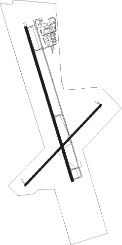
Hays - Hays Regl
Airport details
| Country | United States of America |
| State | Kansas |
| Region | K3 |
| Airspace | Kansas City Ctr |
| Municipality | Ellis County |
| Elevation | 1998ft (609m) |
| Timezone | GMT -6 |
| Coordinates | 38.84222, -99.27317 |
| Magnetic var | |
| Type | land |
| Available since | X-Plane v10.40 |
| ICAO code | KHYS |
| IATA code | HYS |
| FAA code | HYS |
Communication
| Hays Regl AWOS 3 | 125.525 |
| Hays Regl CTAF/UNICOM | 122.800 |
Approach frequencies
| ILS-cat-I | RW34 | 111.5 | 18.00mi |
| 3° GS | RW34 | 111.5 | 18.00mi |
Nearby Points of Interest:
St. Joseph's Church and Parochial School
-Ellis Congregational Church
-Rush County Courthouse
-Paradise Water Tower
-Natoma Presbyterian Church
Nearby beacons
| code | identifier | dist | bearing | frequency |
|---|---|---|---|---|
| HYS | HAYS VORTAC | 0.3 | 326° | 110.40 |
| HY | NETTE (HAYS) NDB | 4.5 | 163° | 374 |
| GB | BABSY NDB | 40.5 | 145° | 419 |
| HLC | HILL CITY VORTAC | 50.9 | 294° | 113.70 |
| DDC | DODGE CITY VORTAC | 68.8 | 216° | 108.20 |
Instrument approach procedures
| runway | airway (heading) | route (dist, bearing) |
|---|---|---|
| RW04 | DISKS (320°) | DISKS SUYJE (30mi, 299°) 4000ft UTUCO (5mi, 311°) 4000ft |
| RW04 | RANSO (80°) | RANSO IVZOT (17mi, 85°) 4000ft UTUCO (5mi, 131°) 4000ft |
| RW04 | UTUCO (54°) | UTUCO 4000ft |
| RNAV | UTUCO 4000ft WOVEP (6mi, 55°) 3700ft HUTIR (3mi, 55°) 2620ft KHYS (2mi, 51°) 2027ft HOSNI (12mi, 56°) 4000ft HOSNI (turn) | |
| RW16 | EQPOX (164°) | EQPOX 4000ft |
| RW16 | IBQUP (114°) | IBQUP AZTIJ (7mi, 72°) 4500ft EQPOX (5mi, 80°) 4000ft |
| RW16 | PUQZE (225°) | PUQZE IMYIF (11mi, 256°) 4500ft EQPOX (5mi, 260°) 4000ft |
| RNAV | EQPOX 4000ft UTINY (6mi, 164°) 3700ft WODAN (2mi, 164°) 2900ft KHYS (3mi, 164°) 2042ft GEYJA (12mi, 164°) 4000ft GEYJA (turn) | |
| RW22 | HOSNI (236°) | HOSNI 4000ft |
| RW22 | IBQUP (114°) | IBQUP JENUL (19mi, 82°) 4200ft HOSNI (5mi, 131°) 4000ft |
| RW22 | ZISDA (266°) | ZISDA HOSNI (8mi, 311°) 4000ft |
| RNAV | HOSNI 4000ft JIKOT (6mi, 235°) 3700ft YESUD (3mi, 235°) 2600ft KHYS (2mi, 239°) 2027ft UTUCO (12mi, 234°) 4000ft UTUCO (turn) | |
| RW34 | DISKS (320°) | DISKS IKAHU (22mi, 322°) 4000ft GEYJA (5mi, 260°) 4000ft |
| RW34 | GEYJA (344°) | GEYJA 4000ft |
| RW34 | RANSO (80°) | RANSO AYUCU (27mi, 101°) 4000ft GEYJA (5mi, 80°) 4000ft |
| RNAV | GEYJA 4000ft YURWU (6mi, 344°) 3700ft OYLUC (3mi, 344°) 2560ft KHYS (2mi, 344°) 2029ft EQPOX (12mi, 344°) 4000ft EQPOX (turn) |
Disclaimer
The information on this website is not for real aviation. Use this data with the X-Plane flight simulator only! Data taken with kind consent from X-Plane 12 source code and data files. Content is subject to change without notice.

