Saginaw - Saginaw Co H W Browne
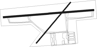
Airport details
| Country | United States of America |
| State | Michigan |
| Region | K5 |
| Airspace | Cleveland Ctr |
| Municipality | Buena Vista Charter Township |
| Elevation | 601ft (183m) |
| Timezone | GMT -5 |
| Coordinates | 43.43336, -83.86230 |
| Magnetic var | |
| Type | land |
| Available since | X-Plane v10.40 |
| ICAO code | KHYX |
| IATA code | n/a |
| FAA code | HYX |
Communication
| Saginaw Co H W Browne AWOS 3 | 118.325 |
| Saginaw Co H W Browne CTAF/UNICOM | 122.800 |
| Saginaw Co H W Browne Approach/Departure | 120.950 |
Approach frequencies
| ILS-cat-I | RW28 | 111.35 | 18.00mi |
| 3° GS | RW28 | 111.35 | 18.00mi |
Nearby Points of Interest:
Saginaw County Fairgrounds Main Gate
-East Genesee Historic Business District
-Saginaw Central City Historic Residential District
-Flint and Pere Marquette Railroad East Saginaw Depot
-Bearinger Building
-East Saginaw Historic Business District
-Michigan Bell Building
-Passolt House
-Central Warehouse
-The Grove
-North Michigan Avenue Historic District
-Davis Carriage House
-Benjamin Cushway House
-State Street Bridge
-Russell Sackett House
-Roethke Houses
-James Clements Municipal Airport
-Gugel Bridge
-Odd Fellows Valley Lodge No. 189 Building
-Trombley House
-Center Avenue Neighborhood Residential District
-Bay City Masonic Temple
-Bay City Station
-Bay City Downtown Historic District
-Midland Street Commercial District

Nearby beacons
| code | identifier | dist | bearing | frequency |
|---|---|---|---|---|
| MBS | SAGINAW VOR/DME | 11 | 295° | 112.90 |
| MB | OLSTE (SAGINAW) NDB | 13.9 | 275° | 257 |
| FNT | FLINT VORTAC | 28.4 | 166° | 116.90 |
| MOP | MOUNT PLEASANT VOR/DME | 39.7 | 282° | 110.60 |
| PSI | DME | 46.3 | 156° | 111 |
Instrument approach procedures
| runway | airway (heading) | route (dist, bearing) |
|---|---|---|
| RW10 | FNT (346°) | FNT SEGOY (27mi, 314°) 2900ft CULAK (6mi, 360°) 2800ft |
| RW10 | MBS (115°) | MBS CULAK (6mi, 205°) 2800ft CULAK (turn) 2800ft |
| RNAV | CULAK 2800ft KURYE (6mi, 90°) 2200ft KHYX (5mi, 90°) 644ft (5138mi, 117°) 800ft IVODY (5125mi, 297°) 2700ft IVODY (turn) | |
| RW28 | FNT (346°) | FNT XADDY (23mi, 24°) 3100ft IVODY (6mi, 0°) 2700ft |
| RW28 | MBS (115°) | MBS IVODY (22mi, 101°) 2700ft IVODY (turn) 2700ft |
| RNAV | IVODY 2700ft EHEMU (7mi, 270°) 2200ft KHYX (5mi, 270°) 641ft (5138mi, 117°) 804ft CULAK (5149mi, 297°) 2800ft CULAK (turn) |
Disclaimer
The information on this website is not for real aviation. Use this data with the X-Plane flight simulator only! Data taken with kind consent from X-Plane 12 source code and data files. Content is subject to change without notice.