Hazen - Mercer Co Regl
Airport details
| Country | United States of America |
| State | North Dakota |
| Region | K3 |
| Airspace | Minneapolis Ctr |
| Municipality | Mercer County |
| Elevation | 1812ft (552m) |
| Timezone | GMT -6 |
| Coordinates | 47.28994, -101.58097 |
| Magnetic var | |
| Type | land |
| Available since | X-Plane v10.40 |
| ICAO code | KHZE |
| IATA code | n/a |
| FAA code | HZE |
Communication
| Mercer Co Regl CTAF | 122.800 |
Nearby Points of Interest:
Former McLean County Courthouse
-McLean County Courthouse
-Hell Creek Formation
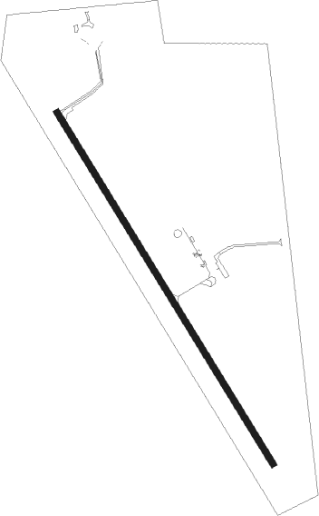
Runway info
| Runway 14 / 32 | ||
| length | 1523m (4997ft) | |
| bearing | 143° / 323° | |
| width | 23m (75ft) | |
| surface | asphalt | |
Nearby beacons
| code | identifier | dist | bearing | frequency |
|---|---|---|---|---|
| HZE | HAZEN NDB | 0.5 | 360° | 414 |
| BIS | BISMARCK VOR/DME | 49.1 | 120° | 116.50 |
| MOT | MINOT VOR/DME | 59.4 | 17° | 117.10 |
Instrument approach procedures
| runway | airway (heading) | route (dist, bearing) |
|---|---|---|
| RW14 | IJGIJ (143°) | IJGIJ 4000ft |
| RW14 | KIJCU (174°) | KIJCU 4000ft IJGIJ (5mi, 251°) 4000ft |
| RW14 | OGSIQ (119°) | OGSIQ 4000ft IJGIJ (5mi, 71°) 4000ft |
| RNAV | IJGIJ 4000ft EHZEJ (6mi, 143°) 3500ft HULMA (2mi, 143°) 2920ft KHZE (4mi, 143°) 1831ft IJKUV (12mi, 143°) 4000ft IJKUV (turn) | |
| RW32 | IJKUV (323°) | IJKUV 4000ft |
| RW32 | KOJSY (299°) | KOJSY 4000ft IJKUV (5mi, 251°) 4000ft |
| RW32 | OGVIQ (354°) | OGVIQ 4000ft IJKUV (5mi, 71°) 4000ft |
| RNAV | IJKUV 4000ft EJRIQ (6mi, 323°) 3500ft JELMU (2mi, 323°) 2820ft KHZE (3mi, 323°) 1859ft IJGIJ (12mi, 323°) 4000ft IJGIJ (turn) |
Disclaimer
The information on this website is not for real aviation. Use this data with the X-Plane flight simulator only! Data taken with kind consent from X-Plane 12 source code and data files. Content is subject to change without notice.