Wichita - Mc Connell Afb
Airport details
| Country | United States of America |
| State | Kansas |
| Region | K3 |
| Airspace | Kansas City Ctr |
| Municipality | Sedgwick County |
| Elevation | 1371ft (418m) |
| Timezone | GMT -6 |
| Coordinates | 37.62312, -97.26763 |
| Magnetic var | |
| Type | land |
| Available since | X-Plane v10.40 |
| ICAO code | KIAB |
| IATA code | IAB |
| FAA code | IAB |
Communication
| Mc Connell AFB ATIS | 124.650 |
| Mc Connell AFB Ground Control | 118.000 |
| Mc Connell AFB Tower | 127.250 |
| Mc Connell AFB WICHITA Approach | 127.250 |
| Mc Connell AFB WICHITA Approach | 134.800 |
| Mc Connell AFB WICHITA Approach | 120.600 |
| Mc Connell AFB WICHITA Approach | 126.700 |
| Mc Connell AFB WICHITA Departure | 134.800 |
| Mc Connell AFB WICHITA Departure | 120.600 |
| Mc Connell AFB WICHITA Departure | 124.750 |
Approach frequencies
| ILS-cat-I | RW19R | 109.9 | 18.00mi |
| ILS-cat-I | RW01L | 111.1 | 18.00mi |
| 3° GS | RW19R | 109.9 | 18.00mi |
| 3° GS | RW01L | 111.1 | 18.00mi |
Nearby Points of Interest:
Administration Building
-Engine House No. 6
-Wichita Scottish Rite Center
-Orpheum Theatre
-Wichita City Carnegie Library Building
-United States Post Office and Federal Building
-Arkansas Valley Lodge No. 21, Prince Hall Masons
-Fairmount Congregational Church
-Riverview Apartments
-Governor L. D. Lewelling House
-James and Ella Truitt House
-Polecat Creek Bridge
-Bartlett Arboretum
-Bucher Bridge
-St. Mark Church
-Old Oxford Mill
-El Dorado Carnegie Library
-Butler County Courthouse
-Warkentin House
-Carnegie Library
-Fischer Field Stadium
-Winfield National Bank Building
-St. John's Lutheran College Girls Dormitory
-Wilmer House
-Salter House
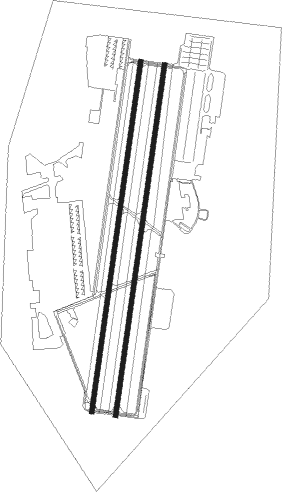
Runway info
Runway 1L / 19R  | ||
| length | 3661m (12011ft) | |
| bearing | 16° / 196° | |
| width | 46m (150ft) | |
| surface | concrete | |
| blast zone | 255m (837ft) / 255m (837ft) | |
| Runway 1R / 19L | ||
| length | 3663m (12018ft) | |
| bearing | 16° / 196° | |
| width | 46m (150ft) | |
| surface | asphalt | |
| blast zone | 255m (837ft) / 255m (837ft) | |
Nearby beacons
| code | identifier | dist | bearing | frequency |
|---|---|---|---|---|
| IAB | MC CONNELL (WICHITA) TACAN | 0 | 204° | 116.50 |
| IC | PICHE (WICHITA) NDB | 9.3 | 257° | 332 |
| ICT | WICHITA VORTAC | 16.7 | 291° | 113.80 |
| CA | HARVS (NEWTON) NDB | 31.3 | 359° | 395 |
| HUT | HUTCHINSON VOR/DME | 38.7 | 299° | 116.80 |
| HU | SALTT (HUTCHINSON) NDB | 43.3 | 307° | 404 |
| PN | PONCA (PONCA CITY) NDB | 48.5 | 168° | 515 |
| ANY | ANTHONY TACAN | 51.3 | 243° | 112.90 |
| PER | PIONEER (PONCA CITY) VORTAC | 52.8 | 173° | 113.20 |
Instrument approach procedures
| runway | airway (heading) | route (dist, bearing) |
|---|---|---|
| RW01L | HOKET (16°) | HOKET 4000ft |
| RW01L | RYLEA (48°) | RYLEA 6000ft HOKET (9mi, 92°) 4000ft |
| RW01L | SIMUH (344°) | SIMUH 5000ft HOKET (8mi, 292°) 4000ft |
| RNAV | HOKET 4000ft BEGLE (9mi, 15°) 3000ft KIAB (6mi, 16°) 1393ft (5751mi, 111°) 1547ft WITBA (5746mi, 291°) 4000ft WITBA (turn) 5000ft | |
| RW01R | HOKET (16°) | HOKET 4000ft |
| RW01R | RYLEA (48°) | RYLEA 6000ft HOKET (9mi, 92°) 4000ft |
| RW01R | SIMUH (344°) | SIMUH 5000ft HOKET (8mi, 292°) 4000ft |
| RNAV | HOKET 4000ft HEPDU (9mi, 19°) 3000ft KIAB (6mi, 11°) 1400ft (5751mi, 111°) 1771ft WITBA (5746mi, 291°) 4000ft WITBA (turn) 5000ft | |
| RW19L | ATREP (231°) | ATREP 5000ft WITBA (10mi, 274°) 4000ft |
| RW19L | CARIE (156°) | CARIE 6000ft WITBA (10mi, 104°) 4000ft |
| RW19L | WITBA (195°) | WITBA 4000ft |
| RNAV | WITBA 4000ft WARUN (9mi, 192°) 3000ft KIAB (6mi, 200°) 1419ft (5751mi, 111°) 1800ft HOKET (5755mi, 291°) 4000ft HOKET (turn) 12000ft | |
| RW19R | ATREP (231°) | ATREP 5000ft WITBA (10mi, 274°) 4000ft |
| RW19R | CARIE (156°) | CARIE 6000ft WITBA (10mi, 104°) 4000ft |
| RW19R | WITBA (195°) | WITBA 4000ft |
| RNAV | WITBA 4000ft FOVEL (9mi, 196°) 3000ft KIAB (6mi, 195°) 1427ft (5751mi, 111°) 1571ft HOKET (5755mi, 291°) 4000ft HOKET (turn) 12000ft |
Disclaimer
The information on this website is not for real aviation. Use this data with the X-Plane flight simulator only! Data taken with kind consent from X-Plane 12 source code and data files. Content is subject to change without notice.