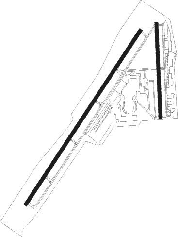
Idaho Falls - Idaho Falls Rgnl
Airport details
| Country | United States of America |
| State | Idaho |
| Region | K1 |
| Airspace | Salt Lake City Ctr |
| Municipality | Idaho Falls |
| Elevation | 4744ft (1446m) |
| Timezone | GMT -7 |
| Coordinates | 43.51372, -112.07075 |
| Magnetic var | |
| Type | land |
| Available since | X-Plane v10.40 |
| ICAO code | KIDA |
| IATA code | IDA |
| FAA code | IDA |
Communication
| Idaho Falls Rgnl ASOS | 135.325 |
| Idaho Falls Rgnl Ground | 121.700 |
| Idaho Falls Rgnl Dep (SLC Center) | 128.350 |
| Idaho Falls Rgnl Tower | 118.500 |
| Idaho Falls Rgnl Apch (SLC Center) | 128.350 |
Approach frequencies
| ILS-cat-I | RW21 | 111.1 | 18.00mi |
| 3° GS | RW21 | 111.1 | 18.00mi |
Nearby Points of Interest:
Bonneville County Courthouse
-Montgomery Ward Building
-Idaho Falls City Building
-Jefferson County Courthouse
-Hell's Half Acre Lava Field
-I.O.O.F. Building
-Jacob Spori Building
-Rexburg Stake Tabernacle
-Madison County Courthouse
-United States Post Office–Blackfoot Main
-Ross Fork Episcopal Church
-Idaho Republican Building
-Blackfoot LDS Tabernacle

Nearby beacons
| code | identifier | dist | bearing | frequency |
|---|---|---|---|---|
| IDA | IDAHO FALLS VOR/DME | 0.4 | 52° | 113.85 |
| DBS | DUBOIS VORTAC | 35 | 346° | 116.90 |
| PI | TYHEE (POCATELLO) NDB | 38.3 | 219° | 383 |
| PIH | POCATELLO VOR/DME | 46.2 | 222° | 112.60 |
Instrument approach procedures
| runway | airway (heading) | route (dist, bearing) |
|---|---|---|
| RW03-Y | IDA (232°) | IDA VIPUC (13mi, 228°) 7000ft VIPUC (turn) 7000ft |
| RW03-Y | ROCCA (74°) | ROCCA VIPUC (10mi, 103°) 7000ft |
| RNAV | VIPUC 7000ft UGADE (6mi, 47°) 6500ft JIDEM (4mi, 47°) 5260ft KIDA (2mi, 49°) 4792ft (6355mi, 111°) 5200ft TERRE (6363mi, 291°) 7500ft TERRE (turn) | |
| RW03-Z | CHEER (42°) | CHEER VIPUC (9mi, 35°) 7000ft UGADE (6mi, 47°) 6500ft |
| RW03-Z | LUDIC (265°) | LUDIC HUDEP (18mi, 239°) 10500ft OKVIE (5mi, 239°) 9300ft JEDUX (7mi, 265°) 8600ft UGADE (8mi, 343°) 6500ft |
| RW03-Z | ZELOR (74°) | ZELOR ROCCA (10mi, 73°) 7500ft FOXUG (7mi, 94°) 7000ft UGADE (7mi, 73°) 6500ft |
| RNAV | UGADE 6500ft KIDA (6mi, 48°) 4792ft TOCYU (6mi, 46°) UFGOD (11mi, 323°) TERRE (10mi, 266°) 7500ft TERRE (turn) | |
| RW21-Y | DBS (166°) | DBS YAGUP (28mi, 142°) 7600ft |
| RW21-Y | IDA (232°) | IDA YAGUP (12mi, 47°) 7600ft YAGUP (turn) 7600ft |
| RW21-Y | LUDIC (265°) | LUDIC ZEKOL (10mi, 291°) 8200ft YAGUP (6mi, 291°) 7600ft |
| RW21-Y | SABAT (219°) | SABAT YAGUP (22mi, 214°) 7600ft |
| RNAV | YAGUP 7600ft WOTES (6mi, 227°) 6700ft HUROD (4mi, 227°) 5320ft KIDA (2mi, 225°) 4780ft (6355mi, 111°) 4935ft UGADE (6360mi, 291°) ROCCA (13mi, 264°) 7500ft ROCCA (turn) | |
| RW21-Z | PIINE (265°) | PIINE LUDIC (8mi, 266°) 12000ft WOSKO (8mi, 284°) 9500ft PUMVE (5mi, 283°) 8000ft WOTES (6mi, 258°) 6700ft |
| RW21-Z | SABAT (219°) | SABAT YAGUP (22mi, 214°) 7600ft WOTES (6mi, 227°) 6700ft |
| RW21-Z | TERRE (129°) | TERRE HULSA (7mi, 90°) 7500ft JESUG (5mi, 90°) 7000ft WOTES (9mi, 146°) 6700ft |
| RNAV | WOTES 6700ft KIDA (7mi, 226°) 4780ft UGADE (6mi, 228°) STOPS (4mi, 251°) ROCCA (9mi, 270°) 7500ft ROCCA (turn) |
Disclaimer
The information on this website is not for real aviation. Use this data with the X-Plane flight simulator only! Data taken with kind consent from X-Plane 12 source code and data files. Content is subject to change without notice.