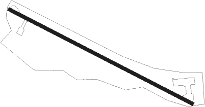
Ida Grove - Ida Grove Muni
Airport details
| Country | United States of America |
| State | Iowa |
| Region | K3 |
| Airspace | Minneapolis Ctr |
| Municipality | Ida County |
| Elevation | 1245ft (379m) |
| Timezone | GMT -6 |
| Coordinates | 42.33260, -95.44489 |
| Magnetic var | |
| Type | land |
| Available since | X-Plane v10.40 |
| ICAO code | KIDG |
| IATA code | n/a |
| FAA code | IDG |
Communication
| Ida Grove Muni CTAF/UNICOM | 122.800 |
Nearby Points of Interest:
Ida County Courthouse
-Alvin Bushnell Bell House
-Lakeside Park Historic District
-Trinity Memorial Episcopal Church (Mapleton, Iowa)
-William A. McHenry House
-Crawford County Courthouse
-Carey House, Denison, Iowa
-Clarence D. Chamberlin House
-Sac County Courthouse
-Sac City Monument Square Historic District
-Illinois Central Passenger Depot-Storm Lake
-Storm Lake Public Library
-Simon E. Dow House
-Jesse J. and Mary F. Allee House
-Cherokee Public Library
-Cherokee Commercial Historic District
-Nishnabotna River Bridge
-I.O.O.F. Hall
Runway info
| Runway 12 / 30 | ||
| length | 968m (3176ft) | |
| bearing | 115° / 295° | |
| width | 15m (50ft) | |
| surface | asphalt | |
| displ threshold | 107m (351ft) / 88m (289ft) | |
Nearby beacons
| code | identifier | dist | bearing | frequency |
|---|---|---|---|---|
| SU | SALIX (SOUIX CITY) NDB | 37.5 | 270° | 414 |
| SUX | SIOUX CITY TACAN | 39 | 271° | 116.50 |
| SPW | SPENCER VOR/DME | 50.9 | 16° | 110 |
| SP | SNORE (SPENCER) NDB | 54.3 | 7° | 394 |
| EGQ | EMMETSBURG NDB | 56.4 | 44° | 410 |
Disclaimer
The information on this website is not for real aviation. Use this data with the X-Plane flight simulator only! Data taken with kind consent from X-Plane 12 source code and data files. Content is subject to change without notice.
