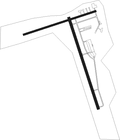
Natchitoches - Natchitoches Regl
Airport details
| Country | United States of America |
| State | Louisiana |
| Region | K4 |
| Airspace | Ft Worth Ctr |
| Municipality | Natchitoches |
| Elevation | 121ft (37m) |
| Timezone | GMT -6 |
| Coordinates | 31.73572, -93.09914 |
| Magnetic var | |
| Type | land |
| Available since | X-Plane v10.40 |
| ICAO code | KIER |
| IATA code | n/a |
| FAA code | IER |
Communication
| Natchitoches Regl AWOS 3 | 119.025 |
| Natchitoches Regl CTAF/UNICOM | 122.800 |
| Natchitoches Regl POLK Approach/Departure | 132.050 |
Approach frequencies
| LOC | RW35 | 110.5 | 18.00mi |
Nearby Points of Interest:
Normal Hill Historic District
-Natchitoches Historic District
-Cherokee Plantation
-Oaklawn Plantation (Natchez, Louisiana)
-Narcisse Prudhomme Plantation
-Oakland Plantation
-Melrose Plantation
-Jones House
-Kate Chopin House
-Fort Jesup
-Hodges Gardens State Park
-Kansas City Southern Depot, Zwolle
-Mayer Hirsch House
-Eden
Nearby beacons
| code | identifier | dist | bearing | frequency |
|---|---|---|---|---|
| OOC | NATCHITOCHES NDB | 4.8 | 165° | 407 |
| SWB | SAWMILL (WINNFIELD) VOR/DME | 25.8 | 61° | 113.75 |
| FXU | POLK (FORT POLK) VOR | 37.9 | 191° | 108.40 |
| AEX | ALEXANDRIA VORTAC | 42 | 129° | 116.10 |
| EMG | ELM GROVE VORTAC | 47.2 | 323° | 111.20 |
| BAD | BARKSDALE (BOSSIER CITY) TACAN | 54.4 | 323° | 115.80 |
| ROQ | RUSTON NDB | 58.5 | 30° | 368 |
| DXB | DE RIDDER NDB | 60.2 | 193° | 385 |
| ML | SABAR (MONROE) NDB | 66.5 | 54° | 392 |
Instrument approach procedures
| runway | airway (heading) | route (dist, bearing) |
|---|---|---|
| RW17 | AEX (309°) | AEX JEVBA (52mi, 316°) 2000ft JEVBA (turn) 2000ft |
| RW17 | MARTA (98°) | MARTA RUVBE (15mi, 67°) 2000ft JEVBA (5mi, 78°) 2000ft |
| RNAV | JEVBA 2000ft IPOYE (7mi, 164°) 1700ft ZOSOM (2mi, 164°) 940ft KIER (3mi, 165°) 161ft (5563mi, 109°) 366ft SABVE (5561mi, 289°) 2000ft SABVE (turn) | |
| RW35 | AEX (309°) | AEX SABVE (34mi, 299°) 2000ft |
| RW35 | MARTA (98°) | MARTA SABVE (28mi, 116°) 2000ft SABVE (turn) 2000ft |
| RNAV | SABVE 2000ft HOREG (5mi, 344°) 1700ft ZAGIL (2mi, 344°) 940ft KIER (3mi, 343°) 164ft (5563mi, 109°) 371ft JEVBA (5566mi, 289°) 2000ft JEVBA (turn) |
Disclaimer
The information on this website is not for real aviation. Use this data with the X-Plane flight simulator only! Data taken with kind consent from X-Plane 12 source code and data files. Content is subject to change without notice.

