Iowa Falls - Iowa Falls Muni
Airport details
| Country | United States of America |
| State | Iowa |
| Region | K3 |
| Airspace | Minneapolis Ctr |
| Municipality | Hardin County |
| Elevation | 1137ft (347m) |
| Timezone | GMT -6 |
| Coordinates | 42.47136, -93.27072 |
| Magnetic var | |
| Type | land |
| Available since | X-Plane v10.40 |
| ICAO code | KIFA |
| IATA code | IFA |
| FAA code | IFA |
Communication
| Iowa Falls Muni CTAF/UNICOM | 122.800 |
| Iowa Falls Muni WATERLOO Approach/Departure | 118.900 |
Nearby Points of Interest:
Slayton Farms-Round Barn
-McClanahan Block
-Princess Sweet Shop
-First National Bank
-Ellsworth-Jones Building
-Washington Avenue Bridge
-W.R.C. Hall
-Sentinel Block
-Glenn and Nell Kurtz Lustron Home and Garage
-Estes Park Band Shell
-United States Post Office
-Carnegie-Ellsworth Public Library
-Iowa Falls Union Depot
-Mills Tower Historic District
-Union Cemetery Gardener's Cottage
-Alden Public Library
-Herman Wood Round Barn
-Folkert Mound Group
-Steamboat Rock Consolidated Schools Building
-Former Eldora Public Library
-Hardin County Courthouse
-Civilian Conservation Corps-Prisoner of War Recreation Hall
-New Providence School Gymnasium
-Maysville Schoolhouse
-Reeve Electric Association Plant
Runway info
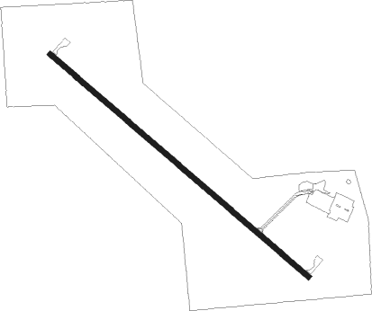
| Runway 13 / 31 | ||
| length | 1402m (4600ft) | |
| bearing | 127° / 307° | |
| width | 23m (75ft) | |
| surface | asphalt | |
Nearby beacons
| code | identifier | dist | bearing | frequency |
|---|---|---|---|---|
| JWJ | ELMWOOD (MARSHALTOWN) VOR/DME | 26.9 | 135° | 109.40 |
| MC | SURFF (MASON CITY) NDB | 34.9 | 354° | 348 |
| MCW | MASON CITY VOR/DME | 37.5 | 355° | 114.90 |
| ALO | WATERLOO VOR/DME | 38.9 | 84° | 112.20 |
| TNU | NEWTON VOR/DME | 41.9 | 167° | 112.50 |
| IY | CHUKK (CHARLES CITY) NDB | 46.4 | 39° | 417 |
Instrument approach procedures
| runway | airway (heading) | route (dist, bearing) |
|---|---|---|
| RW13 | ZIVNI (127°) | ZIVNI 4000ft |
| RNAV | ZIVNI 4000ft YITUG (7mi, 127°) 2800ft HENSO (3mi, 127°) 1700ft KIFA (2mi, 127°) 1169ft (5550mi, 114°) 1600ft SHODR (5560mi, 294°) 4000ft SHODR (turn) | |
| RW31 | VEYUD (307°) | VEYUD 4000ft |
| RNAV | VEYUD 4000ft ZIROL (7mi, 307°) 2800ft WISBU (3mi, 307°) 1800ft KIFA (2mi, 307°) 1177ft (5550mi, 114°) 1600ft ARTYS (5541mi, 295°) 4000ft ARTYS (turn) 4000ft |
Disclaimer
The information on this website is not for real aviation. Use this data with the X-Plane flight simulator only! Data taken with kind consent from X-Plane 12 source code and data files. Content is subject to change without notice.