Willimantic - Windham
Airport details
| Country | United States of America |
| State | Connecticut |
| Region | K6 |
| Airspace | Boston Ctr |
| Municipality | Windham |
| Elevation | 247ft (75m) |
| Timezone | GMT -5 |
| Coordinates | 41.74710, -72.17418 |
| Magnetic var | |
| Type | land |
| Available since | X-Plane v10.40 |
| ICAO code | KIJD |
| IATA code | IJD |
| FAA code | IJD |
Communication
| Windham ASOS | 133.675 |
| Windham CTAF/UNICOM | 122.975 |
| Windham PROVIDENCE Approach | 135.400 |
| Windham PROVIDENCE Approach | 119.450 |
| Windham BRADLEY Departure | 127.800 |
Approach frequencies
| LOC | RW27 | 108.35 | 18.00mi |
Nearby Points of Interest:
Eleazer Williams House
-William Jillson Stone House
-Windham Town Hall
-Willimantic Armory
-Dr. Chester Hunt Office
-Willimantic Freight House and Office
-Witter House
-Samuel Huntington Birthplace
-University of Connecticut Historic District
-Farwell Barn
-Church Farm
-Capron-Phillips House
-South Willington Historic District
-South Coventry Historic District
-Columbia Green Historic District
-Parker-Hutchinson Farm
-Alden Tavern Site
-Natchaug Forest Lumber Shed
-Mansfield Training School and Hospital
-War Office
-William Williams House
-John Trumbull Birthplace
-Knowlton Memorial Hall
-Brigham's Tavern
-Mixer Tavern
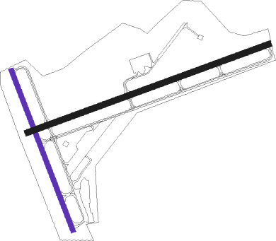
Runway info
Runway 9 / 27  | ||
| length | 1282m (4206ft) | |
| bearing | 78° / 258° | |
| width | 30m (100ft) | |
| surface | asphalt | |
| displ threshold | 62m (203ft) / 0m (0ft) | |
| blast zone | 44m (144ft) / 0m (0ft) | |
| Runway 18 / 36 | ||
| length | 854m (2802ft) | |
| bearing | 158° / 338° | |
| width | 23m (75ft) | |
| surface | asphalt | |
| displ threshold | 0m (0ft) / 244m (801ft) | |
Nearby beacons
| code | identifier | dist | bearing | frequency |
|---|---|---|---|---|
| ORW | NORWICH VOR/DME | 13.8 | 137° | 110 |
| HFD | HARTFORD VOR/DME | 17.9 | 254° | 114.90 |
| PUT | PUTNAM VOR/DME | 19.3 | 58° | 117.40 |
| GON | GROTON VOR/DME | 25.6 | 164° | 110.85 |
| CEF | WESTOVER(SPRINGFIELD/CHIC TACAN | 31.2 | 322° | 114 |
| PVD | PROVIDENCE VOR/DME | 33.3 | 92° | 115.60 |
| BAF | BARNES (WESTFIELD/SPRINGF VORTAC | 34.7 | 307° | 113 |
| MAD | MADISON VOR/DME | 34.9 | 230° | 110.40 |
| HVN | HAVEN DME | 43.2 | 236° | 109.80 |
| SEY | SANDY POINT (BLOCK ISLAND VOR/DME | 44 | 134° | 117.80 |
| CTR | CHESTER VOR/DME | 47.5 | 305° | 115.10 |
| GDM | GARDNER VOR/DME | 48.2 | 8° | 110.60 |
| HTO | HAMPTON (EAST HAMPTON) VORTAC | 50.1 | 190° | 113.60 |
| BDR | BRIDGEPORT VOR/DME | 55.4 | 238° | 108.80 |
| CCC | CALVERTON VOR/DME | 56.6 | 217° | 117.20 |
| FOK | SUFFOLK CO (WESTHAMPTON B TACAN | 58.3 | 207° | 111 |
Instrument approach procedures
| runway | airway (heading) | route (dist, bearing) |
|---|---|---|
| RW09 | HFD (74°) | HFD CAMPU (7mi, 69°) 2400ft |
| RW09 | ORW (317°) | ORW CAMPU (20mi, 289°) 2400ft CAMPU (turn) 2400ft |
| RNAV | CAMPU 2400ft JUFOH (5mi, 78°) 1900ft ZARAS (3mi, 78°) 1080ft KIJD (3mi, 77°) 284ft (4612mi, 120°) 900ft DVANY (4619mi, 300°) 2500ft DVANY (turn) | |
| RW27 | ORW (317°) | ORW HHOTT (15mi, 20°) 2500ft HHOTT (turn) 2500ft |
| RW27 | PUT (238°) | PUT HHOTT (10mi, 203°) 2500ft |
| RNAV | HHOTT 2500ft LINKS (6mi, 258°) 2200ft HUVUX (3mi, 258°) 1260ft KIJD (3mi, 259°) 279ft (4612mi, 120°) 646ft ORW (4602mi, 300°) 2600ft ORW (turn) |
Disclaimer
The information on this website is not for real aviation. Use this data with the X-Plane flight simulator only! Data taken with kind consent from X-Plane 12 source code and data files. Content is subject to change without notice.