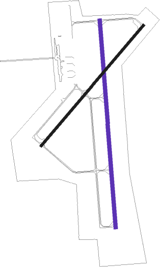
Ankeny - Ankeny Rgnl
Airport details
| Country | United States of America |
| State | Iowa |
| Region | K3 |
| Airspace | Minneapolis Ctr |
| Municipality | Ankeny |
| Elevation | 910ft (277m) |
| Timezone | GMT -6 |
| Coordinates | 41.69135, -93.56635 |
| Magnetic var | |
| Type | land |
| Available since | X-Plane v10.32 |
| ICAO code | KIKV |
| IATA code | IKV |
| FAA code | IKV |
Communication
| Ankeny Rgnl AWOS 3 | 119.175 |
| Ankeny Rgnl CTAF/UNICOM | 122.900 |
| Ankeny Rgnl DES MOINES Approach/Departure | 123.900 |
Approach frequencies
| ILS-cat-I | RW36 | 111.1 | 18.00mi |
| 3° GS | RW36 | 111.1 | 18.00mi |
Nearby Points of Interest:
College Corner Commercial Historic Business District
-Humphrey Center
-Highland Park Historic Business District at Euclid and Sixth Avenues
-Larnerd Case House
-Rees Gabriel House
-Prospect Park Second Plat Historic District
-Ayrshire Apartments
-The Oaklands Historic District
-William H. and Alice Bailey House
-Lowry W. and Hattie N. Goode First North Des Moines House
-Dr. Anna E. and Andrew A. Johnstone House
-Chaffee-Hunter House
-Dr. John B. and Anna M. Hatton House
-The Maine
-William B. Hayes House
-C.H. Baker Double House
-Polk County Homestead and Trust Company Addition Historic District
-Perry and Brainard Block
-Wherry Block
-Sargent's Garage
-William A. and Etta Baum Cottage
-Veneman's Bungalow Court Historic District
-Fish and Game Pavilion and Aquarium
-Julius Scheibe Cottage
-Byron A. Beeson House

Nearby beacons
| code | identifier | dist | bearing | frequency |
|---|---|---|---|---|
| DSM | DES MOINES VORTAC | 15.6 | 198° | 117.50 |
| TNU | NEWTON VOR/DME | 21.2 | 79° | 112.50 |
| PEA | PELLA NDB | 32.8 | 115° | 257 |
| JWJ | ELMWOOD (MARSHALTOWN) VOR/DME | 38.7 | 57° | 109.40 |
| EFW | JEFFERSON NDB | 39.7 | 293° | 391 |
| FO | BARRO (FORT DODGE) NDB | 59.4 | 318° | 341 |
| FOD | FORT DODGE VORTAC | 64 | 322° | 113.50 |
Instrument approach procedures
| runway | airway (heading) | route (dist, bearing) |
|---|---|---|
| RW18 | NEVAD (185°) | NEVAD BALVE (5mi, 197°) 4000ft |
| RW18 | TNU (259°) | TNU BALVE (22mi, 287°) 4000ft BALVE (turn) 4000ft |
| RW18 | ZEMET (125°) | ZEMET JOGPI (12mi, 73°) 4000ft BALVE (7mi, 127°) 4000ft |
| RNAV | BALVE 4000ft COSED (6mi, 180°) 3400ft ZUKUK (5mi, 180°) 1740ft KIKV (3mi, 181°) 943ft (5565mi, 114°) 1600ft TNU (5544mi, 294°) 4000ft TNU (turn) | |
| RW22 | ZUNIP (233°) | ZUNIP 3200ft |
| RNAV | ZUNIP 3200ft CABOX (5mi, 233°) 2500ft JONRU (2mi, 233°) 1740ft KIKV (3mi, 231°) 947ft (5565mi, 114°) 1500ft ZUNIP (5558mi, 294°) 3200ft ZUNIP (turn) | |
| RW36 | ZAGTU (360°) | ZAGTU 3000ft |
| RNAV | ZAGTU 3000ft RROBN (7mi, 0°) 2500ft PARRI (2mi, 0°) 1760ft KIKV (3mi, 359°) 940ft (5565mi, 114°) 1500ft CINOR (5555mi, 294°) 4000ft CINOR (turn) |
Disclaimer
The information on this website is not for real aviation. Use this data with the X-Plane flight simulator only! Data taken with kind consent from X-Plane 12 source code and data files. Content is subject to change without notice.