Killeen - Skylark Fld
Airport details
| Country | United States of America |
| State | Texas |
| Region | K4 |
| Airspace | Houston Oceanic Ctr |
| Municipality | Killeen |
| Elevation | 848ft (258m) |
| Timezone | GMT -6 |
| Coordinates | 31.08583, -97.68650 |
| Magnetic var | |
| Type | land |
| Available since | X-Plane v10.40 |
| ICAO code | KILE |
| IATA code | ILE |
| FAA code | ILE |
Communication
| Skylark Fld AWOS 3 | 128.575 |
| Skylark Fld CTAF/UNICOM | 122.700 |
| Skylark Fld GRAY Approach/Departure | 120.075 |
Approach frequencies
| LOC | RW01 | 108.3 | 18.00mi |
Nearby Points of Interest:
Barton House
-George Washington Baines House
-First Christian Church Parsonage
-V. R. Means House
-Coryell County Courthouse
-Bartlett Commercial Historic District
-Williamson County Courthouse Historic District
-Georgetown Light and Water Works
-Hugh Roy and Lillie Cullen Building
-Harper-Chesser House
-Belford Historic District
-Hutto Commercial Historic District
-The Church of the Visitation
-Burnet County Courthouse
-Westphalia
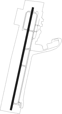
Runway info
| Runway 1 / 19 | ||
| length | 1680m (5512ft) | |
| bearing | 19° / 199° | |
| width | 30m (100ft) | |
| surface | asphalt | |
| displ threshold | 257m (843ft) / 0m (0ft) | |
Nearby beacons
| code | identifier | dist | bearing | frequency |
|---|---|---|---|---|
| IL | IRESH (KILLEEN) NDB | 3.8 | 199° | 278 |
| GRK | GRAY (FORT HOOD) VOR/DME | 7.2 | 247° | 111.80 |
| TPL | DME | 15.3 | 65° | 110.40 |
| AGJ | GOOCH SPRINGS VORTAC | 24.1 | 282° | 112.50 |
| ROB | ROBINSON (WACO) NDB | 40.4 | 56° | 400 |
| ACT | WACO VORTAC | 40.7 | 36° | 115.30 |
| CWK | CENTEX VORTAC | 43.2 | 168° | 112.80 |
Departure and arrival routes
| Transition altitude | 18000ft |
| Transition level | 18000ft |
| SID end points | distance | outbound heading | |
|---|---|---|---|
| ALL | |||
| CONRA2 | 88mi | 89° | |
| RW01 | |||
| LAMPS7 | 75mi | 229° | |
| RW19 | |||
| LAMPS7 | 75mi | 229° | |
Instrument approach procedures
| runway | airway (heading) | route (dist, bearing) |
|---|---|---|
| RW01 | AGJ (102°) | AGJ CIVIP (20mi, 132°) 3100ft IZSUN (6mi, 105°) 3100ft |
| RW01 | DARTE (324°) | DARTE EHWAM (11mi, 302°) 3100ft IZSUN (6mi, 285°) 3100ft |
| RW01 | IZSUN (19°) | IZSUN 3100ft |
| RNAV | IZSUN 3100ft JOTCO (7mi, 19°) 2100ft KILE (4mi, 19°) 888ft (5800mi, 108°) 1300ft IZSUN (5804mi, 288°) 3100ft IZSUN (turn) |
Disclaimer
The information on this website is not for real aviation. Use this data with the X-Plane flight simulator only! Data taken with kind consent from X-Plane 12 source code and data files. Content is subject to change without notice.