Winston Salem - Smith Reynolds
Airport details
| Country | United States of America |
| State | North Carolina |
| Region | K7 |
| Airspace | Atlanta Ctr |
| Municipality | Winston-Salem |
| Elevation | 969ft (295m) |
| Timezone | GMT -5 |
| Coordinates | 36.13371, -80.22199 |
| Magnetic var | |
| Type | land |
| Available since | X-Plane v10.40 |
| ICAO code | KINT |
| IATA code | INT |
| FAA code | INT |
Communication
| Smith Reynolds ATIS | 121.300 |
| Smith Reynolds UNICOM | 122.950 |
| Smith Reynolds Ground Control | 128.250 |
| Smith Reynolds WINSTON SALEM Tower | 123.750 |
| Smith Reynolds GREENSBORO Approach/Departure | 124.350 |
Approach frequencies
| ILS-cat-I | RW33 | 110.3 | 18.00mi |
| 3° GS | RW33 | 110.3 | 18.00mi |
Nearby Points of Interest:
Goler Metropolitan AME Zion Church
-Craver Apartment Building
-Goler Memorial African Methodist Episcopal Zion Church
-Winston-Salem Tobacco Historic District
-P.H. Hanes Knitting Company
-S. J. Nissen Building
-Reynolds Building
-Winston Tower
-Forsyth County Courthouse
-Pepper Building
-O'Hanlon Building
-8 West Third Street
-Winston-Salem City Hall
-Hoots Milling Company Roller Mill
-Shamrock Mills
-J. S. Hill House
-James Mitchell Rogers House
-Conrad-Starbuck House
-William Allen Blair House
-Holly Avenue Historic District
-Arista Cotton Mill Complex
-Joseph Franklin Bland House
-Reynolda Historic District
-Nissen Building
-Single Brothers' House
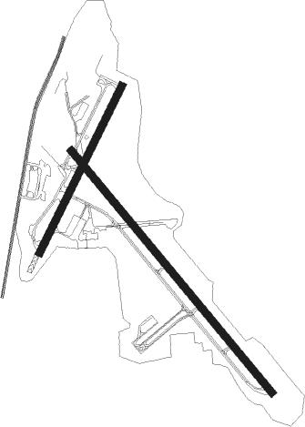
Runway info
Runway 4 / 22  | ||
| length | 1202m (3944ft) | |
| bearing | 36° / 216° | |
| width | 46m (151ft) | |
| surface | asphalt | |
| Runway 15 / 33 | ||
| length | 2031m (6663ft) | |
| bearing | 139° / 319° | |
| width | 46m (151ft) | |
| surface | asphalt | |
| displ threshold | 179m (587ft) / 0m (0ft) | |
Nearby beacons
| code | identifier | dist | bearing | frequency |
|---|---|---|---|---|
| IN | REENO (WINSTON SALEM) NDB | 4.6 | 139° | 317 |
| GSO | GREENSBORO VORTAC | 13 | 110° | 116.20 |
| SIF | SLAMMER (REIDSVILLE) NDB | 26.7 | 62° | 423 |
| RU | ROVDY (SALISBURY) NDB | 27.3 | 214° | 275 |
| UV | BALES (MARTINSVILLE) NDB | 31.1 | 34° | 396 |
| HB | ALAMM NDB | 32.3 | 104° | 361 |
| LIB | LIBERTY VORTAC | 35.3 | 118° | 113 |
| VU | ALLER (ALBEMARLE) NDB | 39.2 | 168° | 346 |
| DAN | DANVILLE VOR | 50.1 | 64° | 113.10 |
| PSK | PULASKI (DUBLIN) VORTAC | 61.9 | 333° | 116.80 |
| SDZ | SANDHILLS (SOUTHERN PINES VORTAC | 63.2 | 145° | 111.80 |
| CLT | CHARLOTTE VOR/DME | 66.9 | 218° | 115 |
| GHJ | STONIA (GASTONIA) NDB | 72.7 | 225° | 260 |
Departure and arrival routes
| Transition altitude | 18000ft |
| Transition level | 18000ft |
| SID end points | distance | outbound heading | |
|---|---|---|---|
| RW04 | |||
| QUAK7 | 67mi | 66° | |
| TRI9 | 37mi | 290° | |
| TRSHA1 | 39mi | 326° | |
| RW15 | |||
| QUAK7 | 67mi | 66° | |
| TRI9 | 37mi | 290° | |
| TRSHA1 | 39mi | 326° | |
| RW22 | |||
| QUAK7 | 67mi | 66° | |
| TRI9 | 37mi | 290° | |
| TRSHA1 | 39mi | 326° | |
| RW33 | |||
| QUAK7 | 67mi | 66° | |
| TRI9 | 37mi | 290° | |
| TRSHA1 | 39mi | 326° | |
| STAR starting points | distance | inbound heading | |
|---|---|---|---|
| ALL | |||
| TRAKS3 | 22.5 | 90° | |
| BROOK4 | 38.4 | 93° | |
| HENBY3 | 36.4 | 199° | |
| BLOCC2 | 46.0 | 314° | |
Instrument approach procedures
| runway | airway (heading) | route (dist, bearing) |
|---|---|---|
| RW15 | FREON (172°) | FREON ADKAW (16mi, 198°) 4100ft |
| RW15 | INGON (140°) | INGON ADKAW (5mi, 318°) 4100ft ADKAW (turn) 4100ft |
| RW15 | PROVE (215°) | PROVE ADKAW (12mi, 272°) 4600ft ADKAW (turn) 4100ft |
| RNAV | ADKAW 4100ft GASTN (6mi, 139°) 2700ft KINT (5mi, 139°) 1024ft (4932mi, 114°) 1369ft COLEB (4928mi, 294°) GSO (9mi, 94°) 3000ft GSO (turn) | |
| RW33 | AZELL (3°) | AZELL BACHE (10mi, 53°) 3000ft |
| RW33 | GSO (290°) | GSO BACHE (7mi, 236°) 3000ft |
| RNAV | BACHE 3000ft COLEB (6mi, 319°) 2500ft EARLL (3mi, 319°) 1520ft KINT (3mi, 319°) 957ft CATSI (2mi, 319°) INGON (4mi, 320°) 3500ft INGON (turn) |
Holding patterns
| STAR name | hold at | type | turn | heading* | altitude | leg | speed limit |
|---|---|---|---|---|---|---|---|
| BLOCC2 | BLOCC | VHF | right | 180 (0)° | DME 5.0mi | ICAO rules | |
| BROOK4 | BROOK | VHF | left | 282 (102)° | DME 4.0mi | ICAO rules | |
| BROOK4 | TRAKS | VHF | left | 282 (102)° | 1.0min timed | ICAO rules | |
| HENBY3 | HENBY | VHF | left | 1 (181)° | DME 11.0mi | ICAO rules | |
| *) magnetic outbound (inbound) holding course | |||||||
Disclaimer
The information on this website is not for real aviation. Use this data with the X-Plane flight simulator only! Data taken with kind consent from X-Plane 12 source code and data files. Content is subject to change without notice.