Lincolnton - Lincolnton Lincoln Co Regl
Airport details
| Country | United States of America |
| State | North Carolina |
| Region | K7 |
| Airspace | Atlanta Ctr |
| Municipality | Lincoln County |
| Elevation | 875ft (267m) |
| Timezone | GMT -5 |
| Coordinates | 35.48333, -81.16125 |
| Magnetic var | |
| Type | land |
| Available since | X-Plane v10.40 |
| ICAO code | KIPJ |
| IATA code | n/a |
| FAA code | IPJ |
Communication
| Lincolnton Lincoln Co Regl AWOS 3 | 119.675 |
| Lincolnton Lincoln Co Regl CTAF/UNICOM | 123.050 |
| Lincolnton Lincoln Co Regl CHARLOTTE Approach/Departure | 134.750 |
Approach frequencies
| ILS-cat-I | RW23 | 111.15 | 18.00mi |
| 3° GS | RW23 | 111.15 | 18.00mi |
Nearby Points of Interest:
First Baptist Church
-Emanuel United Church of Christ
-St. Luke's Church and Cemetery
-Caldwell-Cobb-Love House
-First United Methodist Church
-Pleasant Retreat Academy
-Lincolnton Commercial Historic District
-South Aspen Street Historic District
-Lincoln County Courthouse
-Lincolnton Recreation Department Youth Center
-Shadow Lawn
-Laboratory Historic District
-Ingleside
-Andrew Carpenter House
-Abraham Anthony Farm
-Balls Creek Campground
-Eli Hoyle House
-Hoyle Historic Homestead
-Dallas Historic District
-Foil–Cline House
-Grace Reformed Church
-St. Paul's Reformed Church
-Newton Downtown Historic District
-Bost-Burris House
-Murray's Mill Historic District
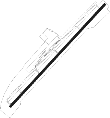
Runway info
| Runway 5 / 23 | ||
| length | 1740m (5709ft) | |
| bearing | 53° / 233° | |
| width | 30m (100ft) | |
| surface | asphalt | |
| displ threshold | 60m (197ft) / 68m (223ft) | |
Nearby beacons
| code | identifier | dist | bearing | frequency |
|---|---|---|---|---|
| GHJ | STONIA (GASTONIA) NDB | 17.5 | 179° | 260 |
| HK | TAWBA (HICKORY) NDB | 19.5 | 335° | 332 |
| CLT | CHARLOTTE VOR/DME | 20.3 | 144° | 115 |
| BZM | BARRETTS MOUNTAIN (HICKOR VOR/DME | 23.4 | 348° | 113.75 |
| SLP | FIRST RIVER (SHELBY) NDB | 25.5 | 242° | 417 |
| FIQ | FIDDLERS (MORGANTON) NDB | 28.3 | 294° | 391 |
| UZ | RALLY (ROCK HILL) NDB | 35.8 | 172° | 227 |
| RU | ROVDY (SALISBURY) NDB | 36 | 70° | 275 |
| DCM | CHESTER NDB | 41.9 | 183° | 220 |
| SPA | SPARTANBURG VORTAC | 46.2 | 240° | 115.70 |
| LKR | LANCASTER NDB | 48 | 158° | 400 |
| BAR | HEMLOCK (BANNER ELK) NDB | 53.3 | 313° | 320 |
| UOT | UNION COUNTY NDB | 53.5 | 211° | 326 |
| JUH | ASHEE (JEFFERSON) NDB | 57.6 | 350° | 410 |
| IN | REENO (WINSTON SALEM) NDB | 59.9 | 59° | 317 |
| JJC | MOUNTAIN CITY NDB | 64.6 | 325° | 396 |
| CTF | CHESTERFIELD VOR/DME | 66.3 | 133° | 108.20 |
| HMV | HOLSTON MOUNTAIN VORTAC | 74.1 | 315° | 114.60 |
Departure and arrival routes
| Transition altitude | 18000ft |
| Transition level | 18000ft |
| SID end points | distance | outbound heading | |
|---|---|---|---|
| ALL | |||
| WEAZL4 | 56mi | 1° | |
| KRITR5 | 31mi | 36° | |
| KILNS4 | 122mi | 73° | |
| BARMY4 | 171mi | 82° | |
| KNI2 | 65mi | 102° | |
| LILLS2 | 69mi | 114° | |
| KWEEN4 | 78mi | 164° | |
| ICONS4 | 90mi | 175° | |
| BEAVY5 | 99mi | 185° | |
| ESTRR4 | 107mi | 236° | |
| BOBZY4 | 47mi | 245° | |
| JOJJO4 | 194mi | 278° | |
| RW05 | |||
| KER3 | 146mi | 187° | |
| RW23 | |||
| KER3 | 146mi | 187° | |
| STAR starting points | distance | inbound heading | |
|---|---|---|---|
| ALL | |||
| CHPTR3 | 60.2 | 20° | |
| UNARM6 | 55.0 | 30° | |
| LIINN3 | 35.8 | 96° | |
| MAJIC4 | 40.5 | 246° | |
| RASLN3 | 59.1 | 308° | |
Instrument approach procedures
| runway | airway (heading) | route (dist, bearing) |
|---|---|---|
| RW05 | IWWON (53°) | IWWON 3200ft |
| RW05 | POBYI (27°) | POBYI 3800ft IWWON (8mi, 344°) 3200ft |
| RW05 | SIYOV (74°) | SIYOV 5200ft IWWON (8mi, 104°) 3200ft |
| RNAV | IWWON 3200ft AMOLE (7mi, 53°) 2700ft BEGAY (3mi, 53°) 1620ft KIPJ (2mi, 53°) 935ft (4973mi, 114°) 1277ft JIVOM (4965mi, 294°) 3000ft JIVOM (turn) | |
| RW23 | HIDOD (255°) | HIDOD 3800ft JIVOM (6mi, 311°) 3000ft |
| RW23 | JIVOM (233°) | JIVOM 3000ft |
| RW23 | JOPAT (206°) | JOPAT 5100ft JIVOM (6mi, 131°) 3000ft |
| RNAV | JIVOM 3000ft CISBU (7mi, 233°) 2500ft GATEQ (3mi, 233°) 1540ft KIPJ (2mi, 233°) 913ft (4973mi, 114°) 1135ft IWWON (4981mi, 293°) 3200ft IWWON (turn) |
Holding patterns
| STAR name | hold at | type | turn | heading* | altitude | leg | speed limit |
|---|---|---|---|---|---|---|---|
| CHPTR3 | EYPAD | VHF | right | 218 (38)° | DME 10.0mi | ICAO rules | |
| CHPTR3 | GRD | NDB | right | 227 (47)° | < 17999ft | 1.0min timed | ICAO rules |
| LIINN3 | LIINN | VHF | right | 302 (122)° | DME 10.0mi | ICAO rules | |
| MAJIC4 | KELLS | VHF | right | 39 (219)° | DME 15.0mi | ICAO rules | |
| MAJIC4 | MAJIC | VHF | left | 39 (219)° | DME 10.0mi | ICAO rules | |
| RASLN3 | DSTEE | VHF | left | 141 (321)° | DME 4.0mi | ICAO rules | |
| RASLN3 | FLO | NDB | left | 140 (320)° | 1.0min timed | ICAO rules | |
| RASLN3 | RODEZ | VHF | left | 141 (321)° | DME 5.0mi | ICAO rules | |
| UNARM6 | GRD | NDB | right | 227 (47)° | < 17999ft | 1.0min timed | ICAO rules |
| UNARM6 | LOCKS | VHF | right | 232 (52)° | < 17999ft | 1.0min timed | ICAO rules |
| UNARM6 | UNARM | VHF | right | 233 (53)° | DME 4.0mi | ICAO rules | |
| *) magnetic outbound (inbound) holding course | |||||||
Disclaimer
The information on this website is not for real aviation. Use this data with the X-Plane flight simulator only! Data taken with kind consent from X-Plane 12 source code and data files. Content is subject to change without notice.