Williamsport - Williamsport Regl
Airport details
| Country | United States of America |
| State | Pennsylvania |
| Region | K6 |
| Airspace | New York Ctr |
| Municipality | Montoursville |
| Elevation | 526ft (160m) |
| Timezone | GMT -5 |
| Coordinates | 41.24166, -76.92181 |
| Magnetic var | |
| Type | land |
| Available since | X-Plane v10.40 |
| ICAO code | KIPT |
| IATA code | IPT |
| FAA code | IPT |
Communication
| Williamsport Regl ASOS | 125.225 |
| Williamsport Regl NEW YORK Clearance DEL | 124.900 |
| Williamsport Regl Ground Control | 121.900 |
| Williamsport Regl Tower | 119.100 |
Approach frequencies
| ILS-cat-I | RW27 | 110.1 | 18.00mi |
| 3° GS | RW27 | 110.1 | 18.00mi |
Nearby Points of Interest:
Canfield Island Site
-Williamsport Armory
-Hart Building
-Williamsport City Hall
-City Hall
-Peter Herdic House
-Millionaire's Row Historic District
-Muncy Historic District
-St. James Episcopal Church
-Benjamin Griffey House
-Allenwood River Bridge
-Hopper-Snyder Homestead
-William Kirk House
-Watsontown River Bridge
-Hower-Slote House
-Plunketts Creek Bridge No. 3
-Bridge in Lewis Township
-Houseknecht Farm
-Lairdsville Covered Bridge
-Milton Historic District
-Milton Freight Station
-Pennsylvania Canal and Limestone Run Aqueduct
-Milton Armory
-Col. James Cameron House
-Jersey Shore Historic District
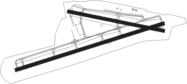
Runway info
Runway 9 / 27  | ||
| length | 2075m (6808ft) | |
| bearing | 80° / 260° | |
| width | 46m (150ft) | |
| surface | asphalt | |
| displ threshold | 0m (0ft) / 78m (256ft) | |
| Runway 12 / 30 | ||
| length | 1302m (4272ft) | |
| bearing | 102° / 282° | |
| width | 46m (150ft) | |
| surface | asphalt | |
Nearby beacons
| code | identifier | dist | bearing | frequency |
|---|---|---|---|---|
| FQM | WILLIAMSPORT VOR/DME | 8.8 | 57° | 114.40 |
| MIP | MILTON VORTAC | 17.5 | 130° | 109.20 |
| SEG | SELINSGROVE VOR/DME | 27.1 | 175° | 110.40 |
| SFK | STONYFORK VOR/DME | 35.2 | 312° | 108.60 |
| UN | PENUE (STATE COLLEGE) NDB | 42.1 | 248° | 388 |
| RAV | RAVINE VORTAC | 43.8 | 155° | 114.60 |
| BZJ | BELLGROVE (INDIANTOWN GAP) NDB | 51.2 | 155° | 328 |
| ULW | ELMIRA VOR/DME | 51.4 | 353° | 109.65 |
| HAR | HARRISBURG VORTAC | 56.8 | 189° | 112.50 |
| MD | ENOLA (HARRISBURG) NDB | 59.7 | 179° | 204 |
| ALP | ALPINE (ELMIRA) NDB | 60.2 | 9° | 245 |
| CFB | BINGHAMTON VOR/DME | 65.3 | 41° | 112.20 |
Instrument approach procedures
| runway | airway (heading) | route (dist, bearing) |
|---|---|---|
| RW09 | FAVUM (92°) | FAVUM ZAGTI (18mi, 101°) 4000ft |
| RW09 | ZAGTI (80°) | ZAGTI 4000ft |
| RNAV | ZAGTI 4000ft JIPAS (7mi, 80°) 2800ft KIPT (7mi, 80°) 570ft (4817mi, 118°) 928ft EPEYI (4814mi, 298°) ZUMEV (7mi, 80°) 4300ft ZUMEV (turn) | |
| RW12 | FAVUM (92°) | FAVUM ZAGTI (18mi, 101°) 4000ft |
| RW12 | ZAGTI (80°) | ZAGTI 4000ft |
| RNAV | ZAGTI 4000ft SOLYO (8mi, 70°) 2800ft WAKUG (3mi, 90°) 1660ft YEXWU (2mi, 90°) 760ft (4818mi, 118°) 928ft GECVE (4815mi, 298°) ZUMEV (8mi, 80°) 4300ft ZUMEV (turn) | |
| RW27 | HULRO (271°) | HULRO JIBGO (5mi, 309°) 4300ft |
| RW27 | ZEKNO (249°) | ZEKNO JIBGO (5mi, 202°) 4300ft |
| RNAV | JIBGO 4300ft ZUMEV (6mi, 260°) 3700ft KIPT (10mi, 260°) 574ft (4817mi, 118°) 980ft ZIMEL (4830mi, 298°) ZIMEL (turn) | |
| RW30 | MIP (310°) | MIP JIVAL (10mi, 360°) 4100ft |
| RW30 | MUNCI (260°) | MUNCI JIVAL (12mi, 235°) 4100ft |
| RNAV | JIVAL 4100ft CODIP (6mi, 282°) 2800ft KIPT (6mi, 281°) 586ft (4817mi, 118°) 840ft ZIMEL (4830mi, 298°) 4500ft ZIMEL (turn) |
Disclaimer
The information on this website is not for real aviation. Use this data with the X-Plane flight simulator only! Data taken with kind consent from X-Plane 12 source code and data files. Content is subject to change without notice.