Sturgis - Kirsch Muni
Airport details
| Country | United States of America |
| State | Michigan |
| Region | K5 |
| Airspace | Chicago Ctr |
| Municipality | Sturgis |
| Elevation | 923ft (281m) |
| Timezone | GMT -5 |
| Coordinates | 41.81329, -85.43896 |
| Magnetic var | |
| Type | land |
| Available since | X-Plane v10.40 |
| ICAO code | KIRS |
| IATA code | IRS |
| FAA code | IRS |
Communication
| KIRSCH MUNI AWOS 3 | 121.325 |
| KIRSCH MUNI CTAF/UNICOM | 123.050 |
| KIRSCH MUNI KALAMAZOO Approach/Departure | 121.200 |
Nearby Points of Interest:
Star Milling and Electric Company Historic District
-John Badlam Howe Mansion
-Samuel P. Williams House
-St. Joseph County Courthouse
-Leverett and Amanda Clapp House
-General Land Office
-Ezra E. and Florence (Holmes) Beardsley House
-Wahbememe Burial Site and Monument
-LaGrange County Courthouse
-Art Gallery Building
-Constantine Historic Commercial District
-John O'Ferrell Store
-Governor John S. Barry House
-Marantette House
-Downtown Three Rivers Commercial Historic District
-St. John of the Cross Episcopal Church
-Solomon Fowler Mansion
-CCC Shelter
-Mason District Number 5 Schoolhouse
-South Monroe Street Historic District
-Fanckboner-Nichols Farmstead
-Carroll Jones House
-G. W. Jones House
-Cornish Griffin Round Barn
-Jacob Straus House
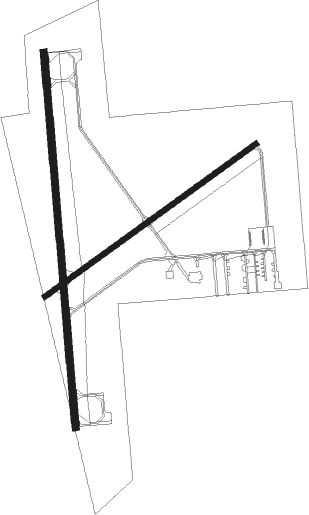
Runway info
Runway 18 / 36  | ||
| length | 1587m (5207ft) | |
| bearing | 180° / 360° | |
| width | 30m (100ft) | |
| surface | asphalt | |
| blast zone | 0m (0ft) / 151m (495ft) | |
| Runway 6 / 24 | ||
| length | 1098m (3602ft) | |
| bearing | 66° / 246° | |
| width | 23m (75ft) | |
| surface | asphalt | |
Nearby beacons
| code | identifier | dist | bearing | frequency |
|---|---|---|---|---|
| IRS | STURGIS NDB | 0.2 | 92° | 382 |
| AZ | AUSTN (KALAMAZOO) NDB | 19.5 | 344° | 371 |
| AZO | KALAMAZOO VOR/DME | 25.9 | 345° | 109 |
| GSH | GOSHEN VORTAC | 31.5 | 244° | 113.70 |
| LFD | LITCHFIELD VOR/DME | 33.6 | 70° | 111.20 |
| OLK | WEBSTER LAKE VOR | 34.1 | 186° | 110.40 |
| BT | BATOL (BATTLE CREEK) NDB | 34.8 | 25° | 272 |
| SB | MISHA (SOUTH BEND) NDB | 35.5 | 262° | 341 |
| ELX | KEELER VOR/DME | 36.4 | 296° | 116.60 |
| GW | SHENK (AUBURN) NDB | 37.6 | 136° | 227 |
| GIJ | GIPPER (NILES) VORTAC | 39.4 | 267° | 115.40 |
| PMM | PULLMAN VOR/DME | 49.1 | 314° | 112.10 |
| JXN | DME | 51.2 | 66° | 115.45 |
| FWA | FORT WAYNE VORTAC | 51.3 | 163° | 117.80 |
| VIO | VICTORY VOR/DME | 58.5 | 357° | 115.95 |
Instrument approach procedures
| runway | airway (heading) | route (dist, bearing) |
|---|---|---|
| RW18 | NUPGE (242°) | NUPGE WIREP (12mi, 279°) 2500ft UKANE (5mi, 246°) 2500ft |
| RW18 | RESGY (154°) | RESGY UKANE (9mi, 128°) 2500ft |
| RW18 | UKANE (179°) | UKANE 2500ft |
| RNAV | UKANE 2500ft ZUGDA (6mi, 180°) 2500ft KIRS (5mi, 178°) 948ft (5201mi, 116°) 1222ft JETKI (5201mi, 296°) 3000ft JETKI (turn) | |
| RW36 | EYEZI (330°) | EYEZI 3000ft JETKI (5mi, 270°) 3000ft |
| RW36 | HERLU (31°) | HERLU 3000ft JETKI (5mi, 90°) 3000ft |
| RW36 | JETKI (0°) | JETKI 3000ft |
| RNAV | JETKI 3000ft NUHTO (6mi, 360°) 2500ft KIRS (5mi, 1°) 952ft UKANE (11mi, 359°) 2500ft UKANE (turn) |
Disclaimer
The information on this website is not for real aviation. Use this data with the X-Plane flight simulator only! Data taken with kind consent from X-Plane 12 source code and data files. Content is subject to change without notice.