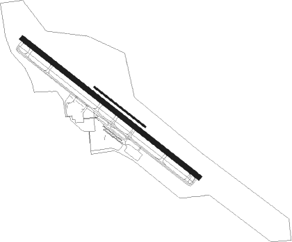
Ithaca - Ithaca Tompkins Intl
Airport details
| Country | United States of America |
| State | New York |
| Region | K6 |
| Airspace | New York Ctr |
| Municipality | Town of Lansing |
| Elevation | 1099ft (335m) |
| Timezone | GMT -5 |
| Coordinates | 42.49136, -76.45872 |
| Magnetic var | |
| Type | land |
| Available since | X-Plane v10.40 |
| ICAO code | KITH |
| IATA code | ITH |
| FAA code | ITH |
Communication
| Ithaca Tompkins Intl ATIS | 125.175 |
| Ithaca Tompkins Intl UNICOM | 122.950 |
| Ithaca Tompkins Intl CTAF | 119.600 |
| Ithaca Tompkins Intl Ground Control | 121.800 |
| Ithaca Tompkins Intl Tower | 119.600 |
| Ithaca Tompkins Intl ELMIRA Approach/Departure | 124.300 |
| Ithaca Tompkins Intl ITHACA Approach/Departure | 119.600 |
Approach frequencies
| ILS-cat-I | RW32 | 108.7 | 18.00mi |
| 3.2° GS | RW32 | 108.7 | 18.00mi |
Nearby Points of Interest:
Dryden District School No. 5
-Forest Home Historic District
-West Dryden Methodist Episcopal Church
-Cornell Heights Historic District
-Caldwell Hall
-Fernow Hall
-Computing and Communications Center, Cornell University
-Rice Hall
-Wing Hall
-Andrew Dickson White House
-Morrill Hall
-Cascadilla School Boathouse
-Telluride House
-Llenroc
-Deke House
-United States Post Office
-De Witt Park Historic District
-Boardman House
-Rufus and Flora Bates House
-Ithaca Downtown Historic District
-Clinton Hall
-St. James AME Zion Church
-Lehigh Valley Railroad Station
-Hayt's Chapel and Schoolhouse
-Second Tompkins County Courthouse

Nearby beacons
| code | identifier | dist | bearing | frequency |
|---|---|---|---|---|
| ITH | DME | 0.2 | 345° | 111.80 |
| IT | VRNAH (ITHACA) NDB | 5.4 | 124° | 266 |
| ALP | ALPINE (ELMIRA) NDB | 20.3 | 230° | 245 |
| CFB | BINGHAMTON VOR/DME | 24.6 | 136° | 112.20 |
| PYA | PENN YAN NDB | 27.9 | 284° | 260 |
| GGT | GEORGETOWN TACAN | 33.1 | 65° | 117.80 |
| ULW | ELMIRA VOR/DME | 34.6 | 235° | 109.65 |
| SYR | SYRACUSE VORTAC | 41.7 | 21° | 117 |
| FZ | FALLN (FULTON) NDB | 48.2 | 11° | 220 |
| SFK | STONYFORK VOR/DME | 64.1 | 230° | 108.60 |
Instrument approach procedures
| runway | airway (heading) | route (dist, bearing) |
|---|---|---|
| RW14-Y | VAFKU (100°) | VAFKU TIFZY (5mi, 47°) 3100ft |
| RNAV | TIFZY 3100ft STATN (6mi, 124°) 2100ft KITH (4mi, 124°) 1127ft (4808mi, 119°) 1500ft VAFKU (4819mi, 299°) 3700ft VAFKU (turn) | |
| RW14-Z | VAFKU (100°) | VAFKU TIFZY (5mi, 47°) 3100ft |
| RNAV | TIFZY 3100ft STATN (6mi, 124°) 2100ft KITH (4mi, 124°) 1127ft HUBTU (3mi, 124°) MESTE (10mi, 202°) 3800ft MESTE (turn) | |
| RW32 | CFB (316°) | CFB OCCIE (10mi, 338°) 3400ft |
| RNAV | OCCIE 3400ft CONUL (10mi, 304°) 3000ft KITH (6mi, 304°) 1153ft (4808mi, 119°) 1385ft STATN (4811mi, 299°) VAFKU (8mi, 270°) 3700ft VAFKU (turn) |
Disclaimer
The information on this website is not for real aviation. Use this data with the X-Plane flight simulator only! Data taken with kind consent from X-Plane 12 source code and data files. Content is subject to change without notice.