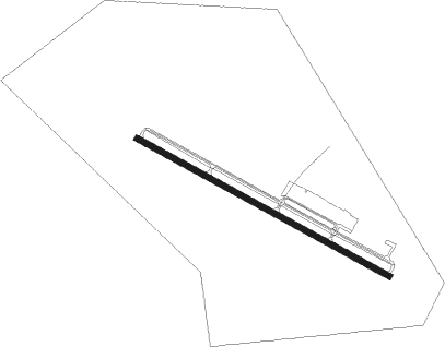
Canandaigua
Airport details
| Country | United States of America |
| State | New York |
| Region | |
| Airspace | Cleveland Ctr |
| Municipality | Town of Canandaigua |
| Elevation | 812ft (247m) |
| Timezone | GMT -5 |
| Coordinates | 42.91174, -77.31956 |
| Magnetic var | |
| Type | land |
| Available since | X-Plane v11.20 |
| ICAO code | KIUA |
| IATA code | n/a |
| FAA code | IUA |
Communication
| Canandaigua AWOS-3 | 118.675 |
| Canandaigua CTAF | 122.800 |
Nearby Points of Interest:
Cobblestone Manor
-North Main Street Historic District
-Canandaigua Historic District
-United States Post Office
-Thaddeus Chapin House
-Adelaide Avenue School
-Marshall House
-Canandaigua Veterans Hospital Historic District
-Brigham Hall
-Benham House
-Saltonstall Street School
-Building at 426 South Main Street
-Seneca Falls Village Historic District
-Felt Cobblestone General Store
-St. Peter's Episcopal Church
-Jeremiah Cronkite House
-Osborne House
-J. and E. Baker Cobblestone Farmstead
-Clifton Springs Sanitarium
-Clifton Springs Sanitarium Historic District
-Charles Bullis House
-Sheldon Cobblestone House
-Mendon Cobblestone Academy
-Mendon Presbyterian Church
-Palmyra Village Historic District
Nearby beacons
| code | identifier | dist | bearing | frequency |
|---|---|---|---|---|
| GEE | GENESEO VOR/DME | 18.7 | 259° | 108.20 |
| PYA | PENN YAN NDB | 19.8 | 135° | 260 |
| ROC | ROCHESTER VOR/DME | 19.8 | 300° | 110 |
| ITH | DME | 45.4 | 116° | 111.80 |
| ALP | ALPINE (ELMIRA) NDB | 47.3 | 140° | 245 |
| ULW | ELMIRA VOR/DME | 50.8 | 160° | 109.65 |
| IT | VRNAH (ITHACA) NDB | 51 | 117° | 266 |
| ELZ | DME | 57.8 | 220° | 111.40 |
Instrument approach procedures
| runway | airway (heading) | route (dist, bearing) |
|---|---|---|
| RW13 | GEE (79°) | GEE HUBNI (9mi, 12°) 4000ft CAMEY (7mi, 75°) 3200ft |
| RW13 | ROC (120°) | ROC CAMEY (8mi, 130°) 3200ft |
| RW13 | UMAGY (304°) | UMAGY CAMEY (20mi, 298°) 3200ft CAMEY (turn) 3200ft |
| RNAV | CAMEY 3200ft MCANN (7mi, 115°) 2400ft TUDDO (3mi, 115°) 1460ft KIUA (3mi, 110°) 829ft (4850mi, 119°) 1300ft UMAGY (4843mi, 299°) 4000ft UMAGY (turn) | |
| RW31 | BUCHH (338°) | BUCHH SSTAN (10mi, 42°) 3200ft |
| RW31 | EEETE (266°) | EEETE SSTAN (10mi, 222°) 3200ft |
| RW31 | SSTAN (297°) | SSTAN 3200ft |
| RNAV | SSTAN 3200ft SHUBE (7mi, 296°) 2400ft KIUA (5mi, 298°) 852ft (4850mi, 119°) 1400ft BUCHH (4843mi, 299°) 3700ft BUCHH (turn) |
Disclaimer
The information on this website is not for real aviation. Use this data with the X-Plane flight simulator only! Data taken with kind consent from X-Plane 12 source code and data files. Content is subject to change without notice.
