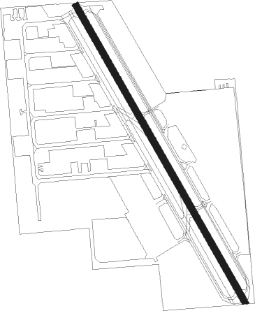
Houston - West Houston
Airport details
| Country | United States of America |
| State | Texas |
| Region | K4 |
| Airspace | Houston Oceanic Ctr |
| Municipality | Harris County |
| Elevation | 106ft (32m) |
| Timezone | GMT -6 |
| Coordinates | 29.81820, -95.67261 |
| Magnetic var | |
| Type | land |
| Available since | X-Plane v10.40 |
| ICAO code | KIWS |
| IATA code | IWS |
| FAA code | IWS |
Communication
| West Houston CTAF/UNICOM | 123.050 |
| West Houston HOUSTON Approach/Departure | 123.800 |
Nearby Points of Interest:
B. Ray and Charlotte Woods House
-David A. Carden House
-Houston Heights Waterworks Reservoir
-River Oaks Garden Club Forum of Civics
-Otto H. Baring House
-Burge House
-Houston Heights Fire Station
-Banta House
-Webber House
-Barker House
-Houston Heights Woman's Club
-Charles Johnson House
-Isbell House
-Gillette House
-Allbach House
-All Saints Catholic Church
-Oscar Lindsay House
-Ben C. and Jenetter Cyrus House
-Heights State Bank Building
-Star Engraving Company building
-John W. Anderson House
-Lamar–Calder House
-John M. and Lottie D. Moore House
-Simon and Mamie Minchen House
-Boulevard Oaks
Nearby beacons
| code | identifier | dist | bearing | frequency |
|---|---|---|---|---|
| IAH | HUMBLE (HOUSTON) VORTAC | 18.9 | 67° | 116.60 |
| BVP | NIXIN (HOUSTON) NDB | 26 | 69° | 326 |
| EFD | ELLINGTON (HOUSTON) TACAN | 29.6 | 112° | 109.40 |
| TNV | NAVASOTA VOR/DME | 34.6 | 321° | 115.90 |
| ELA | EAGLE LAKE VOR/DME | 34.8 | 256° | 116.40 |
| CX | ALIBI (HOUSTON) NDB | 38.2 | 18° | 281 |
| IDU | INDUSTRY VORTAC | 47 | 279° | 110.20 |
| MHF | TRINITY (SMITH POINT) VOR/DME | 50.9 | 106° | 113.60 |
| CL | ROWDY (COLLEGE STATION) NDB | 53.2 | 315° | 260 |
| VUH | SCHOLES (GALVESTON) VOR/DME | 53.4 | 124° | 113 |
| UTS | HUNTSVILLE NDB | 55.5 | 5° | 308 |
| CLL | COLLEGE STATION VORTAC | 61.1 | 316° | 113.30 |
Departure and arrival routes
| Transition altitude | 18000ft |
| Transition level | 18000ft |
| SID end points | distance | outbound heading | |
|---|---|---|---|
| ALL | |||
| GIFFA1 | 96mi | 15° | |
| ELD1 | 255mi | 40° | |
| AEX3 | 294mi | 75° | |
| IDU1 | 242mi | 238° | |
| PSX2 | 146mi | 266° | |
| LOA4 | 200mi | 334° | |
| CRIED1 | 145mi | 347° | |
| RW15 | |||
| BLTWY7 | 92mi | 0° | |
| WYLSN8 | 102mi | 4° | |
| INDIE8 | 223mi | 35° | |
| LURIC8 | 223mi | 47° | |
| STRYA8 | 243mi | 71° | |
| MMALT5 | 172mi | 93° | |
| HOODO7 | 116mi | 112° | |
| WATFO5 | 128mi | 137° | |
| KARRR6 | 135mi | 219° | |
| BORRN4 | 47mi | 269° | |
| STYCK8 | 145mi | 347° | |
| RW33 | |||
| BLTWY7 | 92mi | 0° | |
| WYLSN8 | 102mi | 4° | |
| INDIE8 | 223mi | 35° | |
| LURIC8 | 223mi | 47° | |
| STRYA8 | 243mi | 71° | |
| MMALT5 | 172mi | 93° | |
| HOODO7 | 116mi | 112° | |
| WATFO5 | 128mi | 137° | |
| KARRR6 | 135mi | 219° | |
| BORRN4 | 47mi | 269° | |
| STYCK8 | 145mi | 347° | |
| STAR starting points | distance | inbound heading | |
|---|---|---|---|
| ALL | |||
| TSHRT1 | 36.7 | 40° | |
| BLUBL4 | 43.8 | 128° | |
| OHIIO4 | 36.1 | 241° | |
| CESAN4 | 87.7 | 244° | |
| HUDZY4 | 48.1 | 252° | |
| WAPPL6 | 74.0 | 253° | |
| TKNIQ3 | 71.9 | 296° | |
Instrument approach procedures
| runway | airway (heading) | route (dist, bearing) |
|---|---|---|
| RW15 | LESKR (116°) | LESKR JOSEY (10mi, 77°) 2000ft |
| RNAV | JOSEY 2000ft ORENT (7mi, 151°) 1700ft ZASGI (2mi, 151°) 900ft KIWS (3mi, 152°) 156ft (5701mi, 107°) 600ft SHYNR (5719mi, 287°) 2000ft SHYNR (turn) | |
| RW33 | WUXIM (11°) | WUXIM COART (10mi, 58°) 3000ft |
| RNAV | COART 3000ft EMULE (7mi, 332°) 1700ft KIWS (5mi, 332°) 154ft (5701mi, 107°) 511ft SHYNR (5719mi, 287°) 2000ft SHYNR (turn) |
Holding patterns
| STAR name | hold at | type | turn | heading* | altitude | leg | speed limit |
|---|---|---|---|---|---|---|---|
| BLUBL4 | ELLVR | VHF | right | 351 (171)° | 18000ft - 45000ft | 1.5min timed | ICAO rules |
| HUDZY4 | BRWCK | VHF | left | 55 (235)° | DME 20.0mi | ICAO rules | |
| HUDZY4 | WAPPL | VHF | left | 55 (235)° | DME 10.0mi | ICAO rules | |
| OHIIO4 | LYMBO | VHF | right | 71 (251)° | DME 20.0mi | ICAO rules | |
| OHIIO4 | ZEEKK | VHF | right | 46 (226)° | DME 10.0mi | ICAO rules | |
| TKNIQ3 | TKNIQ | VHF | left | 91 (271)° | DME 10.0mi | ICAO rules | |
| TSHRT1 | ALIEF | VHF | right | 209 (29)° | DME 10.0mi | ICAO rules | |
| TSHRT1 | HYDRL | VHF | right | 209 (29)° | DME 10.0mi | ICAO rules | |
| WAPPL6 | BRWCK | VHF | left | 55 (235)° | DME 20.0mi | ICAO rules | |
| WAPPL6 | WAPPL | VHF | left | 55 (235)° | DME 10.0mi | ICAO rules | |
| *) magnetic outbound (inbound) holding course | |||||||
Disclaimer
The information on this website is not for real aviation. Use this data with the X-Plane flight simulator only! Data taken with kind consent from X-Plane 12 source code and data files. Content is subject to change without notice.