Jackson - Westover Field Amador County
Airport details
| Country | United States of America |
| State | California |
| Region | K2 |
| Airspace | Oakland Ctr |
| Municipality | Amador County |
| Elevation | 1687ft (514m) |
| Timezone | GMT -8 |
| Coordinates | 38.37680, -120.79391 |
| Magnetic var | |
| Type | land |
| Available since | X-Plane v10.40 |
| ICAO code | KJAQ |
| IATA code | n/a |
| FAA code | n/a |
Communication
| Westover Field Amador County AWOS THREE | 121.125 |
| Westover Field Amador County CTAF/UNICOM | 122.800 |
| Westover Field Amador County NORCAL Approach/Departure | 125.100 |
| Westover Field Amador County NORCAL Approach/Departure | 127.400 |
Nearby Points of Interest:
Kennedy Mine
-Knight Foundry
-William J. Paugh House
-Jackson Downtown Historic District
-Scully Ranch
-John J. Snyder House
-Calaveras County Courthouse
-Thorn House
-Alta Mesa Farm Bureau Hall
-Combellack-Blair House
-John Pearson Soda Works
-Confidence Hall
-Murphys Grammar School
-Utica Mansion
-Calaveras County Bank
-Sam Choy Brick Store
-Angels Camp
-Douglas Flat School
-Harmony Grove Church
-Wakamatsu Tea and Silk Farm Colony
-Mormon Island, California
-Copperopolis Congregational Church
-Honigsberger Store
-Reed's Store
-Copperopolis Armory
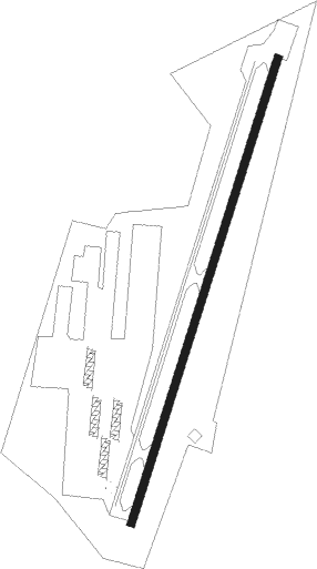
Runway info
| Runway 1 / 19 | ||
| length | 1038m (3406ft) | |
| bearing | 27° / 207° | |
| width | 18m (60ft) | |
| surface | asphalt | |
| blast zone | 29m (95ft) / 0m (0ft) | |
Nearby beacons
| code | identifier | dist | bearing | frequency |
|---|---|---|---|---|
| LIN | LINDEN VOR/DME | 20.6 | 215° | 114.80 |
| HNW | HANGTOWN (PLACERVILLE) VOR/DME | 21 | 7° | 115.50 |
| MCC | MC CLELLAN (SACRAMENTO) VOR/DME | 33.5 | 295° | 109.20 |
| SAC | SACRAMENTO VORTAC | 35.8 | 275° | 115.20 |
| MOD | MODESTO VOR/DME | 45.6 | 192° | 114.60 |
| SWR | SQUAW VALLEY(SOUTH LAKE T VOR/DME | 54.1 | 33° | 113.20 |
| BAB | BEALE (MARYSVILLE) TACAN | 54.6 | 320° | 108.60 |
| MYV | MARYSVILLE VOR/DME | 56.6 | 313° | 110.80 |
| LV | REIGA (LIVERMORE) NDB | 58.8 | 232° | 374 |
Disclaimer
The information on this website is not for real aviation. Use this data with the X-Plane flight simulator only! Data taken with kind consent from X-Plane 12 source code and data files. Content is subject to change without notice.