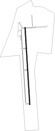
Jasper - Jasper Co Bell Fld
Airport details
| Country | United States of America |
| State | Texas |
| Region | K4 |
| Airspace | Houston Oceanic Ctr |
| Municipality | Jasper County |
| Elevation | 210ft (64m) |
| Timezone | GMT -5 |
| Coordinates | 30.88569, -94.03494 |
| Magnetic var | |
| Type | land |
| Available since | X-Plane v10.40 |
| ICAO code | KJAS |
| IATA code | JAS |
| FAA code | JAS |
Communication
| Jasper Co Bell Fld AWOS 3 | 118.375 |
| Jasper Co Bell Fld CTAF/UNICOM | 122.800 |
Nearby Points of Interest:
Jasper County Courthouse
-US 190 Bridge at the Neches River
-Tyler County Courthouse
-Burks House
-Kirby-Hill House
Nearby beacons
| code | identifier | dist | bearing | frequency |
|---|---|---|---|---|
| DXB | DE RIDDER NDB | 36.9 | 101° | 385 |
| LFK | LUFKIN VORTAC | 38.8 | 292° | 112.10 |
| FXU | POLK (FORT POLK) VOR | 44.1 | 75° | 108.40 |
| LF | FLUFY (LUFKIN) NDB | 45.3 | 293° | 350 |
| GDE | GOODHUE (BEAUMONT) NDB | 49.8 | 192° | 368 |
| OC | NADOS (NACOGDOCHES) NDB | 50.3 | 311° | 253 |
| AUR | SULFY (SULPHUR) NDB | 52 | 138° | 278 |
| DAS | DAISETTA VORTAC | 52.3 | 221° | 116.90 |
| CW | MOSSY (LAKE CHARLES) NDB | 55.5 | 125° | 418 |
| BPT | BEAUMONT VOR/DME | 56.4 | 179° | 114.50 |
| CZJ | AMASON (CENTER) NDB | 57.2 | 353° | 341 |
| LCH | LAKE CHARLES VORTAC | 65.6 | 129° | 113.40 |
| OOC | NATCHITOCHES NDB | 67.5 | 51° | 407 |
Instrument approach procedures
| runway | airway (heading) | route (dist, bearing) |
|---|---|---|
| RW18 | LFK (112°) | LFK UJNOD (31mi, 98°) 2000ft HARBA (5mi, 91°) 2000ft |
| RW18 | RAFTO (181°) | RAFTO HARBA (7mi, 181°) 2000ft |
| RW18 | ROMER (69°) | ROMER UJNOD (24mi, 38°) 2000ft HARBA (5mi, 91°) 2000ft |
| RNAV | HARBA 2000ft MOWHI (6mi, 181°) 1900ft SALUQ (3mi, 181°) 980ft KJAS (3mi, 181°) 254ft BRIRR (13mi, 181°) 3000ft BRIRR (turn) | |
| RW36 | HONEE (39°) | HONEE BRIRR (25mi, 54°) 3000ft |
| RW36 | ROMER (69°) | ROMER EFRUJ (14mi, 105°) 3000ft BRIRR (5mi, 91°) 3000ft |
| RNAV | BRIRR 3000ft HUSPO (7mi, 1°) 1900ft TAZHA (3mi, 1°) 900ft KJAS (3mi, 1°) 219ft MOWHI (6mi, 1°) RAFTO (13mi, 1°) 4000ft RAFTO (turn) |
Disclaimer
The information on this website is not for real aviation. Use this data with the X-Plane flight simulator only! Data taken with kind consent from X-Plane 12 source code and data files. Content is subject to change without notice.