Mineola/quitman - Wood County Collins Fld
Airport details
| Country | United States of America |
| State | Texas |
| Region | K4 |
| Airspace | Ft Worth Ctr |
| Municipality | Wood County |
| Elevation | 434ft (132m) |
| Timezone | GMT -6 |
| Coordinates | 32.74220, -95.49648 |
| Magnetic var | |
| Type | land |
| Available since | X-Plane v10.40 |
| ICAO code | KJDD |
| IATA code | n/a |
| FAA code | JDD |
Communication
| Wood County Collins Fld AWOS 3 | 118.900 |
| Wood County Collins Fld CTAF/UNICOM | 122.800 |
| Wood County Collins Fld LONGVIEW Approach/Departure | 128.750 |
Nearby Points of Interest:
Howard L. and Vivian W. Lott House
-Marcus DeWitt Carlock House
-Florence Robinson Cottage
-Hopkins County Courthouse
-St. James Colored Methodist Episcopal Church
-Cotton Belt Depot Museum
-Tyler City Hall
-Blackstone Building
-William M. Steger Federal Building and United States Courthouse
-People's National Bank Building
-Marvin Methodist Episcopal Church, South
-Carnegie Public Library
-Jenkins-Harvey Super Service Station and Garage
-Elks Club Building
-St. John's AF & AM Lodge
-Whitaker-McClendon House
-Ramey House
-Pittsburg Commercial Historic District
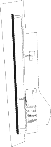
Runway info
| Runway 18 / 36 | ||
| length | 1223m (4012ft) | |
| bearing | 182° / 2° | |
| width | 18m (60ft) | |
| surface | asphalt | |
Nearby beacons
| code | identifier | dist | bearing | frequency |
|---|---|---|---|---|
| UIM | DME | 10.5 | 43° | 114 |
| ABG | AMBASSADOR (BIG SANDY) NDB | 21.5 | 112° | 404 |
| TYR | TYLER VOR/DME | 23.6 | 166° | 114.20 |
| SLR | SULPHUR SPRINGS VOR/DME | 27.5 | 354° | 109 |
| MJF | ARVILLA (GREENVILLE) TACAN | 34.4 | 300° | 109.60 |
| GV | MAJOR (GREENVILLE) NDB | 37.8 | 306° | 201 |
| GG | VEELS (LONGVIEW) NDB | 39.3 | 112° | 410 |
| FZT | FRANKSTON VOR/DME | 40.1 | 183° | 111.40 |
| GGG | GREGG CO. (LONGVIEW) VORTAC | 42.3 | 114° | 112.90 |
| CSZ | CROSSROADS NDB | 46.9 | 214° | 215 |
| PRX | PARIS VOR/DME | 48.1 | 3° | 113.60 |
| CQY | CEDAR CREEK VORTAC | 49.5 | 232° | 114.80 |
| BYP | BONHAM VORTAC | 60.4 | 317° | 114.60 |
| CGQ | POWELL (CORSICANA) NDB | 62.2 | 234° | 344 |
| CRS | CORSICANA NDB | 62.5 | 232° | 396 |
Instrument approach procedures
| runway | airway (heading) | route (dist, bearing) |
|---|---|---|
| RW18 | KUSEC (210°) | KUSEC VERGO (5mi, 272°) 2100ft |
| RW18 | SLR (174°) | SLR VERGO (16mi, 169°) 2100ft |
| RW18 | VERGO (183°) | VERGO 2100ft |
| RNAV | VERGO 2100ft HAFLU (6mi, 183°) 2000ft KJDD (5mi, 183°) 443ft (5683mi, 109°) 820ft DUCAG (5684mi, 289°) 2200ft DUCAG (turn) | |
| RW36 | DUCAG (3°) | DUCAG 2200ft |
| RW36 | FZT (3°) | FZT DUCAG (29mi, 3°) 2200ft |
| RW36 | WOBAM (334°) | WOBAM DUCAG (5mi, 272°) 2200ft |
| RNAV | DUCAG 2200ft HERUX (6mi, 3°) 2000ft KJDD (5mi, 3°) 463ft (5683mi, 109°) 833ft VERGO (5682mi, 289°) 2100ft VERGO (turn) |
Disclaimer
The information on this website is not for real aviation. Use this data with the X-Plane flight simulator only! Data taken with kind consent from X-Plane 12 source code and data files. Content is subject to change without notice.