Jefferson City - Jefferson City Mem
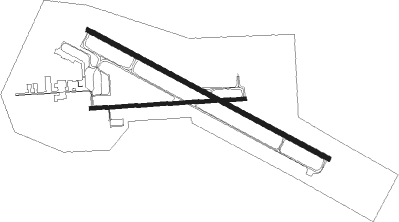
Airport details
| Country | United States of America |
| State | Missouri |
| Region | K3 |
| Airspace | Kansas City Ctr |
| Municipality | Jefferson City |
| Elevation | 546ft (166m) |
| Timezone | GMT -6 |
| Coordinates | 38.59118, -92.15614 |
| Magnetic var | |
| Type | land |
| Available since | X-Plane v10.40 |
| ICAO code | KJEF |
| IATA code | JEF |
| FAA code | JEF |
Communication
| Jefferson City Mem ASOS | 133.625 |
| Jefferson City Mem UNICOM | 122.950 |
| Jefferson City Mem Ground Control | 121.700 |
| Jefferson City Mem Tower | 125.600 |
| Jefferson City Mem MIZZU Approach/Departure | 124.375 |
Approach frequencies
| ILS-cat-I | RW30 | 110.5 | 18.00mi |
| 3° GS | RW30 | 110.5 | 18.00mi |
Nearby Points of Interest:
Missouri Governor's Mansion
-Jefferson Female Seminary
-Cole County Historical Society Building
-Ivy Terrace
-Herman Haar House
-Cole County Courthouse and Jail-Sheriff's House
-Capitol Avenue Historic District
-East End Drugs
-Tergin Apartment Building
-Kaullen Mercantile Company
-Hobo Hill Historic District
-Albert and Wilhelmina Thomas House
-John B. and Elizabeth Ruthven House
-H.E. Gensky Grocery Store Building
-Broadway-Dunklin Historic District
-Hugh and Bessie Stephens House
-Henry and Elizabeth Bockrath House
-Munichburg Commercial Historic District
-Philip Hess House
-Jefferson City Community Center
-Charles J. and Clara B. Schmidt House
-William E. and Frederica M. Zuendt House
-Nelson C. and Gertrude A. Burch House
-Oscar G. and Mary H. Burch House
-John M. and Lillian Sommerer House

Nearby beacons
| code | identifier | dist | bearing | frequency |
|---|---|---|---|---|
| JE | ALGOA (JEFFERSON CITY) NDB | 4.7 | 117° | 397 |
| COU | COLUMBIA VOR/DME | 13.5 | 344° | 110.20 |
| HLV | HALLSVILLE VORTAC | 31.3 | 3° | 114.20 |
| VIH | VICHY (ROLLA/VICHY) VOR/DME | 33.7 | 134° | 117.70 |
| SHY | SUNSHINE (KAISER) VOR/DME | 39.1 | 219° | 108.40 |
| TBN | FORNEY (FORT LEONARD WOOD VOR | 50.9 | 179° | 110 |
| BHN | BUCKHORN (FORT LEONARD WOOD) NDB | 53.7 | 177° | 391 |
Instrument approach procedures
| runway | airway (heading) | route (dist, bearing) |
|---|---|---|
| RW12 | GIBSN (117°) | GIBSN JAKBO (2mi, 116°) 3000ft |
| RW12 | JAKBO (117°) | JAKBO 3000ft |
| RNAV | JAKBO 3000ft IBUYI (6mi, 116°) 2300ft KJEF (6mi, 117°) 592ft FATPI (11mi, 116°) 2800ft FATPI (turn) | |
| RW30 | EDAGY (320°) | EDAGY 2800ft FATPI (5mi, 39°) 2800ft |
| RW30 | FATPI (296°) | FATPI 2800ft |
| RW30 | LECNI (276°) | LECNI 2800ft FATPI (5mi, 219°) 2800ft |
| RNAV | FATPI 2800ft ERINE (6mi, 297°) 2000ft KJEF (5mi, 296°) 601ft GIBSN (14mi, 297°) 3000ft GIBSN (turn) |
Disclaimer
The information on this website is not for real aviation. Use this data with the X-Plane flight simulator only! Data taken with kind consent from X-Plane 12 source code and data files. Content is subject to change without notice.