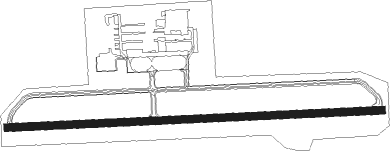
Jasper - Walker Co Bevill Fld
Airport details
| Country | United States of America |
| State | Alabama |
| Region | K7 |
| Airspace | Atlanta Ctr |
| Municipality | Walker County |
| Elevation | 479ft (146m) |
| Timezone | GMT -6 |
| Coordinates | 33.90200, -87.31384 |
| Magnetic var | |
| Type | land |
| Available since | X-Plane v10.40 |
| ICAO code | KJFX |
| IATA code | n/a |
| FAA code | JFX |
Communication
| WALKER CO BEVILL FLD AWOS 3 | 119.225 |
| WALKER CO BEVILL FLD CTAF/UNICOM | 122.700 |
| WALKER CO BEVILL FLD BIRMINGHAM Approach/Departure | 127.675 |
Approach frequencies
| ILS-cat-I | RW27 | 108.9 | 18.00mi |
| 3° GS | RW27 | 108.9 | 18.00mi |
Nearby Points of Interest:
Bankhead House
-Jasper Downtown Historic District
-Boshell's Mill
-Stephenson House
-Winston County Courthouse
-Crane Hill Masonic Lodge
-Stiefelmeyer's
-Louisville and Nashville Railroad Depot
-Ernest Edward Greene House
-Ave Maria Grotto
-Flintridge Building
-Belview Heights Historic District
-Fire Station No. 11
Nearby beacons
| code | identifier | dist | bearing | frequency |
|---|---|---|---|---|
| VUZ | VULCAN (BIRMINGHAM) VORTAC | 24.9 | 119° | 114.40 |
| BH | MCDEN (BIRMINGHAM) NDB | 33.1 | 130° | 224 |
| HAB | DME | 39 | 293° | 110.40 |
| OKW | BROOKWOOD VORTAC | 40 | 174° | 111 |
| LDK | CRIMSON VORTAC | 40.2 | 199° | 117.80 |
| TC | TUSKE (TUSCALOOSA) NDB | 48 | 206° | 362 |
| DCU | DME | 48.5 | 27° | 112.80 |
| MSL | MUSCLE SHOALS VORTAC | 49.1 | 348° | 116.50 |
| RQZ | ROCKET (HUNTSVILLE) VORTAC | 63.4 | 37° | 112.20 |
Instrument approach procedures
| runway | airway (heading) | route (dist, bearing) |
|---|---|---|
| RW09 | CECAV (91°) | CECAV 2600ft |
| RNAV | CECAV 2600ft YILUG (7mi, 91°) 2300ft KJFX (6mi, 92°) 522ft (5271mi, 111°) 750ft SIPSY (5257mi, 291°) 2800ft SIPSY (turn) | |
| RW27 | SIPSY (272°) | SIPSY 2800ft |
| RNAV | SIPSY 2800ft MAYLE (9mi, 272°) 2200ft KJFX (6mi, 272°) 517ft (5271mi, 111°) 781ft CECAV (5284mi, 291°) 2800ft CECAV (turn) |
Disclaimer
The information on this website is not for real aviation. Use this data with the X-Plane flight simulator only! Data taken with kind consent from X-Plane 12 source code and data files. Content is subject to change without notice.