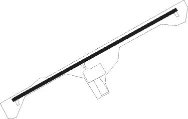
Richlands - Tazewell County
Airport details
| Country | United States of America |
| State | Virginia |
| Region | K6 |
| Airspace | Indianapolis Ctr |
| Municipality | Tazewell County |
| Elevation | 2647ft (807m) |
| Timezone | GMT -5 |
| Coordinates | 37.06375, -81.79828 |
| Magnetic var | |
| Type | land |
| Available since | X-Plane v10.40 |
| ICAO code | KJFZ |
| IATA code | n/a |
| FAA code | JFZ |
Communication
| Tazewell County AWOS 3 | 118.075 |
| Tazewell County CTAF/UNICOM | 123.050 |
Approach frequencies
| LOC | RW25 | 109.75 | 18.00mi |
Nearby Points of Interest:
Williams House
-Richlands Historic District
-Tazewell Avenue Historic District
-Clinch Valley Roller Mills
-Old Kentucky Turnpike Historic District
-Maiden Spring
-Chimney Rock Farm
-Big Crab Orchard Site
-Saltville Historic District
-Saltville Battlefields Historic District
-Scott-Walker House
-George Oscar Thompson House
-Preston House (Saltville, Virginia)
-Tazewell Depot
-Tazewell Historic District
-James Wynn House
-Samuel Gilmer House
-Crabtree-Blackwell Farm
-Clynchdale
-Stephen B. Quillen House
-A.C. Beatie House
-Downtown Chilhowie Historic District
-H.L. Bonham House
-Carter Coal Company Store
-Emory and Henry College
Runway info
| Runway 7 / 25 | ||
| length | 1309m (4295ft) | |
| bearing | 70° / 250° | |
| width | 23m (75ft) | |
| surface | asphalt | |
Nearby beacons
| code | identifier | dist | bearing | frequency |
|---|---|---|---|---|
| GZG | GLADE SPRING (BLACKFORD) VOR/DME | 19.6 | 230° | 110.20 |
| BLF | BLUEFIELD VOR/DME | 32.3 | 68° | 110 |
| JJC | MOUNTAIN CITY NDB | 38.8 | 182° | 396 |
| TR | MOCCA(BRISTOL-JOHNSON-KINGSPOR NDB | 39.4 | 226° | 299 |
| HMV | HOLSTON MOUNTAIN VORTAC | 40.8 | 208° | 114.60 |
| JUH | ASHEE (JEFFERSON) NDB | 44.2 | 143° | 410 |
| BO | BOOIE (BRISTOL) NDB | 52.1 | 226° | 221 |
| BKW | BECKLEY VOR/DME | 53.7 | 43° | 117.70 |
| BAR | HEMLOCK (BANNER ELK) NDB | 54.8 | 185° | 320 |
| RNL | RAINELLE VOR | 72.3 | 47° | 116.60 |
Instrument approach procedures
| runway | airway (heading) | route (dist, bearing) |
|---|---|---|
| RW07 | ZOMAD (70°) | ZOMAD 5900ft |
| RNAV | ZOMAD 5900ft CAYBA (7mi, 70°) 4500ft CODSU (4mi, 70°) 3240ft KJFZ (2mi, 70°) 2707ft (5013mi, 114°) 3200ft ZOMAD (5024mi, 294°) 5900ft ZOMAD (turn) | |
| RW25 | NAYIC (250°) | NAYIC 6400ft |
| RNAV | NAYIC 6400ft DIKTE (7mi, 250°) 5300ft LATIC (3mi, 250°) 4500ft JANEX (4mi, 250°) 3340ft KJFZ (2mi, 250°) 2707ft (5013mi, 114°) 3800ft NAYIC (4999mi, 295°) 6400ft NAYIC (turn) |
Disclaimer
The information on this website is not for real aviation. Use this data with the X-Plane flight simulator only! Data taken with kind consent from X-Plane 12 source code and data files. Content is subject to change without notice.
