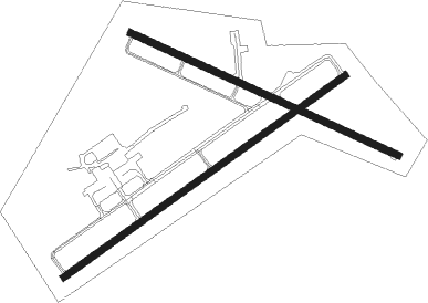
Jamestown - Chautauqua Co Jamestown
Airport details
| Country | United States of America |
| State | New York |
| Region | K6 |
| Airspace | Cleveland Ctr |
| Municipality | Town of Ellicott |
| Elevation | 1723ft (525m) |
| Timezone | GMT -5 |
| Coordinates | 42.15339, -79.25803 |
| Magnetic var | |
| Type | land |
| Available since | X-Plane v10.30 |
| ICAO code | KJHW |
| IATA code | JHW |
| FAA code | JHW |
Communication
| CHAUTAUQUA CO JAMESTOWN AWOS 3 | 118.425 |
| CHAUTAUQUA CO JAMESTOWN CTAF/UNICOM | 122.700 |
| CHAUTAUQUA CO JAMESTOWN Clearance DEL | 126.200 |
| CHAUTAUQUA CO JAMESTOWN Ground Control | 121.800 |
| CHAUTAUQUA CO JAMESTOWN Tower | 120.200 |
| CHAUTAUQUA CO JAMESTOWN ERIE Approach/Departure | 126.050 |
Approach frequencies
| ILS-cat-I | RW25 | 109.7 | 18.00mi |
| 3° GS | RW25 | 109.7 | 18.00mi |
Nearby Points of Interest:
Jamestown Downtown Historic District
-The Wellman Building
-Jamestown Armory
-Partridge-Sheldon House
-Smith Bly House
-Dr. John Lord House
-Lewis Miller Cottage
-Chautauqua Institution
-Point Chautauqua Historic District
-Erie Federal Courthouse
-Mayville
-Leon United Methodist Church
-Guy C. Irvine House
-Clymer District School No. 5
-Gladden Windmill
-Henry Dwight Thompson House
-Harriet Campbell-Taylor House
-Reuben Wright House
-East Main Street Historic District
-Rorig Bridge
-French Portage Road Historic District
-York-Skinner House
-Atwater-Stone House
-Reuben Gridley Wright Farm Complex
-Fredonia Commons Historic District

Nearby beacons
| code | identifier | dist | bearing | frequency |
|---|---|---|---|---|
| JHW | JAMESTOWN VOR/DME | 6.4 | 76° | 114.70 |
| DKK | DME | 20.2 | 357° | 116.20 |
| TDT | DME | 27.3 | 200° | 117.60 |
| BFD | DME | 36 | 120° | 116.60 |
| GB | PLAZZ (BUFFALO) NDB | 47.4 | 32° | 204 |
| FKL | FRANKLIN VOR | 50.6 | 220° | 109.60 |
| BUF | BUFFALO VOR/DME | 53.8 | 38° | 116.40 |
| BU | KLUMP (BUFFALO) NDB | 57.5 | 36° | 231 |
| IAG | NIAGARA FALLS TACAN | 59 | 17° | 111 |
| SN | ST CATHARINES NDB | 59.6 | 0° | 408 |
| IA | KATHI (NIAGRA FALLS) NDB | 60.3 | 24° | 329 |
| ZHM | BINBROOK (HAMILTON) NDB | 64 | 332° | 266 |
| HM | HAMILTON NDB | 66.8 | 322° | 221 |
Instrument approach procedures
| runway | airway (heading) | route (dist, bearing) |
|---|---|---|
| RW07 | GUKBE (66°) | GUKBE 4000ft |
| RW07 | IXADY (84°) | IXADY 4000ft GUKBE (5mi, 141°) 4000ft |
| RW07 | IXFAQ (44°) | IXFAQ 4000ft GUKBE (5mi, 321°) 4000ft |
| RNAV | GUKBE 4000ft EWUHY (6mi, 66°) 3400ft KJHW (6mi, 66°) 1773ft OYNEM (13mi, 66°) 4000ft OYNEM (turn) | |
| RW13 | CRYST (113°) | CRYST 4000ft |
| RW13 | ITVUH (137°) | ITVUH 4000ft CRYST (5mi, 217°) 4000ft |
| RW13 | UVGAW (93°) | UVGAW 4000ft CRYST (5mi, 36°) 4000ft |
| RNAV | CRYST 4000ft KOOTH (5mi, 112°) 3400ft 20THR (3mi, 112°) 2400ft KJHW (2mi, 115°) 1773ft (4928mi, 118°) 2123ft GOSPL (4918mi, 298°) 4000ft GOSPL (turn) | |
| RW25 | MOYVY (226°) | MOYVY 4000ft OYNEM (5mi, 141°) 4000ft |
| RW25 | NEQWU (263°) | NEQWU 4000ft OYNEM (5mi, 321°) 4000ft |
| RW25 | OYNEM (246°) | OYNEM 4000ft |
| RNAV | OYNEM 4000ft KRAUS (6mi, 246°) 3800ft DIPRE (4mi, 246°) 2440ft KJHW (2mi, 247°) 1767ft GUKBE (12mi, 246°) 4000ft GUKBE (turn) | |
| RW31 | GOSPL (292°) | GOSPL 4000ft FOXAT (2mi, 292°) 3800ft |
| RW31 | UCHOB (272°) | UCHOB 4000ft GOSPL (5mi, 217°) 4000ft FOXAT (2mi, 292°) 3800ft |
| RW31 | UVOPY (316°) | UVOPY 4000ft GOSPL (5mi, 37°) 4000ft FOXAT (2mi, 292°) 3800ft |
| RNAV | FOXAT 3800ft FELMO (3mi, 292°) 3400ft KJHW (5mi, 291°) 1757ft (4928mi, 118°) 2123ft CRYST (4938mi, 298°) 4000ft CRYST (turn) |
Disclaimer
The information on this website is not for real aviation. Use this data with the X-Plane flight simulator only! Data taken with kind consent from X-Plane 12 source code and data files. Content is subject to change without notice.