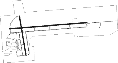
Gulf Shores - Jack Edwards
Airport details
| Country | United States of America |
| State | Alabama |
| Region | K7 |
| Airspace | Jacksonville Ctr |
| Municipality | Baldwin County |
| Elevation | 17ft (5m) |
| Timezone | GMT -6 |
| Coordinates | 30.28862, -87.67943 |
| Magnetic var | |
| Type | land |
| Available since | X-Plane v10.40 |
| ICAO code | KJKA |
| IATA code | GUF |
| FAA code | JKA |
Communication
| JACK EDWARDS AWOS 3 | 134.525 |
| JACK EDWARDS CTAF/UNICOM | 122.700 |
| JACK EDWARDS Clearance DEL | 124.550 |
| JACK EDWARDS PENSACOLA ApproachROACH | 120.650 |
| JACK EDWARDS PENSACOLA DepartureARTURE | 120.650 |
Approach frequencies
| ILS-cat-I | RW27 | 110.7 | 18.00mi |
| 3° GS | RW27 | 110.7 | 18.00mi |
Nearby Points of Interest:
Foley Downtown Historic District
-Governor's Club
-St. Paul's Episcopal Church
-Sunnyside Hotel
-Street House
-Twin Beach AME Church
-Lebanon Chapel AME Church
-United States Post Office
-USS Tecumseh (1863)
-Tolstoy Park
-Pensacola Naval Air Station Historic District
-St. Patrick's Catholic Church
-Montrose Historic District
-Methodist Episcopal Church, South (Daphne, Alabama)
-Charles William Jones House
-North Hill Preservation District
-United States Customs House and Post Office
-American National Bank Building
-Palafox Historic District
-Winston E. Arnow Federal Building
-Lavalle House
-L & N Marine Terminal Building
-Thiesen Building
-Clara Barkley Dorr House
-Pensacola Historic District

Nearby beacons
| code | identifier | dist | bearing | frequency |
|---|---|---|---|---|
| NPA | PENSACOLA TACAN | 19.2 | 79° | 117.20 |
| NUN | SAUFLEY (PENSACOLA) VOR | 20.9 | 62° | 108.80 |
| PKZ | PICKENS (PENSACOLA) NDB | 27.4 | 73° | 326 |
| BFM | BROOKLEY (MOBILE) VORTAC | 27.5 | 311° | 112.80 |
| MOB | WISLE (MOBILE) NDB | 42.9 | 307° | 248 |
| NSE | WHITING (MILTON) TACAN | 43 | 57° | 112.30 |
| NGS | SANTA ROSA (MILTON) TACAN | 43.1 | 66° | 133.60 |
| SJI | SEMMES (MOBILE) VORTAC | 43.9 | 303° | 115.30 |
| HRT | HURLBURT (MARY ESTHER) TACAN | 51.9 | 82° | 110.80 |
| GCV | GREENE CO. (LEAKESVILLE) VORTAC | 64 | 315° | 115.70 |
Instrument approach procedures
| runway | airway (heading) | route (dist, bearing) |
|---|---|---|
| RW09 | BFM (131°) | BFM COPOV (15mi, 153°) 3000ft VUSRY (6mi, 153°) 2500ft |
| RW09 | VUSRY (90°) | VUSRY 2500ft |
| RNAV | VUSRY 2500ft OFEVY (6mi, 90°) 1600ft HUXUP (3mi, 90°) 620ft KJKA (2mi, 93°) 65ft (5285mi, 109°) 284ft WARLY (5273mi, 289°) 2500ft WARLY (turn) | |
| RW27 | BRATT (180°) | BRATT MRITA (26mi, 141°) 3000ft WARLY (8mi, 203°) 2500ft |
| RW27 | PENSI (219°) | PENSI MRITA (23mi, 198°) 3000ft WARLY (8mi, 203°) 2500ft |
| RW27 | WARLY (270°) | WARLY 2500ft |
| RNAV | WARLY 2500ft ORAXE (6mi, 270°) 1600ft JUDEP (2mi, 270°) 820ft KJKA (3mi, 269°) 63ft (5285mi, 109°) 217ft VUSRY (5296mi, 289°) 2500ft VUSRY (turn) |
Disclaimer
The information on this website is not for real aviation. Use this data with the X-Plane flight simulator only! Data taken with kind consent from X-Plane 12 source code and data files. Content is subject to change without notice.