Jackson - Julian Carroll
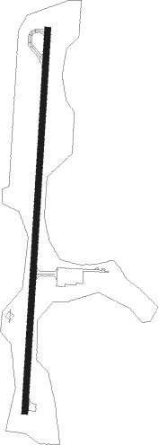
Airport details
| Country | United States of America |
| State | Kentucky |
| Region | K5 |
| Airspace | Indianapolis Ctr |
| Municipality | Breathitt County |
| Elevation | 1379ft (420m) |
| Timezone | GMT -5 |
| Coordinates | 37.59386, -83.31725 |
| Magnetic var | |
| Type | land |
| Available since | X-Plane v10.40 |
| ICAO code | KJKL |
| IATA code | n/a |
| FAA code | JKL |
Communication
| Julian Carroll ASOS | 118.375 |
| Julian Carroll CTAF/UNICOM | 122.800 |
Nearby Points of Interest:
Breathitt County Jail
-M.E. Church, South
-Jackson Commercial District
-William L. Hurst Law Office
-Salyersville National Bank
-Buckhorn Presbyterian Church and the Greer Gymnasium
-Beattyville Grade School
-St. Thomas Episcopal Church
-Morgan County Courthouse
-Red River Gorge
-Judge John E. Cooper House
-Hindman Ben Franklin
-Bolen Building
-Hindman Historic District
-Roderick McIntosh Farm
-Wooton Presbyterian Center
-David McKenzie Log Cabin
-Frenchburg School Campus
-Samuel May House
-Methodist Episcopal Church, South (Prestonsburg, Kentucky)
-First United Methodist Church
-H.B. Rice Insurance Building
-Francis M. Stafford House
-Mayo Mansion
-First National Bank Building
Nearby beacons
| code | identifier | dist | bearing | frequency |
|---|---|---|---|---|
| AZQ | DME | 12.4 | 165° | 111.20 |
| ECB | DME | 39 | 36° | 110.40 |
| IOB | MOUNT STERLING NDB | 42.1 | 305° | 210 |
| LOZ | LONDON VOR/DME | 50.6 | 235° | 116.55 |
Instrument approach procedures
| runway | airway (heading) | route (dist, bearing) |
|---|---|---|
| RW01 | CANLA (10°) | CANLA 3500ft |
| RW01 | DACEL (342°) | DACEL 4500ft CANLA (5mi, 276°) 3500ft |
| RW01 | ESODE (37°) | ESODE 4500ft CANLA (5mi, 96°) 3500ft |
| RNAV | CANLA 3500ft BEDTA (6mi, 10°) 3100ft KJKL (6mi, 10°) 1393ft (5087mi, 114°) 1781ft CANLA (5088mi, 294°) 4500ft CANLA (turn) |
Disclaimer
The information on this website is not for real aviation. Use this data with the X-Plane flight simulator only! Data taken with kind consent from X-Plane 12 source code and data files. Content is subject to change without notice.