Joplin - Joplin Regl
Airport details
| Country | United States of America |
| State | Missouri |
| Region | K3 |
| Airspace | Kansas City Ctr |
| Municipality | Joplin |
| Elevation | 979ft (298m) |
| Timezone | GMT -6 |
| Coordinates | 37.15181, -94.49828 |
| Magnetic var | |
| Type | land |
| Available since | X-Plane v10.40 |
| ICAO code | KJLN |
| IATA code | JLN |
| FAA code | JLN |
Communication
| Joplin Regl ATIS | 120.850 |
| Joplin Regl UNICOM | 122.950 |
| Joplin Regl CTAF | 119.800 |
| Joplin Regl Ground Control | 121.600 |
| Joplin Regl Tower | 119.800 |
Approach frequencies
| ILS-cat-I | RW13 | 110.3 | 18.00mi |
| ILS-cat-I | RW18 | 108.9 | 18.00mi |
| 3° GS | RW13 | 110.3 | 18.00mi |
| 3° GS | RW18 | 108.9 | 18.00mi |
Nearby Points of Interest:
Downtown Webb City Historic District
-South Main Street Historic District
-Gentry Apartments
-Joplin Supply Company
-Ridgway Apartments
-Fox Theatre
-Fifth and Main Historic District
-Elks Club Lodge No. 501
-Olivia Apartments
-Joplin Downtown Historic District
-St. Louis and San Francisco Railroad Building
-Scottish Rite Cathedral
-Newman Brothers Building
-Joplin Carnegie Library
-Main and Eighth Streets Historic District
-Rains Brothers Building
-Inter-State Grocer Company Building
-St. Peter the Apostle Catholic Church and Rectory
-Bonnie & Clyde Garage Apartment
-Edgar Backus Schermerhorn House
-Cassill Place Historic District
-Carthage South Historic District
-Williams' Store
-Rial A. Niles House
-Baxter Springs Independent Oil and Gas Service Station
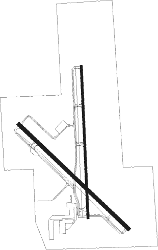
Runway info
Runway 18 / 36  | ||
| length | 1988m (6522ft) | |
| bearing | 182° / 2° | |
| width | 30m (100ft) | |
| surface | concrete | |
| Runway 13 / 31 | ||
| length | 1981m (6499ft) | |
| bearing | 132° / 312° | |
| width | 46m (150ft) | |
| surface | concrete | |
| displ threshold | 118m (387ft) / 91m (299ft) | |
Nearby beacons
| code | identifier | dist | bearing | frequency |
|---|---|---|---|---|
| JL | LUNNS (JOPLIN) NDB | 4.2 | 310° | 344 |
| EOS | NEOSHO VOR/DME | 18.8 | 169° | 117.30 |
| OSW | OSWEGO VOR/DME | 33.7 | 270° | 117.60 |
| RZC | RAZORBACK (FAYETTEVILLE) VORTAC | 57.3 | 157° | 116.40 |
| SLG | SILOAM SPRINGS NDB | 57.8 | 179° | 284 |
Instrument approach procedures
| runway | airway (heading) | route (dist, bearing) |
|---|---|---|
| RW13 | FORIX (112°) | FORIX 3100ft HOTCH (5mi, 54°) 3100ft |
| RW13 | HOTCH (131°) | HOTCH 3100ft |
| RW13 | OMVEE (153°) | OMVEE 3100ft HOTCH (5mi, 234°) 3100ft |
| RNAV | HOTCH 3100ft COVIT (9mi, 132°) 2200ft KJLN (4mi, 131°) 991ft (5620mi, 111°) 1220ft HOVIL (5613mi, 291°) 3100ft HOVIL (turn) | |
| RW18 | MITBY (183°) | MITBY 3100ft |
| RW18 | WOMBA (210°) | WOMBA 3100ft MITBY (5mi, 272°) 3100ft |
| RW18 | ZALER (154°) | ZALER 3100ft MITBY (5mi, 92°) 3100ft |
| RNAV | MITBY 3100ft YUHAX (6mi, 182°) 2600ft KJLN (6mi, 183°) 996ft (5620mi, 111°) 1220ft JEMLO (5621mi, 291°) 3100ft JEMLO (turn) | |
| RW31 | EOS (349°) | EOS REYOB (7mi, 52°) 3100ft HOVIL (5mi, 4°) 3100ft |
| RW31 | HOVIL (312°) | HOVIL 3100ft |
| RW31 | ZOGAR (293°) | ZOGAR WEBLA (5mi, 273°) 3100ft HOVIL (5mi, 272°) 3100ft |
| RNAV | HOVIL 3100ft HUPRO (6mi, 312°) 2800ft WAMAT (4mi, 312°) 1620ft KJLN (2mi, 314°) 1025ft (5620mi, 111°) 1229ft HOTCH (5629mi, 292°) 3100ft HOTCH (turn) | |
| RW36 | HOXER (33°) | HOXER 3100ft JEMLO (5mi, 92°) 3100ft RARRO (4mi, 2°) 2600ft |
| RW36 | JEMLO (2°) | JEMLO 3100ft RARRO (4mi, 2°) 2600ft |
| RW36 | WEVED (331°) | WEVED 3100ft JEMLO (5mi, 272°) 3100ft RARRO (4mi, 2°) 2600ft |
| RNAV | RARRO 2600ft LOVRE (2mi, 2°) 2300ft IKPIF (2mi, 2°) 1540ft KJLN (2mi, 2°) 1017ft (5620mi, 111°) 1381ft MITBY (5619mi, 292°) 3100ft MITBY (turn) |
Disclaimer
The information on this website is not for real aviation. Use this data with the X-Plane flight simulator only! Data taken with kind consent from X-Plane 12 source code and data files. Content is subject to change without notice.