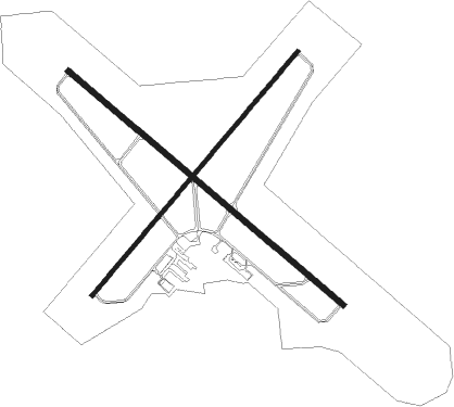
Jamestown - Jamestown Rgnl
Airport details
| Country | United States of America |
| State | North Dakota |
| Region | K3 |
| Airspace | Minneapolis Ctr |
| Municipality | Jamestown |
| Elevation | 1498ft (457m) |
| Timezone | GMT -6 |
| Coordinates | 46.92972, -98.67819 |
| Magnetic var | |
| Type | land |
| Available since | X-Plane v10.40 |
| ICAO code | KJMS |
| IATA code | JMS |
| FAA code | JMS |
Communication
| Jamestown Rgnl ASOS | 118.425 |
| Jamestown Rgnl CTAF/UNICOM | 123.000 |
Approach frequencies
| ILS-cat-I | RW31 | 109.3 | 18.00mi |
| 3° GS | RW31 | 109.3 | 18.00mi |
Nearby Points of Interest:
Grace Episcopal Church
-Elizabeth Apartments
-Seiler Building
-Alfred E. Dickey Free Library
-Franklin School
-Stutsman County Courthouse and Sheriff's Residence/Jail
-Basilica of St. James
-Midland Continental Railroad Depot
-Dagen's Grocery
-Rainbow Arch Bridge
-Barnes County Courthouse
Nearby beacons
| code | identifier | dist | bearing | frequency |
|---|---|---|---|---|
| JMS | JAMESTOWN VOR/DME | 0.1 | 350° | 114.50 |
Instrument approach procedures
| runway | airway (heading) | route (dist, bearing) |
|---|---|---|
| RW04 | GICAY (348°) | GICAY GANEY (47mi, 332°) 3700ft |
| RW04 | JMS (170°) | JMS GANEY (12mi, 235°) 3700ft GANEY (turn) 3700ft |
| RW04 | TAPNN (86°) | TAPNN GANEY (34mi, 94°) 3700ft |
| RNAV | GANEY 3700ft FARSA (6mi, 55°) 3300ft DOCAN (3mi, 55°) 2340ft KJMS (3mi, 56°) 1539ft (5760mi, 115°) 1746ft CALOT (5751mi, 296°) 3300ft CALOT (turn) | |
| RW13 | BEHQY (96°) | BEHQY EVADE (33mi, 88°) 3600ft |
| RW13 | JMS (170°) | JMS EVADE (12mi, 304°) 3600ft EVADE (turn) 3600ft |
| RW13 | UYTAG (169°) | UYTAG EVADE (15mi, 211°) 3600ft |
| RNAV | EVADE 3600ft CAGNI (6mi, 124°) 3300ft BORAC (3mi, 124°) 2160ft KJMS (2mi, 124°) 1552ft (5760mi, 115°) 1787ft FAMDU (5752mi, 295°) 3500ft FAMDU (turn) | |
| RW22 | CHAFE (275°) | CHAFE GINGE (41mi, 281°) 3300ft CALOT (6mi, 304°) 3300ft |
| RW22 | JMS (170°) | JMS CALOT (12mi, 56°) 3300ft CALOT (turn) 3300ft |
| RW22 | UYTAG (169°) | UYTAG FEBIS (11mi, 132°) 3300ft CALOT (6mi, 124°) 3300ft |
| RNAV | CALOT 3300ft ENUSE (6mi, 235°) 3300ft DOLEC (4mi, 235°) 2140ft KJMS (2mi, 235°) 1545ft (5760mi, 115°) 1750ft GANEY (5770mi, 295°) 3700ft GANEY (turn) | |
| RW31 | DUXHO (275°) | DUXHO CAFDE (9mi, 236°) 4000ft |
| RW31 | FAHTU (348°) | FAHTU CAFDE (9mi, 55°) 4000ft |
| RW31 | JMS (170°) | JMS CAFDE (12mi, 125°) 4000ft CAFDE (turn) 4000ft |
| RNAV | CAFDE 4000ft APUYU (6mi, 304°) 3200ft GEPGY (3mi, 304°) 2180ft KJMS (3mi, 304°) 1547ft (5760mi, 115°) 1698ft EVADE (5768mi, 295°) 3600ft EVADE (turn) |
Disclaimer
The information on this website is not for real aviation. Use this data with the X-Plane flight simulator only! Data taken with kind consent from X-Plane 12 source code and data files. Content is subject to change without notice.

