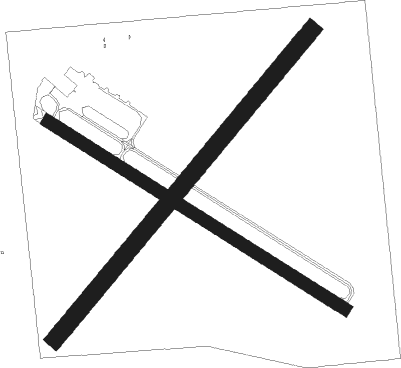
Joliet - Joliet Regl
Airport details
| Country | United States of America |
| State | Illinois |
| Region | K5 |
| Airspace | Chicago Ctr |
| Municipality | Joliet |
| Elevation | 581ft (177m) |
| Timezone | GMT -6 |
| Coordinates | 41.51766, -88.17552 |
| Magnetic var | |
| Type | land |
| Available since | X-Plane v10.40 |
| ICAO code | KJOT |
| IATA code | JOT |
| FAA code | JOT |
Communication
| Joliet Regl AWOS 3 | 119.975 |
| Joliet Regl CTAF/UNICOM | 122.700 |
| Joliet Regl CHICAGO Approach/Departure | 119.350 |
Nearby Points of Interest:
Joliet Regional Airport
-Hiram B. Scutt Mansion
-Christ Episcopal Church
-Joliet YMCA
-United States Post Office
-Joliet Union Station
-Joliet Iron and Steel Works
-Standard Oil Gasoline Station
-Downtown Plainfield Historic District
-Flanders House
-John Heck House
-Fitzpatrick House
-Will County Historical Society Headquarters
-Robert Milne House
-Ron George Round Barn
-Stone Manor
-White and Company's Goose Lake Tile Works
-White and Company's Goose Lake Stoneware Manufactury
-Lemont Methodist Episcopal Church
-Small–Towle House
-McGovney–Yunker Farmstead
-Morris Wide Water Canal Boat Site
-Kendall County Courthouse
-Bristol Congregational Church
-Coleman Hardware Company Building

Nearby beacons
| code | identifier | dist | bearing | frequency |
|---|---|---|---|---|
| JOT | JOLIET VOR/DME | 6.6 | 281° | 112.30 |
| EON | PEOTONE VORTAC | 22.8 | 123° | 113.20 |
| DPA | DUPAGE (CHICAGO) VOR/DME | 23.7 | 335° | 108.40 |
| MX | KEDZI (CHICAGO) NDB | 25.6 | 65° | 248 |
| DTG | DWIGHT NDB | 25.8 | 214° | 344 |
| CGT | CHICAGO HEIGHTS VORTAC | 27.1 | 91° | 114.20 |
| IKK | DME | 30.4 | 144° | 111.60 |
| GCO | DME | 31.1 | 30° | 108.25 |
| IK | LUKOW (KANKAKEE) NDB | 32.4 | 151° | 272 |
| GY | GARIE (GARY) NDB | 38.2 | 86° | 236 |
| OBK | NORTHBROOK VOR/DME | 43.4 | 18° | 113 |
| PNT | PONTIAC VOR/DME | 48.8 | 219° | 109.60 |
| RBS | ROBERTS VOR/DME | 56.2 | 179° | 116.80 |
| UG | WAUKE (CHICAGO/WAUKEGAN) NDB | 59.2 | 22° | 379 |
| LH | EGROW (BLOOMINGTON-NORMAL) NDB | 65.6 | 216° | 334 |
Disclaimer
The information on this website is not for real aviation. Use this data with the X-Plane flight simulator only! Data taken with kind consent from X-Plane 12 source code and data files. Content is subject to change without notice.